
National Register of Historic Places listings in Pickaway County, Ohio facts for kids

Have you ever wondered about old buildings or special places that tell a story about the past? In Pickaway County, Ohio, there's a list of these amazing spots! It's called the National Register of Historic Places listings in Pickaway County, Ohio.
The National Register of Historic Places is like a special club for buildings, sites, and objects that are important in American history, architecture, archaeology, engineering, or culture. When a place is added to this list, it means it's recognized as a valuable part of our heritage and should be protected.
Pickaway County has 32 places on this important list. These places include old houses, ancient Native American mounds, historic schools, and even entire neighborhoods! Let's explore some of these cool historic sites.
Contents
Cool Historic Homes
Many old houses in Pickaway County have a special history. They show us how people lived long ago and what kind of buildings they built.
William Marshall Anderson House
The William Marshall Anderson House is a beautiful old home located at 131 West Union Street in Circleville, Ohio. It was added to the National Register in 1979. This house is a great example of the architecture from its time.
Bellevue (Kingston, Ohio)
North of Kingston, Ohio on State Route 159, you'll find a historic place called Bellevue. It was listed in 1976. This site gives us a peek into the past of the area.
Mount Oval
South of Circleville, off U.S. Route 23, is Mount Oval. This historic site was added to the Register in 1974. It's another example of the important homes that shaped the county's history.
Redlands (Circleville, Ohio)
The Redlands house, located north of Circleville at 1960 North Court Street, joined the list in 1982. It's a significant building that helps tell the story of Circleville's growth.
Ansel T. Walling House
Another interesting home in Circleville is the Ansel T. Walling House at 146 West Union Street. It was recognized in 1987. These old houses often have unique designs and stories about the families who lived there.
Ancient Earthworks and Mounds
Long before modern towns were built, Native American people lived in Pickaway County. They left behind amazing earthworks, like mounds, which are very important for understanding their history and culture.
Adams Archeological Preserve
Southeast of Circleville, off State Route 56, is the Adams Archeological Preserve. This area, listed in 1974, contains ancient sites that teach us about the early inhabitants of Ohio. It's private property, so it's protected for future study.
W.C. Clemmons Mound
The W.C. Clemmons Mound is located northwest of Fox, on the southern side of Florence Chapel Road. This mound, added in 1974, is an important archaeological site. It helps experts learn about the ancient cultures that built these earthworks.
Horn Mound
Near Tarlton, at the dead end of Armstrong Road, is the Horn Mound. It was listed in 1974. These mounds are often burial sites or ceremonial places, giving us clues about the beliefs and practices of ancient people.
Luthor List Mound
Along the Kingston Pike, southeast of Circleville, you'll find the Luthor List Mound, also known as the Burning Mound. It was added to the Register in 1974. These mounds are like giant puzzles that archaeologists try to solve.
Tick Ridge Mound District
The Tick Ridge Mound District is located on the Tick Ridge Peninsula in Deer Creek State Park. This district, listed in 1975, contains several mounds. It's a great place to see how ancient people shaped the landscape.
Historic Public Buildings and Districts
Some places on the National Register are not just single homes, but important public buildings or even whole areas that show how a town grew.
Ashville Depot
The Ashville Depot is an old train station located at Madison and Cromley Streets in Ashville, Ohio. It was added to the Register in 1980. Train depots were once very busy places, connecting towns and helping people and goods travel.
Old Circleville High School
The Old Circleville High School building at 520 South Court Street in Circleville was listed in 2015. This building served many students over the years and holds many memories for the community.
Circleville Historic District
The Circleville Historic District includes the area around Main and Court Streets in Circleville. This entire district was recognized in 1978. It means that many buildings in this area together tell an important story about the town's history and architecture. Walking through it is like stepping back in time!
Circleville Memorial Hall
Memorial Hall in Circleville, located at 165 East Main Street, was added to the Register in 1980. Public halls like this were often used for community events, meetings, and celebrations.
St. Philip's Episcopal Church (Circleville, Ohio)
Saint Philip's Episcopal Church at 129 West Mound Street in Circleville was listed in 1986. Historic churches are important not just for their religious meaning, but also for their architecture and their role in the community's social life.
Scioto Township District No. 2 Schoolhouse
The Scioto Township District No. 2 Schoolhouse at 8143 Snyder Road, east of Orient, was recognized in 1987. This old schoolhouse reminds us of a time when education often happened in small, one-room buildings.
Other Interesting Historic Sites
Pickaway County has a variety of other unique places on the National Register.
Bazore Mill
South of Williamsport on State Route 138, at Deer Creek, is the Bazore Mill. This old mill was listed in 1978. Mills were very important in the past for grinding grain and other tasks, helping local farmers and communities.
The Shack (Williamsport, Ohio)
Northwest of Williamsport is a unique place known as The Shack, also called the Harding Cabin. It was added to the Register in 1974. Sometimes, even small or simple structures can have a big historical meaning.
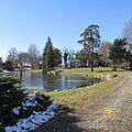
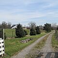
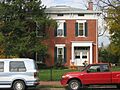
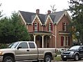
Images for kids
-
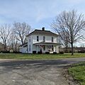
Joseph Black Farmhouse
-
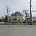
Granville M. Bulen House and Farm Complex
-
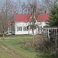
Fridley-Oman Farm
-
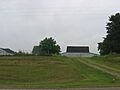
Barns at the Gill-Morris Farm
-
Horsey-Barthelmas Farm
-
Lawndale Farm Complex
-
Matthew McCrea House
-
Morris House
-
Perrill-Goodman Farmhouse
-
Stevenson Peters House
-
Renick Farm
-
Watt-Groce-Fickhardt House


