
Ashville, Ohio facts for kids
Quick facts for kids
Ashville, Ohio
|
|
|---|---|
|
Village
|
|

Looking North on Long Street
|
|

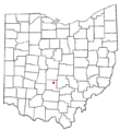
Location of Ashville, Ohio
|
|

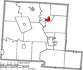
Location of Ashville in Pickaway County
|
|

Ashville, Ohio
Location in Ohio

Ashville, Ohio
Location in the United States

Ashville, Ohio
Location in North America
|
|
| Country | United States |
| State | Ohio |
| County | Pickaway |
| Township | Harrison |
| Area | |
| • Total | 2.23 sq mi (5.78 km2) |
| • Land | 2.23 sq mi (5.78 km2) |
| • Water | 0.00 sq mi (0.00 km2) |
| Elevation | 715 ft (218 m) |
| Population
(2020)
|
|
| • Total | 4,529 |
| • Estimate
(2023)
|
4,760 |
| • Density | 2,030.03/sq mi (783.88/km2) |
| Time zone | UTC-5 (Eastern (EST)) |
| • Summer (DST) | UTC-4 (EDT) |
| ZIP code |
43103
|
| Area code(s) | 740, 220 |
| FIPS code | 39-02680 |
| GNIS feature ID | 2398001 |
| Website | http://ashvilleohio.gov |
Ashville is a small town in Pickaway County, Ohio, United States. In 2020, about 4,529 people lived there. Ashville is located about 17 miles south of Columbus and 8 miles north of Circleville.
Contents
History of Ashville
Long before American settlers arrived in Ohio, Hopewell Native American groups lived in the area that is now Ashville. The Snake Den Mounds, which are ancient earthworks, were built a few miles outside the village. People believe they were built before the year 500.
Centuries later, the Pekowi band of the Shawnee people lived here. This group gave their name to Pickaway County. The Pekowi lived in the area for much of the 1700s, but they eventually moved as more American settlers came west.
Early American Settlement
Ashville is on land that Great Britain took control of in 1763 after winning the French and Indian War. However, white settlers were not allowed to move there at first. After the American Revolutionary War, the United States claimed the area. It was first surveyed, or mapped, in 1799.

Richard Staige (or Stage) Sr. was the first settler in the area that became Ashville. He moved there from Virginia in 1808. After he died in 1811, his sons, Richard Jr. and William, each built a distillery (a place where alcoholic drinks are made) in 1812. Richard Jr. officially bought the land they lived on in 1816.

In 1837, Richard Jr. sold his distillery to Mahlon Ashbrook. By 1845, Ashbrook had also built a gristmill (a mill for grinding grain) on Walnut Creek. He also owned a large store. His sister, Iva "Ivy," and her husband, Daniel Kellerman, ran the store. Daniel Kellerman became the town's first postmaster. At this time, the town was called Ashbrook. In the same year, Ashbrook helped plan the town, and 25 new houses were built.
Mahlon Ashbrook's businesses faced problems in 1855. He lost a lot of his money and moved west, leaving some of his family behind. Like many places in America, the town had economic difficulties in 1857. The growth of the town also slowed down because of the American Civil War.
Railroad Boom and Growth
The building of the Scioto Valley Railroad through Ashville began in 1874. This brought new people and economic growth to the town. Two new grain elevators (buildings for storing grain) were built. Many railroad workers, especially bridge builders, settled in the northern part of Ashville, an area now called Little Chicago.
In 1875, the post office reopened, and a train station was built in 1876. Finally, in the spring of 1882, nearly 70 years after it was first settled, the village was officially named Ashville.
By 1890, Ashville had 430 citizens. The area's first volunteer fire department was started, and water storage tanks called cisterns were built around the village. In the same year, the Norfolk and Western Railway took over the Scioto Valley Railroad.
.jpg)
Over the next ten years, the village grew by more than 50%. This was helped by new businesses, like the Scioto Valley Canning Factory, built in 1899. This factory canned sweet corn. At its busiest, it had 540 employees and could produce over 200,000 cans of corn each day! Many other businesses also opened, such as blacksmith shops, a lumber yard, a hotel, and even an opera house.
In 1904, the Scioto Valley Traction Company opened an electric railway in town. This line carried passengers and goods from Columbus to Chillicothe. It ran until September 1930. The old train station from this line is still on West Main Street.
Around 1910, the Chesapeake and Ohio Railway (now CSX) was built on the west side of town. Many of the workers who built the tracks, called gandy dancers, settled in Little Chicago. Census records show these workers were mostly from Greece and Bulgaria. By this time, the town's population had grown to over 970 people. Ashville became the second most populated area in Pickaway County.
Modern Ashville

Even though the train lines kept running, the village's population growth slowed down. Over the next thirty years, the population only grew by 129 people. The Great Depression also made growth harder.
The population grew quickly again in the 1950s and 1960s. Ashville became a residential town as new homes were built. New large companies also started to come to Ashville, like Columbus Industries, which opened its factory in 1970. During this time, Ashville also became the center of a new school district when Teays Valley Local School District built its high school in 1963.
Another big growth spurt happened in 1994 when home builders started building modern neighborhoods called subdivisions in Ashville. Two major subdivisions, Ashton Village and Ashton Woods, were built on the north side of town. Together, these added almost 100 new homes.
Since 1990, Ashville has continued to be one of the fastest-growing areas in Pickaway County. Many new housing developments, apartments, and condos have been built. The expansion of Rickenbacker International Airport Global Logistics Park and the Norfolk Southern Railway Intermodal Terminal, built in 2008, have created thousands of jobs in the area.
Geography of Ashville
Ashville is located in the Scioto River Valley. It is about 715 feet (218 meters) above sea level. The village is in a flat, fertile area of Western Ohio with gently rolling hills.
The United States Census Bureau says the village covers about 2.51 square miles (6.50 square kilometers), and all of it is land.
Ice Age Activity
The area where Ashville is today was shaped by three major ice ages. These were the Pre-Illinoian, Illinoian, and Wisconsin glaciations.
- Pre-Illinoian Glaciation: The first glaciers reached Ashville about 780,000 years ago. This glacier stopped right at Ashville's location and blocked the ancient Teays River, creating a large lake called Lake Tight. The old Teays River bed later became an important source of underground water for the area.
- Illinoian Glaciation: Around 190,000 to 130,000 years ago, another glacier covered the area. Most of the changes from this glacier were covered by the next one.
- Wisconsin Glaciation: The last ice in the area started about 35,000 years ago and left around 12,000 years ago. A large ice sheet stretched into Ohio. This ice helped create the Scioto River and shaped the land we see today.
Rivers, Creeks, and Brooks
Ashville is part of the Walnut Creek watershed. Walnut Creek is a smaller stream that flows into the Scioto River. It forms the southern border of Ashville and joins the Scioto River about 2.5 miles southwest of the village. Little Walnut Creek meets Walnut Creek about 0.25 miles southeast of the village. Mud Run, a small brook, flows through the western edge of the village and joins Walnut Creek about 1.7 miles southwest.
Population Information
| Historical population | |||
|---|---|---|---|
| Census | Pop. | %± | |
| 1890 | 430 | — | |
| 1900 | 654 | 52.1% | |
| 1910 | 972 | 48.6% | |
| 1920 | 1,032 | 6.2% | |
| 1930 | 1,085 | 5.1% | |
| 1940 | 1,101 | 1.5% | |
| 1950 | 1,303 | 18.3% | |
| 1960 | 1,639 | 25.8% | |
| 1970 | 1,772 | 8.1% | |
| 1980 | 2,046 | 15.5% | |
| 1990 | 2,254 | 10.2% | |
| 2000 | 3,174 | 40.8% | |
| 2010 | 4,097 | 29.1% | |
| 2020 | 4,529 | 10.5% | |
| 2023 (est.) | 4,760 | 16.2% | |
| U.S. Decennial Census | |||
2020 Census Data
According to the census of 2020, there were 4,529 people living in Ashville. There were 1,891 households and 1,320 families. The average income for a household in the village was $60,293.
2010 Census Data
In the census of 2010, there were 4,097 people, 1,598 households, and 1,100 families in the village. The population density was about 1,632 people per square mile (629 people per square kilometer). Most residents (96.7%) were White. About 1.4% of the population identified as Hispanic or Latino.
About 41.6% of households had children under 18 living with them. The average household had 2.56 people, and the average family had 3.05 people. The median age in the village was 32.8 years old. About 29.3% of residents were under 18, and 9.5% were 65 or older.
Education in Ashville
Schools
Teays Valley Local Schools
Before 1963, Ashville and Harrison Township had their own school, Ashville Harrison School. Its last class graduated in 1962. In the fall of 1962, this district joined with two nearby districts to form Teays Valley. Today, the Teays Valley school district has three schools within Ashville's boundaries: Teays Valley High School, East Middle School, and Ashville Elementary.
Brooks-Yates School
Brooks-Yates was a school that helped students in Pickaway County with developmental disabilities. It moved to Teays Valley's main campus in Ashville in 2016. The school closed in 2021 because fewer students were attending.
CSCC – Pickaway County Center
A branch campus of Columbus State Community College used to be located at Teays Valley High School. As of 2022, this campus is no longer active.
Library

Ashville has a public library called the Floyd E. Younkin Branch Library, located on Long Street. It is part of the Pickaway County Library system. It opened in 1999 after the Younkin family, who owned local businesses, donated money to open the library.
Arts and Culture
Churches

There are five Christian churches in Ashville. These include Ashville Church of Christ in Christian Union, Heritage Church of Christ, First English Lutheran Church, Village Chapel Church, and Zion United Methodist Church. First English Lutheran Church helped start the Ashville Food Pantry, which is in the center of the village on Long Street.
Community Park

Ashville has one public park called the Ashville Community Park. It is 10 acres big. A community club bought the land in 1920 and gave it to the village on April 4, 1921. They asked that the village use it for sports and park activities. The club also built an indoor shelter. Soon after, the village built a baseball field with concrete bleachers and a quarter-mile track. Ashville has also added a playground, an outdoor shelter, pickleball courts, basketball courts, restrooms, and a gazebo. The park is where the annual Fourth of July Celebration and Viking Festival are held.
Fourth of July Celebration
Ashville's Fourth of July Celebration has been happening since 1929. Thousands of people come to the community for it every year. The Ashville Community Men's Club hosts this five-day event. It includes food stands, rides, a queen contest, a daily fish fry, music, parades, and a community church service. The carnival is at Ashville Community Park. Fireworks end the celebration on Independence Day night, launched from the Teays Valley High School property.
Viking Festival
The Viking Festival is a spring festival that started in the mid-2000s. It celebrates ancient Scandinavian culture. Hundreds of people gather at the Ashville Community Park. Reenactors dress up and act like Vikings. Visitors can enjoy music, food, and handmade goods from that time. A Viking ship replica is at the center of the camp, and there are also jousting and swordsmanship shows. The festival was paused in 2020 and 2021 because of the COVID-19 pandemic. In 2022, the festival returned and added a beer garden.
Museums
Ashville Depot

The Ashville Depot is an old train station for the Scioto Valley Railway. It was built in 1876 and closed in 1976. This wooden building was added to the National Register of Historic Places in 1980. It is located where Madison and Cromley Streets meet. The building is now used as a meeting place and a railroad museum. The Ashville Community Men's Club owns and runs it.
Ohio's Small Town Museum

In 1978, the Ashville Area Heritage Society opened what became Ohio's Small Town Museum. It is in an old silent film theater, which locals called the Rocky Dreamland Theatre. Charlie Morrison, a longtime village leader, and Bob Hines, a researcher, led this project. The museum has many local items, including a 17-star United States flag, a buoy from the sunken battleship, USS Maine, and a working traffic light invented by local resident Teddy Boor in 1932. The museum claims this traffic light is the world's oldest working traffic light, and the village supports this claim. Guinness World Records also recognized it as the Oldest Functioning Traffic Light.
Old Town Jail Museum
The Old Town Jail Museum is at the corner of Cherry and Long Streets. Built in 1886, the building was the police headquarters until 1988. In 2021, the village opened a museum there to show the village's history with law enforcement. Other parts of the building are used for village council meetings and the streets department.
Notable Residents
- Harley H. Christy, World War I hero and Vice Admiral
- Champ Henson, former Cincinnati Bengals football player
- Ron Hood, politician
- William Ashbrook Kellerman, scientist who studied fungi, journal founder, explorer, and photographer
- Seth Mosley, Christian music singer and producer
- Isham Randolph, civil engineer for Chicago and the Panama Canal
- Brian Stewart, politician
Images for kids
-
Location of Ashville, Ohio
-
Location of Ashville in Pickaway County
See also
 In Spanish: Ashville (Ohio) para niños
