Scioto River facts for kids
Quick facts for kids Scioto River |
|
|---|---|
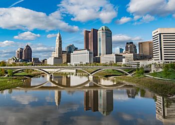
The Scioto River in downtown Columbus, Ohio
|
|
| Physical characteristics | |
| Main source | Near Roundhead, Ohio 40°36′32″N 83°52′37″W / 40.6089398°N 83.8768831°W |
| River mouth | Ohio River near Portsmouth 486 ft (148 m) 38°43′50″N 83°00′46″W / 38.7306319°N 83.0126747°W |
| Length | 231 mi (372 km) |
| Basin features | |
| Basin size | 6,517 sq mi (16,880 km2) |
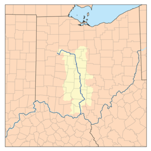
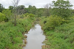
The Scioto River (pronounced sy-OH-tuh) is a river in central and southern Ohio. It is over 231 miles (372 km) long. The river starts in Hardin County, Ohio, near Roundhead, Ohio. It then flows through Columbus, Ohio, where it meets its biggest branch, the Olentangy River. Finally, it joins the Ohio River near Portsmouth, Ohio.
Long ago, early settlers and Native Americans used the Scioto River for moving goods. Today, it is too small for big commercial ships. The river is now mainly used for fun activities like boating and as a source of drinking water. It is the longest river that stays completely within Ohio.
Contents
River's Path and Land Features
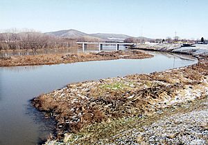
The lower part of the Scioto River valley is very wide, even though the river itself is not that wide. This wide valley was carved out by melting ice from ancient glaciers. The flat valley bottoms are great for farming. This is because floods from the last Ice age left behind rich soil. Because of this, many farms are found along the lower Scioto River. This area has low, rolling hills covered with hardwood trees.
How Glaciers Shaped the Scioto River
The story of the Scioto River is linked to the disappearance of the Teays River system during the Ice Ages. The Teays River used to flow north. But glaciers blocked it, creating huge lakes. One of these, Lake Tight, was about two-thirds the size of today's Lake Erie. When these lakes overflowed, they carved new paths, leading to the creation of the Ohio River. The Scioto River then took over parts of the old Teays River valley. Interestingly, the Scioto River flows in the opposite direction of the Teays River. In cities like Columbus and Dublin, the river has cut through ancient rock. This rock contains fossils from the Devonian period. Many smaller streams flowing into the Scioto have beautiful waterfalls, such as Hayden Falls.
History of the Scioto River Valley
The Scioto River valley was once home to many Native American groups. The most famous are the Mound Builders of the Hopewell tradition. The Adena culture built large burial mounds over 2,000 years ago. You can still see many of these mounds near Chillicothe, Ohio, at the Hopewell Culture National Historical Park. These ancient cultures were very strong and well-known. The name Scioto comes from the Wyandot language word for "deer."
A Path to Freedom
Before the American Civil War, the Scioto River was an important route for enslaved people escaping from the Southern United States. After crossing the Ohio River, they would continue north along the Scioto. Towns like Chillicothe became key stops on the Underground Railroad, a secret network that helped people find freedom.
Music and the River
There is a traditional fiddle tune called "Big Scioty." It is popular in the Appalachian region and is named after the river. The Hammons family from West Virginia is known for this melody.
Recent River Conditions
In 2012, Ohio experienced a severe drought. This caused the Scioto River's water levels to drop to record or near-record lows.
Dams and Water Storage
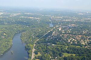
There are two main dams on the Scioto River. The Griggs Dam in Columbus was built between 1904 and 1908. Its purpose was to provide drinking water for the city. Further upstream, near Shawnee Hills, the O'Shaughnessy Dam was built from 1922 to 1925. This dam created an even larger reservoir. At the time, it was called "the finest inland waterway in the United States." Both dams are managed by the city of Columbus.
Main Street Dam Removal
The Main Street Dam in downtown Columbus was built in 1921. Its removal started in November 2013. This project cost $35.5 million and was part of a plan for downtown Columbus. Before it was removed, the Main Street Dam made the Scioto River about 500 feet (150 m) wide in downtown Columbus.
The Scioto Greenways project will make the river nearly half as wide. It will also create 33 acres (13 ha) of new parkland for the city. The river channel will be restored to its natural state with riffles and pools. Experts believe this project will make the river healthier. It will also create a better home for native plants, fish, and mussels.
Cities and Towns Along the Scioto River
Here are some cities and towns along the Scioto River, listed from where it starts to where it ends:
- Roundhead
- McGuffey
- Kenton
- Hepburn
- LaRue
- Green Camp
- Prospect
- Shawnee Hills
- Dublin
- Upper Arlington
- Grandview Heights
- Columbus
- Circleville
- Chillicothe
- Waverly
- Piketon
- Portsmouth
Important Bridges
Here are some notable bridges that cross the Scioto River:
- Main Street Bridge
- Rich Street Bridge
- Discovery Bridge
- Dublin Link
- Bridge Street Bridge (Chillicothe, Ohio)
Other Names for the River
The Scioto River has been known by several other names over time. These include:
- Big Sciota River
- Big Scioto River
- Chianotho River
- Great Siota River
- Menkwi Siipunk
- Riviere Chianouske
- Sci-ou-to
- Sciodoe Creek
- Sciota River
- Seeyotah River
- Sinhioto River
- Siothai River
- Sioto River
See also
 In Spanish: Río Scioto para niños
 | Mary Eliza Mahoney |
 | Susie King Taylor |
 | Ida Gray |
 | Eliza Ann Grier |


