
South Bloomfield, Ohio facts for kids
Quick facts for kids
South Bloomfield, Ohio
|
|
|---|---|
|
Village
|
|

South Bloomfield Municipal Building
|
|

Location of South Bloomfield, Ohio
|
|

Location of South Bloomfield in Pickaway County
|
|
| Country | United States |
| State | Ohio |
| County | Pickaway |
| Township | Harrison |
| Area | |
| • Total | 3.93 sq mi (10.18 km2) |
| • Land | 3.93 sq mi (10.18 km2) |
| • Water | 0.00 sq mi (0.00 km2) |
| Elevation | 682 ft (208 m) |
| Population
(2020)
|
|
| • Total | 2,143 |
| • Density | 545.15/sq mi (210.47/km2) |
| Time zone | UTC-5 (Eastern (EST)) |
| • Summer (DST) | UTC-4 (EDT) |
| ZIP code |
43103
|
| Area code(s) | 740 |
| FIPS code | 39-73068 |
| GNIS feature ID | 2399843 |
| Website | http://www.southbloomfieldoh.com/ |
South Bloomfield is a small village located in Pickaway County, Ohio, United States. In 2020, about 2,143 people lived there. It has been one of the fastest-growing villages in central Ohio since the year 2000.
Contents
South Bloomfield's Story
South Bloomfield was first planned out in 1803. A person named General James Denny was hired to measure and divide the land. He marked out 40 acres into 80 different lots. The people who started the town hoped it would become the main town, or "county seat," for the area. However, things changed, and it didn't happen.
Did you know? South Bloomfield was once known as the Puppetry Capital of America!
Where is South Bloomfield?
The village covers an area of about 4.28 square miles (10.18 square kilometers). All of this area is land, with no large bodies of water inside the village limits.
Who Lives Here?
The number of people living in South Bloomfield has changed a lot over the years. Here's how the population has grown:
| Historical population | |||
|---|---|---|---|
| Census | Pop. | %± | |
| 1870 | 283 | — | |
| 1880 | 303 | 7.1% | |
| 1890 | 272 | −10.2% | |
| 1900 | 222 | −18.4% | |
| 1910 | 212 | −4.5% | |
| 1920 | 230 | 8.5% | |
| 1930 | 235 | 2.2% | |
| 1940 | 238 | 1.3% | |
| 1950 | 250 | 5.0% | |
| 1960 | 424 | 69.6% | |
| 1970 | 610 | 43.9% | |
| 1980 | 934 | 53.1% | |
| 1990 | 900 | −3.6% | |
| 2000 | 1,179 | 31.0% | |
| 2010 | 1,744 | 47.9% | |
| 2020 | 2,143 | 22.9% | |
| U.S. Decennial Census | |||
In 2010, there were 1,744 people living in the village. Most people living in South Bloomfield were White (97.1%). A small number of people were African American, Native American, or Asian. About 1.1% of the population was Hispanic or Latino.
The average age of people in the village was about 34 years old. Many families lived there, with about 4 out of 10 households having children under 18.
Learning in South Bloomfield
Students in South Bloomfield attend schools that are part of the Teays Valley Local School District.
South Bloomfield in Videos
South Bloomfield has been shown in a video called "We Are... Teays Valley." This video highlights many cool things about the area, including achievements and its connections to history.
Pictures of South Bloomfield
-
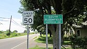
South Bloomfield corporation limit sign
-
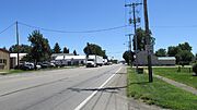
Looking south on North Walnut Street (US Highway 23) in South Bloomfield
-
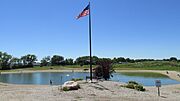
Krazy Kats Pay Lake
-
Rick Brown Memorial VFW Post 7941
-
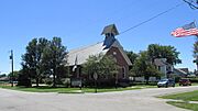
South Bloomfield United Methodist Church
-
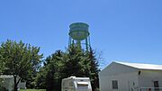
South Bloomfield Water Tower
-
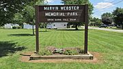
Marvin Webster Memorial Park
-
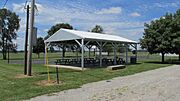
Marvin Webster Memorial Park


See also
 In Spanish: South Bloomfield (Ohio) para niños
