National Register of Historic Places listings in Preble County, Ohio facts for kids
Hey everyone! Have you ever wondered about really old and important buildings or places in your town? Well, in Preble County, Ohio, there's a special list of places that are super important to history. This list is called the National Register of Historic Places. It's like a hall of fame for buildings, bridges, and even old forts that tell us stories about the past.
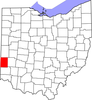
This page shows you all the cool historic spots in Preble County, Ohio, that are on this special list. These places are recognized by the United States government for their historical value. You can even see where many of them are located on a map! There are 19 amazing places in Preble County that have made it onto this special list.
Historic Places in Preble County
This section lists all the amazing places in Preble County that are on the National Register of Historic Places. Each one has a unique story and helps us understand the history of Ohio and the United States.
| Name on the Register | Image | Date listed | Location | City or town | Description | |
|---|---|---|---|---|---|---|
| 1 | Acton House |
(#85001944) |
115 W. Main St. 39°44′38″N 84°38′15″W / 39.74375°N 84.6375°W |
Eaton | The Acton House is a historic home located in Eaton. It was added to the National Register in 1985. | |
| 2 | Brubaker Covered Bridge |
(#75001527) |
West of Gratis on Aukerman Creek Rd. 39°39′06″N 84°32′39″W / 39.651667°N 84.544167°W |
Gratis Township | This beautiful covered bridge is a classic example of old bridge building. It was added to the list in 1975. | |
| 3 | Bunker Hill House |
(#01001062) |
7919 State Route 177 in Fairhaven 39°38′13″N 84°46′20″W / 39.636944°N 84.772222°W |
Dixon Township | The Bunker Hill House, located in Fairhaven, became a historic site in 2001. | |
| 4 | Camden City Hall and Opera House |
(#98000100) |
54 W. Central Ave. 39°37′44″N 84°39′00″W / 39.628889°N 84.65°W |
Camden | This building served as both the city hall and an opera house, a place for performances, showing its importance to the community. It was listed in 1998. | |
| 5 | Camden Public School |
(#98000041) |
110 W. Central Ave. 39°37′48″N 84°38′33″W / 39.63°N 84.6425°W |
Camden | This old school building in Camden was recognized for its historical importance in 1998. | |
| 6 | Christman Covered Bridge |
(#76001516) |
1.5 miles northwest of Eaton 39°46′13″N 84°39′18″W / 39.770278°N 84.655000°W |
Washington Township | Another beautiful covered bridge, the Christman Covered Bridge, was added to the list in 1976. | |
| 7 | Daniel Christman Homestead |
(#82001486) |
West of Eaton on U.S. Route 35 39°45′44″N 84°40′04″W / 39.762222°N 84.667778°W |
Washington Township | This homestead, or old farm, belonged to Daniel Christman and was recognized in 1982. | |
| 8 | Eaton High School |
(#14001052) |
307 N. Cherry St. 39°44′50″N 84°38′08″W / 39.747222°N 84.635556°W |
Eaton | The main building of Eaton High School is a more recent addition to the list, recognized in 2014. | |
| 9 | Fort St. Clair Site |
(#70000514) |
1 mile west of downtown Eaton 39°44′16″N 84°39′15″W / 39.737778°N 84.654167°W |
Eaton | This site is where Fort St. Clair once stood, an important military post from early American history. It was listed in 1970. | |
| 10 | Geeting Covered Bridge |
(#75001528) |
2 miles west of Lewisburg on Price Rd. 39°50′37″N 84°35′50″W / 39.843611°N 84.597222°W |
Monroe Township | The Geeting Covered Bridge, a well-preserved example of its kind, was added to the Register in 1975. | |
| 11 | Harshman Covered Bridge |
(#76001517) |
4 miles north of Fairhaven on Concord-Fairhaven Rd. spanning Four Mile Creek 39°42′09″N 84°46′11″W / 39.702500°N 84.769611°W |
Dixon Township | This covered bridge crosses Four Mile Creek and was recognized as historic in 1976. | |
| 12 | Historic Associate Reformed Church and Cemetery |
(#08000161) |
6471 Camden-College Corner Rd. 39°36′11″N 84°45′38″W / 39.603°N 84.7605°W |
Israel Township | This historic church and its cemetery tell stories of the community's past. It was added to the list in 2008. | |
| 13 | Hueston Woods Park Mound |
(#71000650) |
Trail near Class A Campground in Hueston Woods State Park 39°35′05″N 84°46′44″W / 39.584722°N 84.778888°W |
Israel Township | This ancient mound in Hueston Woods State Park is a significant archaeological site, recognized in 1971. | |
| 14 | Lange Hotel |
(#90002213) |
1 W. Dayton St. 39°44′41″N 84°31′57″W / 39.744722°N 84.5325°W |
West Alexandria | The Lange Hotel is a historic building in West Alexandria, added to the Register in 1991. | |
| 15 | Roberts Covered Bridge |
(#71000651) |
City park in southwestern Eaton 39°44′26″N 84°38′20″W / 39.740444°N 84.63875°W |
Eaton | This covered bridge was moved to a city park in Eaton from its original spot, showing how important it was to save. It was listed in 1971. | |
| 16 | St. Clair Street Bridge |
(#78002175) |
Over Seven Mile Creek 39°44′24″N 84°38′19″W / 39.74°N 84.638611°W |
Eaton | This bridge over Seven Mile Creek in Eaton was added to the National Register in 1978. | |
| 17 | George B. Unger House |
(#78002176) |
29 E. Dayton St. 39°44′40″N 84°31′51″W / 39.744444°N 84.530833°W |
West Alexandria | The George B. Unger House is a historic home in West Alexandria, recognized in 1978. | |
| 18 | Warnke Covered Bridge |
(#76001518) |
Northeast of Lewisburg on Swamp Creek Rd. 39°52′26″N 84°30′53″W / 39.873889°N 84.514722°W |
Harrison Township | The Warnke Covered Bridge, located northeast of Lewisburg, was added to the list in 1976. | |
| 19 | West Alexandria Depot |
(#06000696) |
71 E. Dayton St. 39°44′42″N 84°31′43″W / 39.745°N 84.528611°W |
West Alexandria | The West Alexandria Depot is an old train station, an important part of transportation history, listed in 2006. |


