
National Register of Historic Places listings in Silver Bow County, Montana facts for kids

Have you ever wondered about old buildings and places that are super important to history? In Silver Bow County, Montana, there's a special list of places called the National Register of Historic Places. This list helps protect buildings, sites, and objects that tell us about the past of the United States. It's like a hall of fame for historic spots!
Silver Bow County has 20 amazing places on this list. Two of them are even more special and are called National Historic Landmarks. These landmarks are considered important to the entire country's history. Let's explore some of these cool historic sites!
Contents
Historic Places in Silver Bow County
Many of the places on the National Register in Silver Bow County are found in or near the city of Butte, Montana. These sites tell stories about mining, daily life, and important people from long ago.
Butte-Anaconda Historic District
The Butte-Anaconda Historic District is a huge area that includes most of the developed parts of Butte, Anaconda, and Walkerville. It's so important that it's one of the two National Historic Landmarks in the county! This district shows us what life was like when mining was a huge industry in Montana. You can see old buildings, mines, and homes that tell the story of the copper boom.

Important Homes and Mansions
Silver Bow County has some grand old houses that belonged to important people.
Charles W. Clark Mansion
The Charles W. Clark Mansion is a beautiful old house located at 108 North Washington Street in Butte. It was built for Charles W. Clark, who was a member of a very famous and powerful family in Montana's mining history.
_-_Silver_Bow_County,_Montana.png)
W. A. Clark Mansion
Another impressive home is the W. A. Clark Mansion, also known as the Copper King Mansion. It's located at 219 West Granite Street in Butte. This mansion belonged to William A. Clark, Charles's father, who was a very wealthy and influential person in the mining industry and even became a U.S. Senator.
_2002-05.jpg)
Burton K. Wheeler House
The Burton K. Wheeler House is another National Historic Landmark in Butte, found at 1232 East 2nd Street. Burton K. Wheeler was a very important politician from Montana. He served as a U.S. Senator for many years and was known for his strong opinions and work in government. His home is recognized for its connection to his life and career.
_-_Silver_Bow_County,_Montana.png)
Historic Schools
Several old school buildings in Butte are also on the National Register, showing how communities grew and valued education.
Hawthorne Grade School
The Hawthorne Grade School is located at 3500 White Way. This old school building is a reminder of the many students who learned and grew up in Butte.

Madison Grade School
Another historic school is the Madison Grade School at 45 East Greenwood. Like Hawthorne, it represents the history of education in the area.
_-_Silver_Bow_County,_Montana.png)
Other Interesting Places
Silver Bow County has a variety of other unique and important historic sites.
Matt's Place Drive-In
If you like old-fashioned diners, you'd be interested in Matt's Place Drive-In at 2339 Placer Street in Butte. This spot is famous for its classic American diner feel and has been serving up food for a long time. It's a fun example of a historic business.
_-_Silver_Bow_County,_Montana.png)
Parrot Mine Shops Complex
The Parrot Mine Shops Complex at 244 Anaconda Road in Butte is a historic industrial site. It was part of the huge mining operations that made Butte famous. These shops were where equipment was repaired and maintained for the mines.
_-_Silver_Bow_County,_Montana.png)
Silver Bow County Poor Farm Hospital
The Silver Bow County Poor Farm Hospital at 3040 Continental Drive in Butte is a historic building that once served as a hospital for people who needed care. It tells a story about how communities provided support for their residents in the past.

Socialist Hall
The Socialist Hall at 1957 Harrison Avenue in Butte is a building with a unique history. It was a meeting place for people who believed in certain political ideas called "socialism," which focuses on community ownership and equal distribution of resources. It played a role in the social and political movements of its time.

Mike Mansfield Federal Building and United States Courthouse
The Mike Mansfield Federal Building and United States Courthouse at 400 North Main Street in Butte is an important government building. It serves as a courthouse and a place for federal government offices. It's named after Mike Mansfield, another very important politician from Montana who served as a U.S. Senator and Ambassador.

Images for kids
-
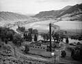
Big Hole Pumpstation

