
National Register of Historic Places listings in Stark County, Ohio facts for kids

Welcome to Stark County, Ohio! This area is home to many special buildings and places that are listed on the National Register of Historic Places. This list helps us remember and protect important parts of American history.
The National Register of Historic Places is like a special club for buildings, sites, and objects that are important to the history of the United States. When a place is on this list, it means it has a unique story to tell about our past. In Stark County, there are 90 such places! One of them is even a National Historic Landmark, which is a super important designation.
Historic Places You Can Visit
Many of Stark County's historic places are still standing and tell amazing stories. Let's explore some of them!
Buildings with Cool Stories
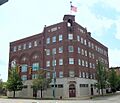
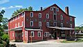
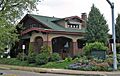
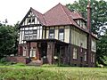
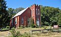
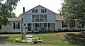
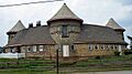
- Brewster Railroad YMCA/Wandle House: Imagine a place built in 1916 for railroad workers to stay! This building in Brewster was once a dormitory for the Wheeling and Lake Erie Railway. Today, it's a museum where you can learn about local history and even a restaurant!
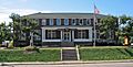
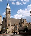
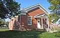
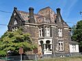
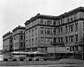
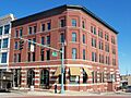
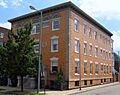
- Canton Public Library: Libraries are always special places. This one in Canton is a historic building where people have been reading and learning for many years.
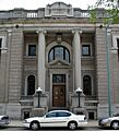
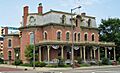
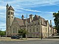
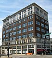
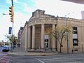
- City National Bank Building: Located in Canton, this building is part of the First Ladies National Historic Site. It's connected to the history of America's First Ladies.
- Clearview Golf Club: This golf club near East Canton is truly unique! It was opened in 1948 by William J. Powell, an African American man. It's the only golf club in the United States designed, built, owned, and operated by an African American. The Powell family still runs it today!
- Eagles Building-Strand Theater: In Alliance, this building once housed the Eagles club and the Strand Theater. Think of all the movies and shows people watched here!
- Elson-Magnolia Flour Mill: This old flour mill in Magnolia reminds us of how food was made long ago. It's a piece of industrial history.
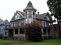
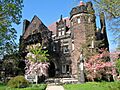
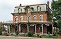
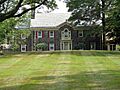
- Glamorgan Castle: This amazing building in Alliance looks like a real castle! It's a grand historic home that stands out.
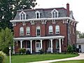
- Haines House: Also in Alliance, the Haines House has its own website, showing how important it is to local history.
- Hartville Hotel: This historic hotel in Hartville is now known as the Hartville Pie Factory and Restaurant. Imagine staying in a hotel that now serves delicious pies!
- Hoover Company Historic District: In North Canton, this area includes the original buildings of the Hoover Company, famous for vacuum cleaners. It's a cool look into how a big company started.
- Ideal Department Store Building: In Massillon, this building was once a busy department store. Think of all the shopping people did here!
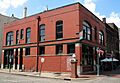
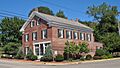
- Landmark Tavern: This tavern in Canton has been around for a long time, serving as a gathering place for the community.
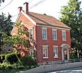
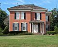
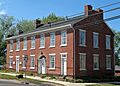
- Maudru House: Located in Maximo, this is the only brick house in the area. It stands out as a historic landmark.
- New Baltimore Inn: This inn in Marlboro Township has been a stopping point for travelers for many years.
- Old McKinley High School: In Canton, this building was once a high school. Imagine all the students who walked its halls and learned there!
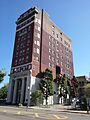
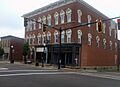
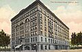
- Onesto Hotel: This grand hotel in Canton was a fancy place for visitors to stay.
- Palace Theater: Another historic theater in Canton, the Palace Theater has hosted countless performances and events.
- St. Edward Hotel: This hotel in Canton also has a long history of welcoming guests.
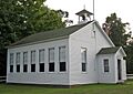
- Science Hill School: West of Alliance, this was a one-room schoolhouse built around 1870. It was the last one-room school in Stark County, operating until 1956! Imagine learning with all grades in one room.
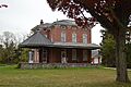
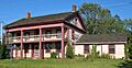
- Stahl-Hoagland House: In Navarre, this house was built in 1834 by a canal boat captain. It tells a story of the Ohio and Erie Canal and the people who worked on it.
- Werner Inn: This inn in East Canton is another historic place that provided lodging for travelers.
Important Churches and Memorials
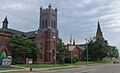
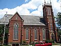
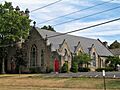
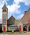
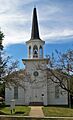
- First Methodist Episcopal Church (Canton): This church in Canton was the home church of President William McKinley. It's now called Church of the Savior.
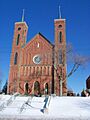
- First Methodist Episcopal Church (Massillon): This church in Massillon is another historic place of worship.
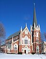
- First Methodist Episcopal Church of Alliance, Ohio: Alliance also has a historic Methodist church.
- First Reformed and First Lutheran Churches: These two churches in Canton have a shared history. First Reformed is now known as First Church of the Resurrection.
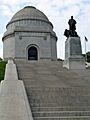
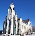
- McKinley National Memorial: This is a very important site in Canton. It's the tomb of President William McKinley, who was from Ohio. It's a National Historic Landmark, meaning it's one of the most important historic places in the entire country.
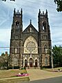
- St. John's Catholic Church (Canton): This church in Canton was named a Minor basilica by the Holy See in 2012, which is a special honor.
- Saint Joseph's Roman Catholic Church (Massillon): This Massillon church is another beautiful historic place of worship.
- St. Louis Church (Louisville): This church in Louisville is a historic landmark in its community.
- St. Mary's Catholic Church (Massillon): Another historic Catholic church in Massillon.
- St. Paul's Reformed Church (Navarre): South of Navarre, this church has a long history, even though it had only one active member in 2008!
- St. Peter Church (Canton): This Canton church is another historic Catholic church.
- St. Timothy's Protestant Episcopal Church: This church in Massillon is also a protected historic site.
- Trinity Lutheran Church (Canton): This Canton church is another historic place of worship.
- Wilmot United Brethren Church: This church in Wilmot is a historic landmark along U.S. Route 62.
Historic Districts and Homes
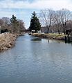
- Canal Fulton Historic District: This area in Canal Fulton and Lawrence Township includes parts of the Ohio-Erie Canal. It's a great place to see how life was during the canal era.
- Fourth Street Historic District (Massillon): This district in Massillon is a collection of historic buildings.
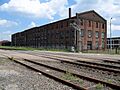
- Hercules Motors Corporation Industrial Complex: In Canton, this complex shows the history of a major industrial company.
- Hoover Farm: East of North Canton, this farm is also known as the Hoover Historical Center. It's connected to the Hoover family, who founded the famous vacuum company.
- Louisville Historic District (Louisville): This district in Louisville includes many historic buildings that show the town's past.
- Ridgewood Historic District: This area in Canton is known for its historic homes and beautiful architecture.
- Rochester Square Historic District: In Navarre, this district includes several historic buildings that make up a unique square.
- Upper Downtown Canton Historic District: This large district in Canton includes many historic buildings in the heart of the city.
- Saxton House: This house in Canton is part of the First Ladies National Historic Site. It's connected to the family of First Lady Ida Saxton McKinley.
Other Interesting Sites
- First National Bank Building (Massillon): This historic bank building in Massillon shows the financial history of the area.
- Five Oaks (Massillon): This historic home in Massillon is a grand example of old architecture.
- Harry S. Renkert House: This house in Canton now hosts the Greater Canton Amateur Sports Hall of Fame.
- Seven Ranges Terminus: West of Magnolia, this spot marks an important survey point used to divide up land in Ohio and other states long ago. It extends into Carroll and Tuscarawas counties.
- Spring Hill (Massillon): This historic site in Massillon has a unique story.
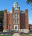
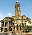
- Stark County Courthouse and Annex: In Canton, this building is where many important legal and government decisions have been made for Stark County.
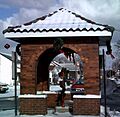
- The Town Pump of East Sparta: This historic town pump in East Sparta is a simple but important reminder of how communities got water in the past.
Former Listings
Some historic places were once on the National Register but have since been removed. This can happen if a building is demolished or moved.
- Case Mansion: This mansion in Canton was once listed but was removed in 1990.
- Hotel Courtland: Also known as the Hotel St. Francis, this Canton hotel was removed from the list in 1995 because it was torn down in 1992.
- William Kettering Homestead: This homestead near Massillon was removed from the list in 1990 because it was moved to a new location.
Images for kids
-
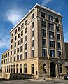
Alliance Bank Building
-
Jacob H. Bair House
-
Barber-Whitticar House
-
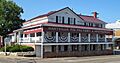
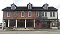
Bender's Restaurant-Belmont Buffet
-
Bordner House
-
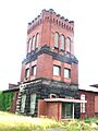
Brewster Railroad YMCA
-
Ohio-Erie Canal in Canal Fulton
-
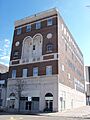
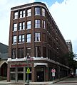
Canton Public Library
-
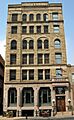
City National Bank Building
-
City Savings Bank & Trust Company
-
Clearview Golf Club
-
George E. Cook House
-
Dewalt Building
-

John and Syd Dobkins House
-
Eagles Building-Strand Theater
-
Eagles' Temple
-
Earley-Hartzell House
-
Elson-Magnolia Flour Mill
-
Harry E. Fife House
-
Charles E. Firestone House
-
Saxton House (part of First Ladies National Historic Site)
-
First Methodist Episcopal Church (Canton)
-
First Methodist Episcopal Church (Massillon)
-
First Methodist Episcopal Church (Alliance)
-
First National Bank Building (Massillon)
-
First Reformed and First Lutheran Churches
-
Five Oaks
-
Charles Steese House (Fourth Street Historic District)
-
Frances Apartment Building
-
Garnet B. French House
-
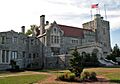
Glamorgan Castle
-
Haines House
-
Hartville Hotel
-
Harvard Company-Weber Dental Manufacturing Company
-
Hercules Motors Corporation Industrial Complex
-

Hoover Company Historic District
-
Hoover Farm
-
Ideal Department Store Building
-
Lake Township School
-
Landmark Tavern
-
Loew-Define Grocery Store and Home
-
Louisville Historic District
-
Brooke and Anna E. Martin House
-
Massillon Cemetery Building
-
Maudru House
-
William McKinley Tomb
-
Mellett-Canton Daily News Building
-
John Miller House
-
Mount Union College District
-
New Baltimore Inn
-
Old McKinley High School
-
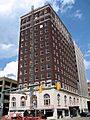
Onesto Hotel
-
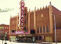
Palace Theater
-
Robert A. and Elizabeth H. Purcell House
-
Walter S. Putman House
-
Harry S. Renkert House
-
Ridgewood Historic District
-
Rochester Square Historic District
-
St. Edward Hotel
-
St. John's Catholic Church
-
Saint Joseph's Roman Catholic Church
-
St. Louis Church
-
St. Mary's Catholic Church
-
St. Paul's Reformed Church
-
St. Peter Church
-
St. Timothy's Protestant Episcopal Church
-
Saxton House
-
August Schuffenecker Building
-
Science Hill School
-
Emanuel and Frederick Serquet Farm
-

Seven Ranges Terminus
-
Spring Hill
-
Stahl-Hoagland House
-
Stark County Courthouse and Annex
-

Harry Bartlett Stewart Property
-
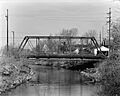
Third Street Bridge (Demolished)
-
Henry H. Timken Estate Barn
-
The Town Pump of East Sparta
-
Trinity Lutheran Church
-
Upper Downtown Canton Historic District
-
Vicary House
-
Werner Inn
-
Wilmot United Brethren Church
-
Hotel Courtland (Former Listing)
.JPG)
.JPG)


.JPG)
.JPG)


.JPG)

.JPG)
.JPG)


.JPG)
.JPG)


.JPG)

.JPG)
.JPG)
.JPG)

.JPG)
.JPG)

.JPG)
.JPG)
.JPG)
.JPG)


.JPG)
.JPG)
.JPG)

.JPG)

.JPG)
.JPG)

.JPG)

.JPG)
.JPG)
.JPG)


.JPG)
.JPG)

.JPG)


.JPG)
.JPG)

.JPG)
_2.JPG)

.JPG)
.JPG)

.JPG)
.JPG)
_edit.JPG)


.JPG)


.JPG)
.JPG)
.JPG)
.jpg)
