National Register of Historic Places listings in Wabash County, Indiana facts for kids
Have you ever wondered about old buildings or special places that tell a story? In Wabash County, Indiana, there are many such spots! These places are so important that they are listed on something called the National Register of Historic Places. This list helps protect and celebrate buildings, areas, and objects that have special meaning in history.
You can think of the National Register as a hall of fame for historic places across the United States. When a place is added, it means it's recognized for its historical, architectural, or archaeological importance. This list helps people learn about the past and keep these treasures safe for future generations.
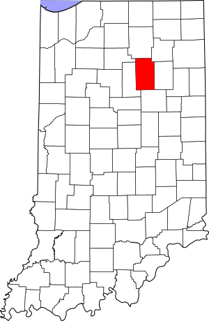
In Wabash County, there are 32 different places and areas that are currently on this special list. One place was on the list before but has since been removed. If a place is inside a town, its name will show the town. If it's in the countryside, it will show the name of its township. Some places are so big they might even be in more than one area!
Historic Places in Wabash County
This section lists all the amazing places in Wabash County that are part of the National Register of Historic Places. Each entry tells you a little about the place, where it is, and when it was added to the list.
| Name on the Register | Image | Date listed | Location | City or town | Description | |
|---|---|---|---|---|---|---|
| 1 | 4th Roann Covered Bridge |
(#81000022) |
North of Roann on N. County Road 700W 40°54′56″N 85°55′27″W / 40.915556°N 85.924167°W |
Paw Paw Township and Roann | This beautiful old bridge is a classic example of a covered bridge. It helps people cross the river and looks like something from a postcard! | |
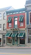
| 2 | James M. Amoss Building |
(#84001742) |
110 S. Wabash St. 40°47′52″N 85°49′16″W / 40.797667°N 85.821000°W |
Wabash | This building is a historic structure in the heart of Wabash. It shows the architecture from a past era. | |
| 3 | Downtown Wabash Historic District |
(#86001678) |
Roughly bounded by Hill, Wabash, Canal, and Miami Sts. 40°47′50″N 85°49′17″W / 40.797222°N 85.821389°W |
Wabash | This isn't just one building, but a whole area! It includes many historic buildings in the downtown part of Wabash. | |
| 4 | East Wabash Historic District |
(#11000390) |
Roughly bounded by Walnut, E. Market, N. Wabash, and S. East Sts. 40°47′56″N 85°49′04″W / 40.798889°N 85.817778°W |
Wabash | Another historic district in Wabash, this area has many old homes and buildings that show how the city grew. | |
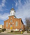
| 5 | First Christian Church |
(#83000161) |
110 W. Hill St. 40°47′56″N 85°49′22″W / 40.798889°N 85.822778°W |
Wabash | This church building is recognized for its unique architecture and its role in the community's history. | |
| 6 | Halderman-Van Buskirk Farmstead |
(#13000092) |
5653 N700W, south of Roann 40°54′22″N 85°55′26″W / 40.906111°N 85.923889°W |
Paw Paw Township | This old farm shows what rural life was like in the past. It includes the farmhouse and other farm buildings. | |
| 7 | Hominy Ridge Shelter House |
(#94001122) |
On the south bank of the Salamonie River, north of Hominy Ridge Lake and southeast of Lagro, in the Salamonie River State Forest 40°48′34″N 85°40′59″W / 40.809444°N 85.683056°W |
Lagro Township | Located in a state forest, this shelter house is a historic spot for outdoor activities and gatherings. | |
| 8 | Honeywell Memorial Community Center |
(#83000042) |
275 W. Market St. 40°47′45″N 85°49′30″W / 40.795833°N 85.825000°W |
Wabash | The Honeywell Center is a well-known community building in Wabash. It has been a hub for events and activities for many years. | |
| 9 | Honeywell Studio |
(#05000609) |
378 N. State Road 15 40°49′48″N 85°51′26″W / 40.830000°N 85.857222°W |
Wabash | This studio is another important site connected to the Honeywell family, showing their impact on the area. | |
| 10 | Hopewell Methodist Episcopal Church and Cemetery |
(#15000600) |
5031 E300N 40°52′13″N 85°41′57″W / 40.870278°N 85.699167°W |
Lagro Township | This historic church and its cemetery tell stories of the community's past and its early settlers. | |
| 11 | LaFontaine Historic District |
(#14000809) |
Roughly Kendall and Branson between Walnut and Gruell Sts. 40°40′27″N 85°43′21″W / 40.674167°N 85.722500°W |
La Fontaine | This district in LaFontaine includes several important buildings that show the town's history and growth. | |
| 12 | Lentz House (Hotel Sheller) |
(#82000050) |
Walnut and 2nd Sts. 41°00′01″N 85°46′08″W / 41.000278°N 85.768889°W |
North Manchester | Once a hotel, this building in North Manchester has a long history and unique architectural features. | |
| 13 | Thomas J. Lewis House |
(#06000521) |
105 S. Arnold St. 40°54′41″N 85°55′18″W / 40.911444°N 85.921667°W |
Roann | This house in Roann is a great example of historic residential architecture in the area. | |
| 14 | Manchester College Historic District |
(#90001929) |
604 College Ave. 41°00′38″N 85°45′45″W / 41.010556°N 85.7625°W |
North Manchester | This district includes important buildings on the campus of Manchester College, showing its long educational history. | |
| 15 | Thomas R. Marshall School |
(#04000206) |
603 Bond St. 41°00′19″N 85°45′45″W / 41.005278°N 85.7625°W |
North Manchester | This school building is named after a famous person and represents the history of education in North Manchester. | |
| 16 | McNamee-Ford House |
(#95000199) |
536 N. Wabash St. 40°48′20″N 85°49′16″W / 40.805556°N 85.821111°W |
Wabash | The McNamee-Ford House is a significant historic home in Wabash, known for its architecture. | |
| 17 | Noftzger-Adams House |
(#79000024) |
102 E. 3rd St. 41°00′06″N 85°46′11″W / 41.001528°N 85.769861°W |
North Manchester | This house in North Manchester is an important example of historic residential design. | |
| 18 | North Manchester Covered Bridge |
(#82000051) |
S. Mill St. at the Eel River 40°59′45″N 85°45′55″W / 40.995833°N 85.765278°W |
North Manchester | Another beautiful covered bridge, this one crosses the Eel River and is a landmark in North Manchester. | |
| 19 | North Manchester Historic District |
(#02000687) |
Roughly bounded by Maple, 3rd, and Mill Sts., and the northern bank of the Eel River 40°59′58″N 85°46′15″W / 40.999444°N 85.770833°W |
North Manchester | This large area in North Manchester contains many historic buildings that show the town's development over time. | |
| 20 | North Manchester Public Library |
(#96000290) |
204 W. Main St. 40°59′57″N 85°46′20″W / 40.999250°N 85.772222°W |
North Manchester | The public library building in North Manchester is recognized for its historical importance and architecture. | |
| 21 | North Wabash Historic District |
(#99001077) |
Roughly bounded by W. Maple, N. Carroll, Ferry, Miami, Pawling, N. Wabash, and Union Sts. 40°48′13″N 85°49′18″W / 40.803611°N 85.821667°W |
Wabash | This district covers a northern part of Wabash, featuring many buildings that tell the story of the city's past. | |
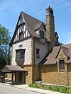
| 22 | Peabody Memorial Tower |
(#10000377) |
400 W. 7th St. 41°00′22″N 85°46′33″W / 41.006000°N 85.775833°W |
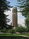
North Manchester | The Peabody Memorial Tower is a prominent landmark in North Manchester, known for its height and design. | |
| 23 | Roann Historic District |
(#13000093) |
Roughly bounded by State Road 16 and West, Ohio, and Beamer Sts. 40°54′40″N 85°55′30″W / 40.911111°N 85.925000°W |
Paw Paw Township and Roann | This historic district in Roann includes a collection of buildings that show the town's unique character and history. | |
| 24 | Roann-Paw Paw Township Public Library |
(#02001561) |
240 S. Chippewa Rd. 40°54′36″N 85°55′29″W / 40.91°N 85.924722°W |
Roann | This library building in Roann is a historic site, representing the importance of learning in the community. | |
| 25 | St. Patrick's Roman Catholic Church |
(#99000306) |
W. Main St. 40°50′11″N 85°43′48″W / 40.836389°N 85.73°W |
Lagro | St. Patrick's Church in Lagro is a historic religious building with a long past in the area. | |
| 26 | Stockdale Mill |
(#04000204) |
N. County Road 800W at Stockdale 40°54′52″N 85°56′36″W / 40.914444°N 85.943333°W |
Paw Paw Township | The Stockdale Mill is an old mill building, showing how people used to process grains and other materials. | |
| 27 | Teague Barn Wabash Importing Company Farm Stable |
(#02000691) |
4568 W. Mill Creek Pike, southwest of Wabash 40°46′31″N 85°52′44″W / 40.775278°N 85.878889°W |
Noble Township | This historic barn was part of a farm that imported animals, showing a unique part of agricultural history. | |
| 28 | West Wabash Historic District |
(#88000447) |
Bounded roughly by the Norfolk Southern railroad line and Union, Wabash, Miami, Main, and Holliday Sts. 40°47′54″N 85°49′28″W / 40.798333°N 85.824444°W |
Wabash | This district in western Wabash includes many historic buildings, showing the city's expansion. | |
| 29 | Solomon Wilson Building |
(#84001743) |
102 S. Wabash St. 40°47′52″N 85°49′15″W / 40.797778°N 85.820833°W |
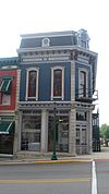
Wabash | The Solomon Wilson Building is a historic structure in Wabash, adding to the city's rich architectural heritage. |
Former Listings
Sometimes, a place might be removed from the National Register of Historic Places. This can happen if the building is changed too much, or if it is no longer standing. Here is one such example from Wabash County.
| Name on the Register | Image | Date listed | Date removed | Location | City or town | Summary | |
|---|---|---|---|---|---|---|---|
| 1 | North Manchester Planing and Band Saw Mill |
(#82000052) |
|
705 Main (mill); 706-708 W. Grant and 202 N. High St. (houses) 40°59′55″N 85°46′40″W / 40.9986°N 85.7778°W |
North Manchester | This old mill was once an important part of North Manchester's industry. It was also known as the J.A. Browne Co. Mill. It was removed from the list in 1995. |


