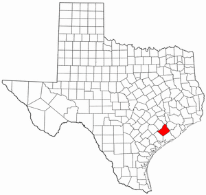
National Register of Historic Places listings in Wharton County, Texas facts for kids
Have you ever wondered about old buildings and places that tell a story? In Wharton County, Texas, there are many special spots that are officially recognized for their history! These places are listed on something called the National Register of Historic Places. It's like a special club for important historical buildings, sites, and objects across the United States.
When a place is on this list, it means it's considered important to the history of the local area, the state, or even the whole country. It helps protect these places and makes sure their stories can be shared for many years to come. You can even see where many of these places are on a map by clicking "Map of all coordinates" if you're curious!
Contents
What is the National Register of Historic Places?
The National Register of Historic Places is the official list of the nation's historic places worth saving. It's managed by the National Park Service. Being on this list helps people understand and appreciate the history around them. It also encourages communities to take care of these important sites.
Why are places in Wharton County on the list?
Wharton County has a rich history, especially in the city of Wharton. Many of the buildings listed on the National Register are old homes, churches, and even bridges. They show us what life was like in the past and how the community grew over time. Most of these places were added to the list on March 18, 1993, which was a big day for preserving history in Wharton County!
Historic Homes and Buildings
Many of the places on the list are beautiful old houses. These homes belonged to important people in Wharton's past or show special ways of building that were popular long ago. For example, the Willie Banker Jr. House and the Moses Bernstein House are both historic homes in Wharton. The Bolton-Outlar House and the Wiley J. Croom House also tell stories of early families.
Other interesting homes include the F. F. Dannon House and the Dr. Green Davidson House. The Ben and Mary Davis House and the Nettie Elkins House are also recognized. You can also find the E. Clyde and Mary Elliott House and the Henry B. Garrett House on the list.
The John A. and Sophie Garrett House and the George C. and Annie Gifford House are examples of historic family homes. The Joseph Andrew Hamilton House and the Gerard A. Harrison House are also important. The Harrison-Dennis House and the Edwin Hawes House are part of Wharton's architectural history. Sadly, the Edwin Hawes Jr. House was demolished, but it was once on the list too.
There are also general "House at" listings, like the House at 401 North Richmond and the House at 512 North Resident, which are important for their design or history. The Merrell-Roten House, Moran-Moore House, J. H. Speaker House, and Louis F. Worthing House complete the list of individual homes.
Important Public Places
Not all historic places are homes. Some are public buildings or structures that were important to the community.
- Old First Methodist Episcopal Church South: This old church building played a big role in the spiritual life of Wharton.
- St. John's Evangelical Lutheran Church: Another significant church building that has served the community for many years.
Bridges and Transportation
Bridges are also very important historical structures, showing how people traveled and traded.
- Colorado River Bridge: This bridge crosses the Colorado River and was a key part of Old US 59, connecting people and goods.
- Texas and New Orleans Railroad Bridge: This railroad bridge also crosses the Colorado River, showing the importance of trains in the area's development.
- Texas and New Orleans Railroad Depot: A train station is a place where people arrived and departed, making this depot a vital part of Wharton's transportation history.
Historic Districts
Sometimes, it's not just one building that's important, but a whole group of buildings or a neighborhood. These are called "historic districts."
- Linn Street Historic District: This area includes several blocks of Richmond Road, Houston Street, and Linn Street. It's recognized for its collection of historic buildings.
- West Milam Street Mercantile Historic District: This district on West Milam Street shows what the business area of Wharton looked like in the past.
- Wharton County Courthouse Historic Commercial District: This district is centered around the Wharton County Courthouse and includes many historic commercial buildings nearby. It's a key area that shows the heart of the county's business and government.
Images for kids
| Name on the Register | Image | Date listed | Location | City or town | Description |
|---|


