
Wharton, Texas facts for kids
Quick facts for kids
Wharton, Texas
|
|
|---|---|

Wharton County Courthouse
|
|

Wharton, Texas
Location in Texas

Wharton, Texas
Location in the United States
|
|
| Country | United States |
| State | Texas |
| County | Wharton |
| Area | |
| • Total | 8.28 sq mi (21.45 km2) |
| • Land | 8.24 sq mi (21.36 km2) |
| • Water | 0.04 sq mi (0.09 km2) |
| Elevation | 102 ft (31 m) |
| Population
(2020)
|
|
| • Total | 8,627 |
| • Density | 1,047.54/sq mi (404.44/km2) |
| Time zone | UTC-6 (Central (CST)) |
| • Summer (DST) | UTC-5 (CDT) |
| ZIP code |
77488
|
| Area code(s) | 979 |
| FIPS code | 48-78136 |
| GNIS feature ID | 1371316 |
Wharton is a city in Wharton County, Texas, USA. It's also the main town of Wharton County. It's about 60 miles (97 km) southwest of Houston. In 2020, about 8,627 people lived there. Wharton is located right on the Colorado River. U.S. Highway 59 runs past the west side of the city.
Contents
History of Wharton, Texas
Wharton started as part of a mail route in 1838, during the time of the Republic of Texas. The community was named after two brothers, John and William Wharton. They were important leaders in Texas' fight for independence.
The first settlers arrived in 1846. They built a community along the Colorado River, which was originally a plantation area. A post office was set up the next year. Albert Clinton Horton, the first lieutenant governor of Texas, was one of the early settlers.
Land for the town's courthouse square was given by William Kincheloe. It was surveyed by Virgil Stewart and William J. E. Heard. Early settlers came from many southern states like Alabama, Kentucky, and Virginia.
European Jewish immigrants from Germany also arrived in the 1850s. They started businesses and built the Congregation Shearith Israel, a synagogue. Other settlers included people from Switzerland, Germany, Mexico, and the Czech Republic. After the Civil War, descendants of enslaved people also became part of the community.
Early Economy and Growth
The area first grew because of farming. Before the Civil War, plantations used enslaved African Americans for labor. Farmers grew potatoes, cotton, corn, rice, and sugarcane. Businesses also raised cattle and made molasses and sugar.
Over time, Wharton had many industries. These included a cottonseed oil mill, a sugarcane factory, and cotton gins. There was also a milk-processing plant, an ice plant, and other businesses. Today, oil and sulfur production nearby still help the town's economy. In the early 1880s, Wharton had about 200 people.
Railroads and Modernization
In 1881, the New York, Texas and Mexican Railway was the first railroad to reach Wharton. More than ten years later, the Gulf, Colorado and Santa Fe railroad arrived in 1899. These railroads brought new settlers and helped businesses grow. The population increased to 1,689 by 1900 and 2,346 by 1920. In 1888, the first opera house opened in Wharton.
Wharton became an official city in 1902. Most buildings were made of wood back then. A big fire on December 30, 1902, destroyed many wooden businesses. After the fire, business owners and the city decided to use brick for new buildings. They also built a water system with fire hydrants to prevent future fires.
Community and Education
A free library was started in 1902 by the New Century Club. The city took it over in 1904. In 1935, most of the library's books went to the Wharton Public School. The first public park opened in 1913. The Wharton Chamber of Commerce was formed in 1919.
The city grew the most during the 1930s, even during the Great Depression. The population jumped from 2,261 in 1930 to 4,386 in 1940. The Wharton Little Theatre started in 1932. Wharton County Junior College was established in 1946, offering higher education.
The town's population continued to grow, reaching 5,734 in 1960 and 7,881 in 1970. A community concert series began in the 1960s. By the 1980s, Wharton had many different businesses. These included a large physical therapy service called Health-focus. There was also M. I. Drilling Fluids and the Formosa Plastics Group. The economy also relied on the county government.
In the 1980s, Horton Foote, a famous screenwriter who won an Academy Award, moved back to Wharton. He was born and grew up there. The Wharton County Historical Museum shows exhibits about famous people from Wharton. These include journalist Dan Rather and Medal of Honor winner Roy Benavidez. The museum also has a wildlife collection.
Wharton's population stayed steady at the end of the 20th century. It was 9,033 in 1980, 9,011 in 1990, and 9,237 in 2000. The 2010 census showed a slight decrease to 8,832 people.
Geography of Wharton
According to the United States Census Bureau, Wharton covers about 7.2 square miles (18.6 km2). Only a tiny part of this area is water.
U.S. Route 59 (which will become Interstate 69) passes through the west side of Wharton. To the northeast on US 59 is Rosenberg. To the southwest is El Campo. State Highway 60 also goes through Wharton. It heads south to Bay City and north to East Bernard.
FM 102 starts in Wharton and goes northwest to Eagle Lake. FM 1301 also starts in Wharton and goes southeast to Boling-Iago. The Colorado River flows through Wharton from the northwest. After passing through the city, the river flows more to the south.
Climate in Wharton
The weather in Wharton has hot, humid summers. Winters are usually mild to cool. According to climate experts, Wharton has a humid subtropical climate. This means it gets a lot of rain and has warm temperatures for most of the year.
People in Wharton
| Historical population | |||
|---|---|---|---|
| Census | Pop. | %± | |
| 1910 | 1,505 | — | |
| 1920 | 2,346 | 55.9% | |
| 1930 | 2,691 | 14.7% | |
| 1940 | 4,386 | 63.0% | |
| 1950 | 4,450 | 1.5% | |
| 1960 | 5,734 | 28.9% | |
| 1970 | 7,881 | 37.4% | |
| 1980 | 9,033 | 14.6% | |
| 1990 | 9,011 | −0.2% | |
| 2000 | 9,237 | 2.5% | |
| 2010 | 8,832 | −4.4% | |
| 2020 | 8,627 | −2.3% | |
| U.S. Decennial Census | |||
In 2020, about 8,627 people lived in Wharton. There were 3,293 households and 1,840 families.
In 2000, the city had 9,237 people. The population density was about 1,278 people per square mile. The city's population was made up of different groups:
- 56.33% White
- 26.43% African American
- 0.41% Native American
- 0.71% Asian
- 14.18% from other races
- 1.78% from two or more races
- About 31.08% of the population were Hispanic or Latino (of any race).
Of the households in 2000, 31.5% had children under 18. About 44.2% were married couples. Around 15.7% had a female head of household with no husband. About 35.9% were not families. The average household had 2.51 people, and the average family had 3.21 people.
The median age in the city was 34 years old. About 27.2% of the population was under 18. About 16.2% were 65 or older. The median income for a household was $26,704. For a family, it was $34,543. About 22.2% of the population lived below the poverty line.
Notable People from Wharton
Many interesting people have come from Wharton:
- Bert Adams (1891–1940) – A baseball catcher for the Philadelphia Phillies.
- B. J. Baylor (born 1998) – A professional NFL football player for the Atlanta Falcons.
- Jesse McI. Carter (1863–1930) – A United States Army major general in World War I.
- Larry Dale (1923–2010) – A blues singer and guitarist.
- Thyra J. Edwards (1897–1953) – An educator, social worker, journalist, and activist for labor, civil rights, and women's rights.
- Horton Foote (1916–2009) – A famous playwright and screenwriter.
- Van G. Garrett – A poet.
- Go Man Go (1953–1983) – A three-time World Champion Quarter Running Horse. He is in the American Quarter Horse Hall of Fame.
- Albert Clinton Horton (1798–1865) – A Texan politician and the first Lieutenant Governor of Texas.
- Jim Kearney (born 1943) – A former NFL safety for the Kansas City Chiefs.
- Lamar Lathon (born 1967) – A former NFL player for the Carolina Panthers.
- Leroy Mitchell (born 1944) – A former NFL cornerback for the Boston Patriots.
- Robert Parker (1960–2021) – An NCAA track and field coach for Texas A&M University.
- Dan Rather (born 1931) – A famous journalist and former national news anchor for CBS.
- Memo Rodriguez (born 1995) – A professional MLS midfielder for Houston Dynamo.
- Heath Sherman (born 1967) – A former NFL running back for the Philadelphia Eagles.
- David McCann "Mac" Sweeney (born 1955) – A Republican former member of the U.S. Representative from Texas.
- Billy Waddy (1954–2022) – An NFL wide receiver for the Los Angeles Rams.
Images for kids
-
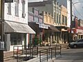
Downtown Wharton
-
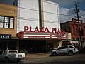
Plaza Theater
-
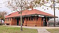
Historic railroad depot
-
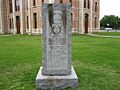
Confederate monument
-
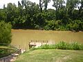
Colorado River in Wharton
-
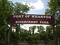
Riverfront Park


See also
 In Spanish: Wharton (Texas) para niños
