
Boling-Iago, Texas facts for kids
Quick facts for kids
Boling-Iago, Texas
|
|
|---|---|

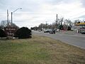
Welcome to Boling sign at FM 442 and FM 1301
|
|

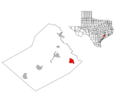
Location of Boling-Iago, Texas
|
|
| Country | United States |
| State | Texas |
| County | Wharton |
| Area | |
| • Total | 4.726 sq mi (12.241 km2) |
| • Land | 4.669 sq mi (12.093 km2) |
| • Water | 0.057 sq mi (0.148 km2) |
| Population
(2000)
|
|
| • Total | 1,271 |
| • Density | 268.94/sq mi (103.83/km2) |
| Time zone | UTC-6 (Central (CST)) |
| • Summer (DST) | UTC-5 (CDT) |
| ZIP code |
77420
|
| Area code(s) | 979 |
| FIPS code | 48-09232 |
Boling-Iago (pronounced BOH-ling eye-AY-goh) is a small community in Wharton County, Texas, United States. It's known as a census-designated place (CDP), which means it's an area identified by the census for statistical purposes. In 2000, about 1,271 people lived here.
Boling-Iago is located along Farm to Market Road 1301. It's about 10 miles (16 km) southeast of Wharton, which is the main town in the county. The community of Boling is where FM 1301 and Farm to Market Road 442 meet. Iago is about 1.5 miles (2.4 km) northeast, at the intersection of FM 1301 and Farm to Market Road 1096. The local school district, Boling Independent School District, was recognized for its good performance in 2010. You might see many oil pumps and tanks around, showing that Boling and Iago are built on top of oil-rich land.
After the 2010 census, this area was divided into two separate CDPs: Boling and Iago.
Contents
Exploring Boling-Iago's Location
Boling-Iago covers about 4.669 square miles (12.093 km2) of land. It also has a small amount of water, about 0.057 square miles (0.148 km2).
Caney Creek: A Local Waterway
Caney Creek flows through the area from the northwest to the southeast. Near Iago, you'll find the creek south of Farm to Market Road 1301. Between Iago and Boling, it crosses to the north side of the highway. The creek then loops past Boling on its north side. Eventually, Caney Creek flows into Matagorda Bay near Sargent.
Nearby Towns and Roads
Farm to Market Road 1301 continues northeast for about 10.5 miles (16.9 km). It ends at Texas State Highway 60 in Wharton. To the south, Pledger is the next community, about 6.2 miles (10.0 km) away on FM 1301. Lane City is 6.8 miles (10.9 km) southwest on Farm to Market Road 442. You can also reach Needville by traveling northeast on FM 442. From Iago, Farm to Market Road 1096 goes southwest to meet FM 442. The community of Newgulf is also nearby. You can get there by going 1.5 miles (2.4 km) southeast on FM 1301, then 1.6 miles (2.6 km) northeast on County Road 190.
A Look Back: Boling-Iago's History

The first settlement in this area was called Floyd's Lane. It was on an old trail that connected different river crossings. Another trail followed Caney Creek to Wharton. Boling was officially started in 1900. This happened when the New York, Texas & Mexican Railroad built a train line through the area.
How Boling Got Its Name
The town was named after Mary Bolling Vineyard. She was only six years old at the time. Her father, Robert E. Vineyard, was the one who had the town surveyed. By 1907, Boling had a school, a store, and a blacksmith shop. About ten families lived there. The school had four teachers and 104 Black students. These children were descendants of African-American people who had worked on plantations in the area before the American Civil War. Their parents often worked as sharecroppers or hired hands on the large farms that remained.
Growth Thanks to Oil
Boling grew a lot between 1920 and 1930. Its population went from 20 to 450 people. This growth happened because petroleum (oil), sulphur, and natural gas were found nearby. The post office opened in 1926. At that time, the second "L" was dropped from the name, changing it from Bolling to Boling. Many of the town's streets were named after the oil companies that operated there. You can still find streets named Atlantic, Gulf, Humble, Magnolia, Sinclair, Sun, and Texas.
The Boling Chamber of Commerce was created in 1935. The town's population reached 800 in 1944. It dipped to 521 in 1972, then went up to 1,297 in 1990. The local economy faced a challenge in December 1993. This was when the sulphur plant in Newgulf closed down. In 2000, Boling's population was 1,271.
Community Life: People and Education
In 2010, Boling-Iago had a population of 1,342 people. Most households were families, including married couples and single women with children. Many households also had seniors over 65 years old. The average household had about 3.20 people.
Schooling in Boling-Iago

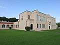
The Boling Independent School District serves Boling-Iago. Its three schools are in different communities. Boling High School is in Boling. Iago Junior High School is in Iago. Newgulf Elementary School is in Newgulf. In 1973, the district also took in part of the Hungerford Independent School District. The sports teams at Boling High School are called the Bulldogs.
In 2010, the Boling ISD received a "Recognized" rating from the Texas Education Agency (TEA). This means the schools were doing well. About 49% of the students were Hispanic, 41% were white, and 9% were African-American. Half of the students (50%) were from economically disadvantaged families. About 9% of students received special education services. While the junior high and high schools were "Recognized," the elementary school earned an "Exemplary" rating. This is a very high honor! There were about 500 students in the district's schools.
If students want to go to college after high school, Wharton County Junior College is the designated community college for the Boling ISD area.
Who Lives Here?
Most people in Boling-Iago were born in Texas. Some were born in other states, and a few were born in Latin American countries. Many people speak only English. However, a good number of people are bilingual, speaking both English and Spanish.
Beneath the Surface: Geology and Oil

A major geological feature in the Boling-Iago area is the Boling salt dome. This is a large, oval-shaped underground structure. It's mostly located between Boling and the San Bernard River. The top layer of rock, called caprock, is about 383 feet (117 m) below the surface. People suspected there might be oil because of sulphur in water wells and natural gas seeping from the San Bernard River.
The Discovery of Oil
In 1922, the first land lease was bought, and test wells were drilled. The first successful oil well was drilled in 1925. It was called the Texas Company's #3 Taylor. This well produced about 10,000 barrels of oil every day! By December 1937, there were 91 oil wells producing in the Boling Field. However, by the end of 1946, many wells were producing less oil.
In April 1947, new oil wells were drilled near Iago. These were on the southwest edge of the Boling salt dome. Soon after, more successful wells were drilled on other sides of the structure. Between 1947 and 1951, the oil field's production jumped. It averaged 1 million barrels of oil per year! By the end of 1952, there were 180 oil wells. In 1927, sulphur was also found in the caprock. From that year until 1952, about 38 million tons of sulphur were taken from the Boling salt dome.
Weather in Boling-Iago
The weather in this area has hot and humid summers. The winters are generally mild to cool. Boling-Iago, Texas, has a humid subtropical climate. This type of climate is often shown as "Cfa" on climate maps.
Images for kids
-
Welcome to Boling sign at FM 442 and FM 1301
-
Location of Boling-Iago, Texas
-
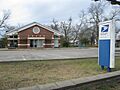
The US Postal Service changed the name from Bolling in 1926.
-
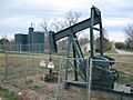
Oil pump jack was on FM 1301 in Iago in 2012.
-
Boling High School
