
Lane City, Texas facts for kids
Quick facts for kids
Lane City, Texas
|
|
|---|---|

Lane City sign on FM 442 looking southwest
|
|

Lane City, Texas
Location in Texas

Lane City, Texas
Location in the United States
|
|
| Country | United States |
| State | Texas |
| County | Wharton |
| Elevation | 85 ft (26 m) |
| Time zone | UTC-6 (Central (CST)) |
| • Summer (DST) | UTC-5 (CDT) |
| Area code(s) | 979 |
| GNIS feature ID | 1360924 |
Lane City is a small, unincorporated community in Wharton County, Texas, United States. This means it's a town that isn't officially governed by its own local government. In 2000, about 111 people lived there. Lane City is part of the larger Greater Houston area.
Contents
History of Lane City
How Lane City Got Its Name
Lane City was named after Jonathan Lane. He was a lawyer and the president of the Cane Belt Railroad. In 1900, the Cane Belt Railroad finished its tracks from Eagle Lake to Wharton County. A company from St. Louis helped pay for this. Lane City became the end of this new railroad line.
Early Days and Rice Farming
In 1901, Jonathan Lane bought a huge amount of land, about 25,000 acres, in Wharton County. He later sold it to the Missouri-Lincoln Trust Company. Soon, new settlers started to arrive, encouraged by a company called Colonial Land Company. They even handed out a leaflet called A Trip to the Gulf Coast of Texas in the northern states.
The leaflet said that growing rice would make people rich. Land was offered in large sections, starting at 120 acres. Farmers could pay a small amount of money down. They agreed to grow rice on most of their land and give part of their crop as payment.
Water for Crops
To help the farmers, a big pumping station was built on the Colorado River. Two smaller pumping stations were also set up. These stations provided water to the farms through a 23-mile long canal system. This system was run by the Bay Prairie Irrigation Company, which later became the Southern Irrigation Company. Jonathan Lane's brother, T. W. Lane, started overseeing this company in 1904. The main pumping station was said to have the biggest pump of its kind in the world!
Railroad and Growth
Around 1902, the Gulf, Colorado and Santa Fe Railway built a short rail line to the Colorado River pumping station. This rail line was removed before 1940, and a county road was built where it used to be.
A post office was opened in 1901 under the name Arnim. But on February 13, 1911, its name was changed to Lane City.
Life in Lane City's Golden Age
By 1909, Lane City was thriving. It had many businesses, including:
- Grocery stores
- Churches (Methodist and Baptist)
- A saloon
- A lumberyard
- A blacksmith shop
- A plant nursery
- A two-story brick train station
- A drugstore
- A Knights of Pythias lodge (a social club)
- A hotel
There was also a three-story building that held rice offices, a mill, and warehouses. Lane City was a busy place for social events, sometimes hosting up to 200 visitors. Most people were involved in the rice business or made money from it. The Gulf Coast Nursery provided trees like citrus, peach, and fig trees for planting. Farmers were also encouraged to raise hogs, cattle, and turkeys on their land to help the soil.
A Big Storm and Changes
In July 1909, a powerful hurricane hit Lane City. It destroyed most of the buildings and crops. The large pumping station was badly damaged, and all the two-story buildings were ruined. Lane City never fully recovered from this storm.
Later, sulfur was found nearby. The Gulf, Colorado, and Santa Fe Railway built a new rail line from Lane City to Newgulf and then to Thompsons. This helped with the sulfur mining. Oil and gas production also grew in the 1950s and early 1980s.
Modern Times in Lane City
In 1974, a company called Perma-Pom started making pom-poms for cheerleaders in Lane City. By the early 1990s, it employed many people. This plant was on the same land where an old sugar mill once stood, followed by a rice mill and a cotton gin, which later burned down.
By 1990, farming was still important, but cotton, milo, and corn had replaced rice as the main crops. The canal system for irrigation was still working. The community still had its post office and a convenience store with a gas station. The Methodist church building, built in 1903, was taken down in 1984. Only one Black Baptist church was still active in Lane City in 1990.
Population Changes
The population of Lane City has changed over the years:
- 1920: 150 people
- 1960: 200 people
- 1980-2000: 111 people
Tornado Event
On December 2, 1953, a strong tornado, rated F2, hit Lane City. It pushed two farmhouses off their foundations. The tornado caused about $2,500 in damages.
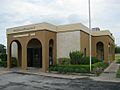
Lane City has a post office with the ZIP code 77453.
Geography of Lane City
Lane City is located on Texas State Highway 60. It's also on the Atchison, Topeka and Santa Fe Railway. The community is about 10 miles southeast of Wharton and 15 miles north of Bay City. It is also three miles east of the Colorado River.
Education in Lane City
In 1909, Lane City had its own school. In 1948, there was a vote to combine schools, but it didn't pass. However, students from Lane City were allowed to attend Wharton High School because Lane City didn't have high school teachers. In 1957, Lane City officially joined the Wharton Independent School District.
Images for kids
-
US Post Office in Lane City

