
Caney Creek (Matagorda Bay) facts for kids
Quick facts for kids Caney Creek (Matagorda Bay) |
|
|---|---|

Caney Creek at the FM 457 bridge near Caney
|
|
| Country | United States |
| Physical characteristics | |
| Main source | Matthews, Texas |
| River mouth | Sargent, Texas |
| Length | 155 miles (249 km) |
Caney Creek (Matagorda Bay) is a river in Texas. It starts northwest of Wharton and flows generally southeast. The creek then empties into the Gulf of Mexico near Sargent. The main river to its west is the Colorado River. To its east is the San Bernard River.
Journey of Caney Creek
Caney Creek begins about 1 mile south of Matthews. This is in Colorado County. It starts in an area with many irrigation canals and old stream paths. From there, Caney Creek flows about 155 miles (249 km) to the southeast. It then flows into the Intracoastal Waterway. This is about 5.5 miles (8.9 km) southeast of Sargent.
Thousands of years ago, the Colorado River actually flowed through the channel that Caney Creek now uses. The Colorado River later changed its path. Caney Creek even joins the Colorado River for about 1.0 mile (1.6 km) near Glen Flora. It then leaves the Colorado River just below that town. The creek has wide curves, which shows it is a very old stream.
For part of its journey, Caney Creek is "intermittent." This means it doesn't always flow with water. But once it reaches the Matagorda County line, other streams join it. This makes it a continuously flowing waterway from that point on. The land along the creek is used for farming crops like rice and cotton. It is also used for raising cattle.
Where the Creek Flows
After passing through Wharton, Caney Creek runs east and southeast. It flows along the south side of FM 1301. The stream goes through Boling-Iago. Then it goes south along FM 1301 to Pledger.
From Pledger, Caney Creek flows south. It runs on the west side of FM 1728. It also passes to the east of Van Vleck. The creek continues south through Allenhurst. It passes east of Caney. From there to its mouth, the stream follows FM 457.
Caney Creek flows southeast past Cedar Lane. Here, Linnville Bayou joins it just below the FM 521 bridge. The creek then turns south. It passes through Hawkinsville and Sargent. Finally, it reaches the Gulf of Mexico. It first meets the Intracoastal Waterway before emptying into the Gulf and East Matagorda Bay.
Water Quality
Caney Creek is part of the Brazos-Colorado Coastal Basin. The Texas Commission on Environmental Quality and the Environmental Institute of Houston (part of University of Houston–Clear Lake) check the water quality in this area. They have stations that monitor the water in Caney Creek and Linnville Bayou.
-
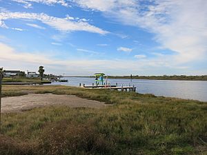
Caney Creek in Sargent, not far above where it empties into the Intercoastal Waterway
-
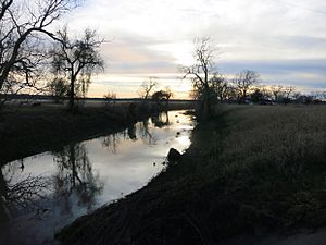
Caney Creek looking upstream at the FM 457 bridge in Cedar Lane
-
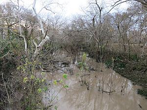
Caney Creek looking upstream at the County Road 112 bridge in Ashwood


History of Caney Creek
Caney Creek was first called Canebrake Creek. This was because thick cane plants grew along its banks. Early settlers later cleared this cane away. The rich soil along the creek was noticed by a surveyor named Elias R. Wightman. He was one of the Old Three Hundred settlers. His report brought many Anglo-American settlers to the area in the 1820s.
Stephen F. Austin's colonists often burned the cane. This helped make the soil even richer for farming. Growing sugar became very successful. Soon, large homes were built, and one area was known as Plantation Row. In 1825, Robert Harris Williams is thought to have built the first machine for separating cotton in Texas. This was along the banks of Caney Creek.
During the American Civil War, a local commander named John B. Magruder built defenses at the mouth of Caney Creek. In early 1864, these defenses helped stop a naval attack.
