
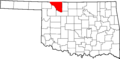
National Register of Historic Places listings in Woods County, Oklahoma facts for kids

Have you ever wondered about old buildings or places that tell a story about the past? In Woods County, Oklahoma, there are many special spots that are so important, they're listed on something called the National Register of Historic Places. This list helps protect places that are important to American history, architecture, archaeology, engineering, or culture. Think of it like a hall of fame for historic buildings and sites!
When a place is added to the National Register, it means it's recognized as a valuable part of our shared heritage. It helps people learn about the past and makes sure these places are preserved for future generations. In Woods County, there are 15 different properties that have earned this special recognition. Most of them are in the city of Alva, but some are in other towns too, like Waynoka.
Contents
What is the National Register of Historic Places?
The National Register of Historic Places is the official list of the nation's historic places worth saving. It's managed by the National Park Service, which is part of the United States government. Being on the list doesn't mean the government owns the property, but it does offer some benefits, like special grants or tax breaks, to help owners take care of these historic sites.
Why are places added to the list?
Places can be added to the National Register for many reasons. Maybe they are:
- Very old and show how people lived long ago.
- Designed in a unique or important architectural style.
- Connected to important events in history.
- Associated with famous people.
- Important for understanding a specific culture or way of life.
It's all about finding places that have a special story to tell about our country's past.
Historic Places in Woods County
Many of the historic places in Woods County are buildings in the city of Alva. These buildings often show the architectural styles and daily life from the late 1800s and early 1900s, when the town was growing.
Alva's Historic Buildings
- Alva Armory: This building, listed in 1988, was once a place where soldiers trained. Armories are often built to be strong and impressive.
- Branson Building: Listed in 1984, this building on Barnes Street is an example of the commercial buildings that made up Alva's downtown.
- Buildings on College Avenue: Several buildings on College Avenue, like the ones at 405-407, 409, and the Kavanaugh and Shea Building at 403, were all added to the list in 1984. They show the typical look of businesses and offices from that time.
- Building at 500 Flynn Street: Another commercial building from Alva's past, added in 1984.
- Central National Bank: Located at 401 College Avenue, this bank building was also listed in 1984. Banks were often built to look grand and trustworthy.
- Hotel Bell: This hotel on Barnes Street was added to the list more recently, in 2013. Hotels are important because they show how people traveled and stayed in towns long ago.
- I.O.O.F. Hall: The Independent Order of Odd Fellows (I.O.O.F.) was a fraternal organization, and their hall on Barnes Street (listed 1984) was a community gathering place.
- Nickel Ensor McClure House: This historic home on Locust Street was added in 2010. Old houses often tell us about the families who lived there and the styles of the time.
- Science Hall: Found on the Northwestern Oklahoma State University campus, this building was listed in 1983. University buildings often have unique designs and are important for education history.
- Stine Building: Another historic commercial building on Barnes Street, listed in 1982.
Waynoka's Historic Sites
Waynoka also has its own important historic places:
- Waynoka Santa Fe Depot and Harvey House: Listed way back in 1974, this site was a crucial stop along the old Santa Fe railroad tracks. Depots were busy places where trains arrived and departed, and Harvey Houses were famous restaurants that served travelers.
- Waynoka Telephone Exchange Building: This building on South Main Street was added in 2014. Telephone exchange buildings were vital for connecting people through phone calls before cell phones existed!
These places help us remember and appreciate the history of Woods County and the people who lived there.
Images for kids
-
Location of Woods County in Oklahoma
