Woods County, Oklahoma facts for kids
Quick facts for kids
Woods County
|
|
|---|---|

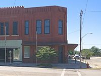
Historic Central National Bank in Alva (2017)
|
|

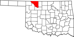
Location within the U.S. state of Oklahoma
|
|
 Oklahoma's location within the U.S. |
|
| Country | |
| State | |
| Founded | 1893 |
| Named for | Samuel Newitt Wood |
| Seat | Alva |
| Largest city | Alva |
| Area | |
| • Total | 1,290 sq mi (3,300 km2) |
| • Land | 1,286 sq mi (3,330 km2) |
| • Water | 3.5 sq mi (9 km2) 0.3%% |
| Population
(2020)
|
|
| • Total | 8,624 |
| • Density | 6.685/sq mi (2.581/km2) |
| Time zone | UTC−6 (Central) |
| • Summer (DST) | UTC−5 (CDT) |
| Congressional district | 3rd |
Woods County is a county located in the northwestern part of the U.S. state of Oklahoma. As of the 2020 census, about 8,624 people lived here. Its main town, or county seat, is Alva. The county is named after Samuel Newitt Wood, an important political leader from Kansas.
Contents
History of Woods County
Early Inhabitants and Explorers
Woods County has a very long history. The Burnham site in the county shows that people lived here over 11,000 years ago. These early people belonged to what is called the pre-Clovis culture.
Later, the area was home to Native American groups like the Antelope Creek Phase people. They were part of the Southern Plains Villagers and are related to today's Wichita and Affiliated Tribes.
The first European explorers came much later. In 1811, George C. Sibley traveled through the area. He visited a salt formation near the town of Freedom, Oklahoma. In 1843, Nathan Boone explored along the Cimarron River.
How Woods County Was Formed
The land that is now Woods County was once part of the Cherokee Outlet. This land was promised to the Cherokee Nation by a treaty. It became important for raising cattle. A branch of the Chisholm Trail, used for moving cattle, ran through the area.
The U.S. Government bought the Cherokee Outlet in the late 1800s. They divided the land into counties before opening it for new settlers. One of these new areas was called M County.
Alva was chosen as the county seat. On November 6, 1894, M County was renamed Woods County. The name was chosen to honor Samuel Newitt Wood, a political leader from Kansas. Even though his name was misspelled on the ballot, the name stuck. Woods County then became part of the Oklahoma Territory.
In 1906, when Oklahoma became a state, parts of Woods County were used to create Major County and Alfalfa County. A small part of Woodward County was also added to Woods County.
Geography
Woods County covers about 1,290 square miles. Most of this area, about 1,286 square miles, is land. Only a small part, about 3.5 square miles, is water. The county is located right along the border with Kansas.
Major Highways
These are the main roads that run through Woods County:
 U.S. Highway 64
 U.S. Highway 281
 State Highway 11
 State Highway 14
 State Highway 34
 State Highway 45
Neighboring Counties
Woods County shares borders with these other counties:
- Comanche County, Kansas (to the north)
- Barber County, Kansas (to the northeast)
- Alfalfa County (to the east)
- Major County (to the south)
- Woodward County (to the southwest)
- Harper County (to the west)
Population and People
| Historical population | |||
|---|---|---|---|
| Census | Pop. | %± | |
| 1910 | 17,567 | — | |
| 1920 | 15,939 | −9.3% | |
| 1930 | 17,005 | 6.7% | |
| 1940 | 14,915 | −12.3% | |
| 1950 | 14,526 | −2.6% | |
| 1960 | 11,932 | −17.9% | |
| 1970 | 11,920 | −0.1% | |
| 1980 | 10,923 | −8.4% | |
| 1990 | 9,103 | −16.7% | |
| 2000 | 9,089 | −0.2% | |
| 2010 | 8,878 | −2.3% | |
| 2020 | 8,624 | −2.9% | |
| U.S. Decennial Census 1790-1960 1900-1990 1990-2000 2010 |
|||
In 2010, there were 8,878 people living in Woods County. The population density was about 7 people per square mile. Most people in the county were white (88.4%). There were also black or African American (3.3%), Native American (2.4%), and Asian (0.9%) residents. About 4.8% of the population was Hispanic or Latino.
The average age in the county was 34.7 years old. About 18.8% of the population was under 18 years old.
Communities
Woods County has several towns and communities:
Cities
Towns
Census Designated Places
These are areas that are like towns but are not officially incorporated as cities or towns:
Unincorporated Communities
These are small settlements that do not have their own local government:
- Lookout
- Winchester
Former Communities
A map from 1911 shows many settlements in Woods County that no longer exist or are now very small places. Some of these include:
- Abbie
- Cora
- Coy
- Eagle
- Fairvalley
- Fanshaw
- Farry
- Faulkner
- Fitzlen
- Flagg
- Galena
- Gamet
- Heman
- Irene
- Kingman
- Saratoga
- Tegarden
- Whitehorse
Historic Places
There are several sites in Woods County listed on the National Register of Historic Places. Most of these are in Alva, but some are also in Waynoka.
See also
 In Spanish: Condado de Woods para niños
 | Janet Taylor Pickett |
 | Synthia Saint James |
 | Howardena Pindell |
 | Faith Ringgold |


