
National Register of Historic Places listings in eastern Worcester, Massachusetts facts for kids
There are 98 special places and areas in Worcester, Massachusetts, located east of the I-190 and I-290 highways, that are listed on the National Register of Historic Places. This list includes many important buildings and neighborhoods. Two of these listings are also found in other parts of Worcester. For example, one of the 1767 Milestones is in northwestern Worcester. Also, the Blackstone Canal Historic District stretches across all three sections of the city. You can see where these places are on an online map by clicking "Map of all coordinates."
Contents
What is the National Register of Historic Places?
The National Register of Historic Places is like a special list of important buildings, sites, and objects in the United States. It's kept by the U.S. government to help protect and celebrate places that have a big meaning in American history, architecture, archaeology, engineering, or culture. When a place is on this list, it means it's recognized as being valuable to our past. This helps people understand and appreciate the stories these places tell.
Discovering Historic Places in Eastern Worcester
Eastern Worcester is home to many fascinating historic sites. These places show us what life was like long ago and how the city has grown. From old homes to schools and even firehouses, each spot has its own unique story.
Milestones and Canals: Tracing Worcester's Past
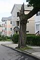
One of the oldest listings is the 1767 Milestones. These are old markers that helped people find their way between Springfield and Boston a very long time ago. Milestone 47 is in eastern Worcester, and Milestone 48 is in northwestern Worcester.
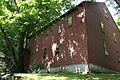
Another important historic area is the Blackstone Canal Historic District. This district includes parts of the old Blackstone Canal, which was a waterway used for transporting goods in the 1800s. It was a vital part of the region's early economy, connecting Worcester to Providence, Rhode Island.
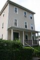
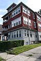
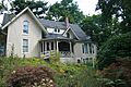
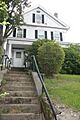
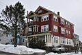
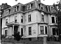
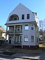
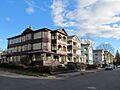
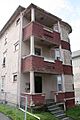
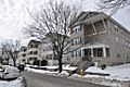
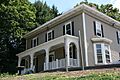
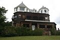
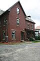
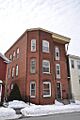
Homes with History: Three-Deckers and More
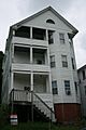
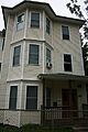
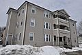
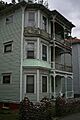
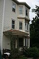
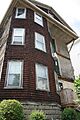
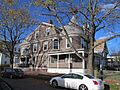
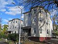
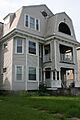
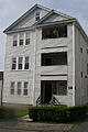
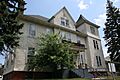
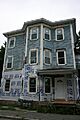
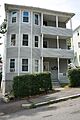
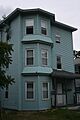
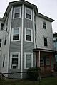
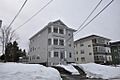
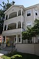
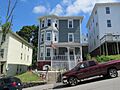
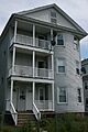
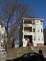
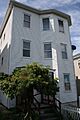
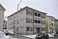
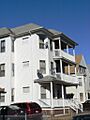
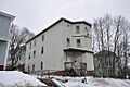
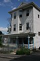
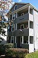
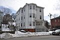
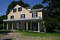
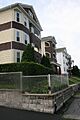
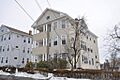
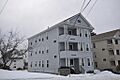
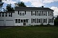
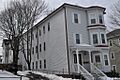
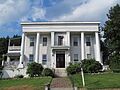
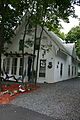
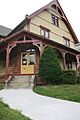
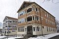
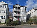
Many of the historic places in eastern Worcester are homes. Some are grand houses, while others are "three-deckers." A three-decker is a type of house with three apartments, one on each floor. They were very popular in New England cities like Worcester, especially in the late 1800s and early 1900s, because they could house many families.
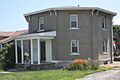
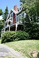
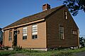
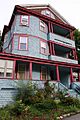
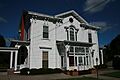
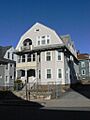
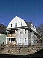
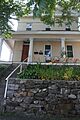
- The Arad Alexander House at 53 Waverly Street was listed in 1980.
- The Richard Barker Octagon House at 312 Plantation Street is unique because of its eight-sided shape. It was also listed in 1980.
- The George Bentley House at 9 Earle Street is another historic home from 1980.
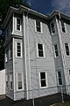
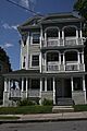
- Many three-deckers are on the list, like the Ludwig Anderson Three-Decker, Peter Baker Three-Decker, and Lydia Blodgett Three-Decker. These homes show how people lived and how neighborhoods developed in Worcester.
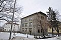
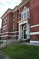
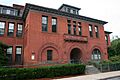
Community Buildings: Schools, Firehouses, and Libraries
Beyond homes, several public buildings are also recognized for their historical importance:
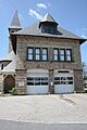
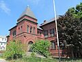
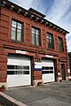
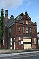
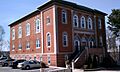
- The Bloomingdale Firehouse on Franklin Street, listed in 1980, served the community for many years.
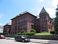
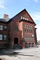
- The Bloomingdale School and Dartmouth Street School are examples of historic schools that educated generations of Worcester children.
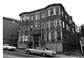
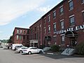
- The East Worcester School-Norcross Factory shows how buildings were sometimes repurposed. It was once a school and then a factory.
- The Elizabeth Street School is another important educational building on the list.
- The Providence Street Firehouse and Quinsigamond Firehouse also highlight the city's history of public services.
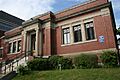
- Libraries like the Greendale Branch Library and Quinsigamond Branch Library are also listed, showing their role as centers of learning and community.
Unique and Notable Sites
Some listings stand out for their special purpose or design:
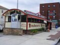
- The Boulevard Diner on Shrewsbury Street is a classic American diner, listed in 2000. It's a great example of mid-20th-century roadside architecture.
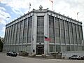
- The Higgins Armory Museum on Barber Avenue, listed in 1980, was once a museum dedicated to arms and armor.
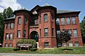
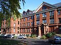
- College of the Holy Cross has two of its original buildings, Fenwick and O'Kane Halls, listed for their historical significance.
- The Shaarai Torah Synagogue on Providence Street is an important religious building listed in 1990.
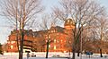
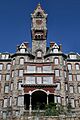
- The Worcester Asylum and related buildings, now known as the Worcester State Hospital, is a large historic complex that once served as a mental health facility.
Historic Neighborhoods: Districts with Character
Several "historic districts" are also on the list. These are areas where many buildings together create a historically important neighborhood.
- The Euclid Avenue-Montrose Street Historic District and Fay Street Historic District are examples of neighborhoods with many historic homes.
- The Houghton Street Historic District, Ingleside Avenue Historic District, Perry Avenue Historic District, Providence Street Historic District, View Street Historic District, and Woodford Street Historic District all preserve the unique character of their areas.
- Worcester Academy is a historic school campus that includes several important buildings like Walker Hall and Dexter Hall.
These historic places in eastern Worcester help us connect with the past and understand the rich history of the city.
Images for kids
-
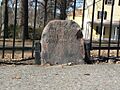
Milestone 47
-
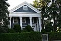
Arad Alexander House
-
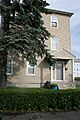
Ludwig Anderson Three-Decker
-
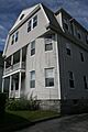
Peter Baker Three-Decker
-
Richard Barker Octagon House
-
George Bentley House
-
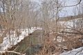
Blackstone Canal Historic District
-
Lydia Blodgett Three-Decker
-
Bloomingdale Firehouse
-
Bloomingdale School
-
Borden-Pond House
-
Eric Bostrom Three-Decker
-
Boulevard Diner
-
Henry Bousquet Three-Decker
-
Eric Carlson Three-Decker
-
Chadwick-Brittan House
-
Frederick Daniels House
-
Dartmouth Street School
-
Rodney Davis Three-Decker
-
Mary Dean Three-Decker (Demolished)
-
Louis Delsignore Three-Decker
-
Philip Duke Three-Decker
-
David Dworman Three-Decker
-
East Worcester School-Norcross Factory
-
Elizabeth Street School
-
Knut Erikson Three-Decker
-
Euclid Avenue-Montrose Street Historic District
-
Fay Street Historic District
-
Amos Flagg House
-
Benjamin Flagg House
-
George Fontaine Three-Decker
-
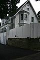
Forest Hill Cottage
-
Andrew Friberg Three-Decker
-
George Gale House
-
Thomas Giguere Three-Decker
-
Goddard House (Demolished)
-
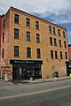
Goldberg Building
-
Grafton Street School
-
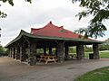
Green Hill Park Shelter
-
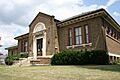
Greendale Branch Library
-
Greendale Village Improvement Society Building
-
Evert Gullberg Three-Decker
-
Higgins Armory Museum
-
Holy Cross College (O'Kane Hall)
-
Houghton Street Historic District
-
David Hunt Three-Decker
-
Ingleside Avenue Historic District
-
John and Edward Johnson Three-Decker
-
John Johnson Three-Decker
-
Paul Johnson Three-Decker
-
Erick Kaller Three-Decker (146 Eastern Ave.)
-
Erick Kaller Three-Decker (148 Eastern Ave.)
-
Larchmont
-
Swan Larson Three-Decker
-
Morris Levenson Three-Decker
-
Charles Lundberg Three-Decker
-
Charles Magnuson Three-Decker
-
Malvern Road School
-
Anthony Massad Three-Decker
-
Patrick McGrath Three-Decker
-
Patrick McGuinness Three-Decker
-
Frank McPartland Three-Decker
-
Charles Miles House
-
Jesse Moore House
-
Sarah Munroe Three-Decker
-
Patrick Murphy Three-Decker
-
Christina Nelson Three-Decker
-
Richard O'Brien Three-Decker
-
Odd Fellows' Home (Demolished)
-
Timothy Paine House
-
Perry Avenue Historic District
-
Lars Petterson-Adolph Carlson Three-Decker
-
Lars Petterson-Fred Gurney Three-Decker
-
Lars Petterson-Silas Archer Three-Decker
-
Lars Petterson-James Reidy Three-Decker
-
Addison Prentiss House
-
Providence Street Firehouse
-
Providence Street Historic District
-
Arthur Provost Three-Decker
-
Quinsigamond Branch Library
-
Quinsigamond Firehouse
-
Ezra Rice House
-
Catharine Roynane Three-Decker
-
Draper Ruggles House
-
Shaarai Torah Synagogue
-
Bridget Shea Three-Decker
-
Soho Cottage
-
Edna Stoliker Three-Decker
-
Leonard Sturtevant House
-
D. Wheeler Swift House
-
Upsala Street School
-
View Street Historic District
-
Ward Street School-Millbury Street
-
Woodford Street Historic District
-
Worcester Academy (Dexter Hall)
-
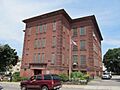
Worcester Asylum and related buildings
-
Anthony Zemaitis Three-Decker


.jpg)

