Nebnellis River facts for kids
Quick facts for kids Nebnellis River |
|
|---|---|

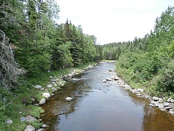
Nebnellis River downstream from Chemin du Barrage towards the confluence with Rivière Chaudière.
|
|
| Country | Canada |
| Province | Quebec |
| Region | Estrie |
| MRC | Le Granit Regional County Municipality |
| Physical characteristics | |
| Main source | Mountain streams Frontenac, (MRC) Le Granit Regional County Municipality, Québec 563 metres (1,847 ft) 45°32′54″N 70°41′33″W / 45.548304°N 70.692431°W |
| River mouth | Chaudière River Frontenac 347 metres (1,138 ft) 45°38′12″N 70°49′22″W / 45.63667°N 70.82278°W |
| Length | 18.1 kilometres (11.2 mi) |
| Basin features | |
| Progression | Chaudière River, St. Lawrence River |
| River system | St. Lawrence River |
| Tributaries |
|
The Nebnellis River (called rivière Nebnellis in French) is a cool waterway in Quebec, Canada. It's like a smaller stream that flows into a bigger river called the Chaudière River. The Chaudière River then continues its journey north to join the mighty St. Lawrence River. So, the Nebnellis River is part of a big river family!
Discover the Nebnellis River
This river is located in the beautiful Estrie region of Quebec, within the Le Granit Regional County Municipality. It's about 18.1 kilometers (around 11 miles) long. That's like walking for a few hours!
Where the River Starts and Ends
The Nebnellis River begins high up in the mountains, fed by small streams in a place called Frontenac. It starts at an elevation of about 563 meters (around 1,847 feet) above sea level. Imagine starting your journey from a high point!
As it flows, it eventually reaches its end point, or "mouth," also in Frontenac. Here, it joins the Chaudière River at a lower elevation of about 347 meters (around 1,138 feet).
The River's Name
The name "Rivière Nebnellis" was officially recognized on December 5, 1968. This was done by the Commission de toponymie du Québec, which is a group that names places in Quebec.
 | DeHart Hubbard |
 | Wilma Rudolph |
 | Jesse Owens |
 | Jackie Joyner-Kersee |
 | Major Taylor |


