Neil's Harbour, Nova Scotia facts for kids
Quick facts for kids
Neil's Harbour
Gaelic: Acarsaid Nèill
|
|
|---|---|

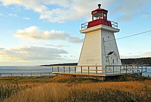
The Neil's Harbour Lighthouse
|
|
| Country | |
| Province | |
| Municipality | Municipality of the County of Victoria |
| Time zone | UTC−4 (AST) |
| • Summer (DST) | UTC−3 (ADT) |
| Canadian Postal Code |
B0C 1N0
|
| Area code(s) | 902 |
| Telephone Exchange | 336 |
| NTS Map | 011K16 |
| GNBC Code | CBBFE |
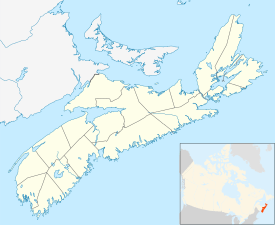
Neil's Harbour is a small community found on Cape Breton Island in Nova Scotia, Canada. It is part of the Municipality of the County of Victoria. An "unincorporated area" means it's a community that doesn't have its own local government, but is part of a larger county or municipality.
Contents
History of Neil's Harbour
Early Settlers
Evidence suggests that Neil's Harbour was first settled by the Acadians. The Acadians were French-speaking people who settled in parts of eastern Canada, including Nova Scotia, starting in the 1600s.
How it Got its Name
The community is named after a person called Neil McLennan. He was an important figure in the early days of the settlement.
Life in Neil's Harbour
What People Do
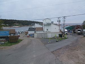
About 300 people live in Neil's Harbour all year round. Most residents work in the fishing industry. They often catch lobster and crab, which are very popular seafoods. Fishing is the main way people make a living here.
The Victoria Co-Op Fisheries Ltd. is a big employer for people in Neil's Harbour. It's located nearby in a place called New Haven. This co-op helps process and sell the fish caught by local fishers.
Churches in the Community
Neil's Harbour has an Anglican church that is still used today. There is also a Presbyterian church, but it is no longer open for services.
Schools and Learning
The first school in Neil's Harbour was built a long time ago, in 1878. Today, students attend the Cabot Education Centre. This school is located on the west side of the village, right along the famous Cabot Trail. The Cabot Trail is a scenic highway that goes around the coast of Cape Breton Island.
 | Shirley Ann Jackson |
 | Garett Morgan |
 | J. Ernest Wilkins Jr. |
 | Elijah McCoy |


