Cabot Trail facts for kids
Quick facts for kids Cabot Trail |
||||
|---|---|---|---|---|
| Trunk 30 | ||||
| Lua error in Module:Infobox_road/map at line 15: attempt to index field 'wikibase' (a nil value). | ||||
| Route information | ||||
| Length | 298 km (185 mi) | |||
| Major junctions | ||||
| Location | ||||
| Counties: | Victoria County, Inverness County | |||
| Highway system | ||||
Provincial highways in Nova Scotia
|
||||

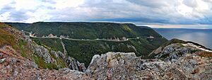
The Cabot Trail is a famous highway and a very scenic road located in northern Victoria County and Inverness County. It's found on Cape Breton Island in Nova Scotia, Canada.
This amazing route is about 298 kilometers (185 miles) long. It forms a big loop around the northern tip of Cape Breton Island. As you drive, you'll pass through the beautiful Cape Breton Highlands. The trail is named after John Cabot, an explorer who landed in Atlantic Canada in 1497. Even though historians think he landed in Newfoundland, the trail was named after him to help promote tourism in Nova Scotia. The first parts of this road were finished in 1932.
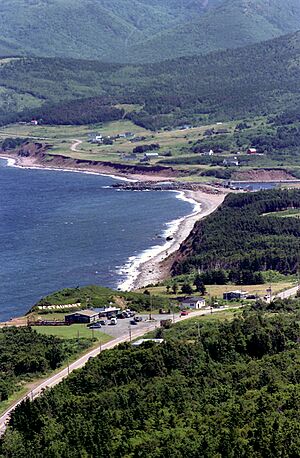
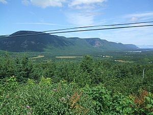
A large part of the Cabot Trail's northern section goes right through Cape Breton Highlands National Park. The western and eastern parts of the road follow the rugged coastline. This offers incredible views of the ocean. The southwestern section of the trail winds through the Margaree River valley. After that, it goes along the peaceful Bras d'Or Lake.
The Department of Transportation calls this road Trunk 30. The "Cabot Trail" road itself starts at Exit 7 on Nova Scotia Highway 105 in Buckwheat Corner. It then loops around and ends at Exit 11 on Highway 105 in South Haven. The entire "Cabot Trail" scenic route includes all of Trunk 30. It also includes the part of Highway 105 between these two exits.
Exploring Towns Along the Trail
As you travel the Cabot Trail, you'll discover many interesting communities:
- Baddeck: This town is often called the gateway to the Cabot Trail. It's home to the Alexander Graham Bell National Historic Site. Here you can learn about the famous inventor of the telephone.
- St. Anns: This is where you'll find the Gaelic College of Celtic Arts and Crafts. It's a special place to learn about Scottish culture, music, and dance.
- Ingonish: This is a historic fishing village and one of the first places settled on Cape Breton. It's the eastern entrance to Cape Breton Highlands National Park. You can also visit Keltic Lodge resort and Cape Smokey Provincial Park here.
- Belle Cote: This small fishing village is located where the Margaree River meets the Gulf of St. Lawrence. It marks the traditional border between Scottish settlements to the south and Acadian villages to the north.
- Chéticamp: This is an Acadian fishing village. It's well-known for its beautiful hooked rugs and lively fiddle music. It serves as the western entrance to Cape Breton Highlands National Park.
- Pleasant Bay: This spot is about halfway along the Cabot Trail. It's known as the "whale watching capital of Cape Breton." You might even spot some whales!
- Dingwall: This is another small fishing village nestled in the highlands of Cape Breton Island.
- Cape North: This is the northernmost point of the Cabot Trail. Here you can visit the North Highlands Community Museum. You can also see local crafts at the Arts North Gallery.
 | Percy Lavon Julian |
 | Katherine Johnson |
 | George Washington Carver |
 | Annie Easley |


