New Blaine, Arkansas facts for kids
Quick facts for kids
New Blaine, Arkansas
|
|
|---|---|

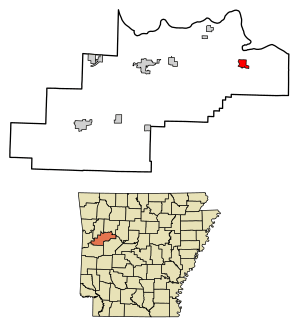
Location in Logan County, Arkansas
|
|
| Country | United States |
| State | Arkansas |
| County | Logan |
| Area | |
| • Total | 1.90 sq mi (4.93 km2) |
| • Land | 1.59 sq mi (4.13 km2) |
| • Water | 0.31 sq mi (0.80 km2) |
| Elevation | 397 ft (121 m) |
| Population
(2020)
|
|
| • Total | 173 |
| • Density | 108.46/sq mi (41.88/km2) |
| Time zone | UTC-6 (Central (CST)) |
| • Summer (DST) | UTC-5 (CDT) |
| Area code(s) | 479 |
| GNIS feature ID | 2612130 |
| FIPS code | 05-49070 |
New Blaine is a small community in Logan County, Arkansas, United States. It is an "unincorporated community," meaning it doesn't have its own city government. It's also a census-designated place (CDP), which means the U.S. Census Bureau counts its population. In 2020, about 173 people lived in New Blaine.
The National Register of Historic Places is a list of special places in the United States. These places are important because of their history or unique architecture. Several historic sites are found in or near New Blaine:
- Anhalt Barn: An old barn located on County Road 68.
- Old Arkansas Highway 22: Parts of this historic road are now known as AR 197, AR 197 Loop, and Rainwater Loop.
- Elizabeth Hall: A historic building located off AR 22.
- Farmer's State Bank: An old bank building found at 100 Seallars Street.
- Freeborn T. Lasater House: A historic home located at 494 AR 197.
- Main Street Bridge: This bridge is at 2002 Sellers Street, crossing Silver Smith Branch.
- New Blaine School: The old school building is at the corner of AR 22 and Spring Road.
- Troy Lasater Service Station: An old service station located on the AR 197 Loop.
Contents
Geography of New Blaine
New Blaine is located in the eastern part of Logan County. It sits in a valley near Little Shoal Creek. This creek flows into an arm of Lake Dardanelle. Lake Dardanelle is a large lake formed by a dam on the Arkansas River.
Arkansas Highway 22 runs through the community. If you travel east on Highway 22, you will reach Dardanelle about 16 miles away. Traveling west will take you to Paris, which is about 18 miles away. Arkansas Highway 197 branches north from Highway 22 in New Blaine. It leads about 2 miles north to the Shoal Bay Recreation Area.
The New Blaine CDP covers a total area of about 1.9 square miles (4.93 square kilometers). Most of this area, about 1.59 square miles (4.13 square kilometers), is land. The rest, about 0.31 square miles (0.80 square kilometers), is water, making up about 16.53% of the total area.
Population and People
The United States Census Bureau counts the population of the country every ten years. This helps us understand how many people live in different places.
New Blaine's Population Over Time
The population of New Blaine has stayed fairly steady over the past few years:
- In 2010, the population was 174 people.
- In 2020, the population was 173 people.
Who Lives in New Blaine?
The 2020 census also collects information about the different groups of people living in New Blaine. This helps us see the community's diversity.
- Most residents are White (not Hispanic or Latino), making up about 80.92% of the population.
- About 9.83% of the population is Asian (not Hispanic or Latino).
- About 5.20% of residents are of Mixed Race (not Hispanic or Latino).
- About 4.05% of the population is Hispanic or Latino. This group can be of any race.
Education in New Blaine
Students in New Blaine attend schools that are part of the Paris School District. The main high school for the area is Paris High School.
See also
 In Spanish: New Blaine (Arkansas) para niños
 | Emma Amos |
 | Edward Mitchell Bannister |
 | Larry D. Alexander |
 | Ernie Barnes |


