New Hampden, Virginia facts for kids
Quick facts for kids
New Hampden, Virginia
|
|
|---|---|

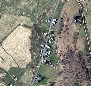
Aerial view of New Hampden, Virginia
|
|
| Country | United States |
| State | Virginia |
| County | Highland |
| Elevation | 2,598 ft (792 m) |
| Time zone | UTC−5 (Eastern (EST)) |
| • Summer (DST) | UTC−4 (EDT) |
| GNIS feature ID | 1496000 |
New Hampden is a small, unincorporated community located in Highland County, Virginia, United States. This means it's a group of homes and buildings that isn't officially a town or city with its own local government.
Contents
Discovering New Hampden
New Hampden is found in the beautiful Blue Grass Valley. It sits right along Virginia State Route 640. The community is about 5.7 miles (9.2 km) north of Monterey, Virginia.
Where is New Hampden Located?
New Hampden is situated on the banks of the South Branch Potomac River. It is west of the northern end of Monterey Mountain. You can also find it southwest of the community of Blue Grass, Virginia. The interesting Devils Backbone rock outcrop is also nearby. New Hampden first appeared around the year 1858. People at the time noted that it had a very "regular appearance." This was different from other villages that grew without much planning.
A Glimpse into the Past
West of New Hampden, there is a very old and important site. It was a flint quarry. Native Americans used this quarry to gather flint. Flint was a crucial material for making tools and arrowheads. Some stories say that this area was so important that different native tribes considered it to be neutral ground. This meant it was a safe place for everyone.
The Historic Rexrode Mill
New Hampden is also home to a historic grist mill. A grist mill is a building where grain is ground into flour. This particular mill started working around 1816 or 1817. It was originally known as the Rexrode Mill. The mill continued to operate for many years, finally closing down in 1944. The old mill building still stands today, reminding us of the community's past.
 | Sharif Bey |
 | Hale Woodruff |
 | Richmond Barthé |
 | Purvis Young |


