
Highland County, Virginia facts for kids
Quick facts for kids
Highland County
|
||
|---|---|---|

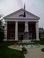
Highland County Courthouse in Monterey
|
||
|
||

Location within the U.S. state of Virginia
|
||
 Virginia's location within the U.S. |
||
| Country | ||
| State | ||
| Founded | 1847 | |
| Seat | Monterey | |
| Largest town | Monterey | |
| Area | ||
| • Total | 416 sq mi (1,080 km2) | |
| • Land | 415 sq mi (1,070 km2) | |
| • Water | 0.7 sq mi (2 km2) 0.2% | |
| Population
(2020)
|
||
| • Total | 2,232 | |
| • Density | 5.365/sq mi (2.0716/km2) | |
| Time zone | UTC−5 (Eastern) | |
| • Summer (DST) | UTC−4 (EDT) | |
| Congressional district | 6th | |

Highland County is a county in Virginia. In 2020, it had 2,232 people, making it the least populated county in the state. Its main town, or county seat, is Monterey.
Highland County is often called "Virginia's Switzerland" because of its beautiful mountains. It's one of the highest counties in the eastern United States.
Contents
History
People from Europe started settling in this part of Virginia around 1745. This area is west of the Blue Ridge Mountains, which was known as "Transmountaine" (meaning "beyond the mountains") in old Virginia.
Most early settlers came from Maryland and Pennsylvania, traveling south along the Great Wagon Road. German immigrants moved into the northern part of the county, while Scots-Irish settlers moved into the southern part.
After the American Revolutionary War, when Virginia and the other 12 colonies became independent from Great Britain, the area still had very few people. In the 1840s, the important Staunton-Parkersburg Turnpike was built through the county. This toll road helped connect the Shenandoah Valley with the Ohio River.
Highland County was officially formed in 1847. It was created from parts of Bath County and Pendleton County. People wanted a new county because it was hard to travel to the old county seats. The new turnpike also made the area more important. The county was named "Highland" because of its high elevation.
During the American Civil War (1861–1865), controlling the Staunton-Parkersburg Turnpike was very important. Soldiers from both the Union and Confederate armies spent a difficult winter in 1861 holding positions along the road. The Battle of McDowell happened here on May 8, 1862. It was the first victory for Stonewall Jackson in his famous Shenandoah Valley campaign.
In the 1900s, the Turnpike became U.S. Route 250. Today, it's still the main east-west road in Highland County and a National Scenic Byway as it crosses into West Virginia.
Geography
Highland County covers about 416 square miles (1,077 square kilometers). Most of this is land, with only a small amount of water.
The western edge of the county follows the Eastern Continental Divide in the Allegheny Mountains. The eastern edge is along the ridge of Shenandoah Mountain. The county is bordered by Pocahontas County, West Virginia to the west, Pendleton County, West Virginia to the north, Augusta County, Virginia to the east, and Bath County, Virginia to the south.

Highland County has an average elevation of about 2,832 feet (863 meters). This makes it one of the highest counties in the eastern United States. The highest point is 4,545 feet (1,385 meters) in the Allegheny Mountains, and the lowest is 1,625 feet (495 meters) near the Cowpasture River.
The county is part of the Ridge-and-Valley Appalachians, which means it has many valleys and mountain ridges running from northeast to southwest. These valleys include Alleghany Valley, Bluegrass Valley, Monterey Valley, Bullpasture Valley, and Cowpasture Valley. Most of the county's rivers flow into the James River, while northern parts drain into the Potomac River.

Adjacent counties
- Augusta County (southeast)
- Bath County (south)
- Pendleton County, West Virginia (north)
- Pocahontas County, West Virginia (west)
Protected areas
Parts of the George Washington National Forest are in Highland County, mostly along its western and eastern borders. The Highland Wildlife Management Area is a large wildlife preserve managed by the Virginia Department of Wildlife Resources. Together, the national forest and wildlife area cover about 28% of the county's land.
Highland County is also inside the United States National Radio Quiet Zone. This is a special area where radio activity is limited to prevent interference with important telescopes and listening stations in West Virginia.
Climate and weather
| Weather chart for Monterey, VA | |||||||||||||||||||||||||||||||||||||||||||||||
|---|---|---|---|---|---|---|---|---|---|---|---|---|---|---|---|---|---|---|---|---|---|---|---|---|---|---|---|---|---|---|---|---|---|---|---|---|---|---|---|---|---|---|---|---|---|---|---|
| J | F | M | A | M | J | J | A | S | O | N | D | ||||||||||||||||||||||||||||||||||||
|
3.4
37
17
|
3.2
41
18
|
4.1
49
26
|
3.7
59
34
|
4.3
68
44
|
4.1
76
52
|
4.2
80
56
|
2.9
78
54
|
3.4
72
48
|
3.6
63
37
|
3.6
51
29
|
3.5
42
21
|
||||||||||||||||||||||||||||||||||||
| temperatures in °F precipitation totals in inches source: NOAA (normals, 1971–2000); The Weather Channel |
|||||||||||||||||||||||||||||||||||||||||||||||
|
Metric conversion
|
|||||||||||||||||||||||||||||||||||||||||||||||
Highland County has a climate with warm summers and consistent rainfall throughout the year. Monterey, the county seat, has an average temperature of about 47.6°F (8.7°C) each year. Higher parts of the county are cooler, while lower areas are warmer.
The lowest temperature ever recorded in Monterey was -26°F (-32°C) in January 1985. The highest was 95°F (35°C) in July 1952. The county gets about 41 inches (1,041 mm) of rain and 34 inches (86 cm) of snow each year.
Tornadoes are very rare in Highland County. Only one has been officially recorded, in 1959, but it caused no damage or injuries. The county has experienced some severe hail and strong winds over the years.
Highland County also has good wind resources, making it a great place for wind power to generate electricity.
Economy

In 2013, about 1,142 people worked in Highland County, and the unemployment rate was 5.3%.
Historically, agriculture has been very important to Highland County's economy. Raising cattle is especially good for the area because the mountains mean there isn't much flat land for growing crops. About 36% of the county's land is used for farming.
Wool production is also a big industry. In 2010, Highland County ranked fifth in Virginia for the most sheep and lambs, with about 4,500 animals. The county also had about 8,000 cattle and produced a lot of hay.
The largest employer in the county in 2012 was the government, especially local government jobs. Other important job sectors included finance, healthcare, construction, and retail. The biggest employers were Allen Lowry Logging and Highland County Public Schools.
Highland County is part of the Appalachian region. Its economy is considered "transitional," meaning it's in a period of moving between weaker and stronger economic times.
Transportation
Highways

Highland County does not have any Interstate highways. However, you can reach Interstate 64 and Interstate 81 in nearby Augusta County.
The county has three main state highways: Virginia State Route 84, U.S. Route 250, and U.S. Route 220. These roads have seen more traffic recently, but even the busiest parts only have about 1,600 vehicles per day. The Virginia Department of Transportation maintains all primary and many secondary roads in the county.
U.S. Route 250

U.S. 250 enters Highland County from West Virginia at a high elevation of about 4,280 feet (1,300 meters). It travels about 32.45 miles (52.22 km) through the county. The road goes through valleys and over mountains, passing through the village of Hightown. Hightown is special because it's where the waters divide, with some flowing to the James River and others to the Potomac River.
After Hightown, U.S. 250 goes over Monterey Mountain and then reaches Monterey, the county seat. In Monterey, it crosses U.S. 220, the county's main north-south road. U.S. 250 then continues east through mountainous areas towards McDowell and Head Waters, eventually leaving the county and entering Augusta County over Shenandoah Mountain.
U.S. Route 220
U.S. 220 is Highland County's main north-south road. It enters from West Virginia and travels about 23.59 miles (37.97 km) through the county. It crosses the South Branch Potomac River at Forks of Waters.
The road continues southwest, passing through Possum Trot before reaching Monterey, where it meets U.S. 250. South of Monterey, U.S. 220 passes by Trimble Knob, a unique cone-shaped hill that was once a volcano about 35 million years ago! The route then follows river valleys, passing through Vanderpool and Mustoe, before entering Bath County, Virginia.
Virginia State Route 84

Virginia State Route 84 enters Highland County from West Virginia in the southwest. It travels about 14.94 miles (24.04 km) through villages like Mill Gap and Meadowdale before connecting with U.S. 220 at Vanderpool.
Other transportation
Highland County does not have any public airports or train lines. The closest commercial airport is the Shenandoah Valley Regional Airport in nearby Augusta County. The nearest train service is in Staunton.
Historically, there were plans for railroads to come to Highland County, but they were never built. The mountainous land and small population made it too difficult and expensive to build train tracks here.
Community services
Education
Public education in Highland County is provided by Highland County Public Schools. The district has one elementary school (Highland Elementary) for grades K-5 and one high school (Highland High School) for grades 6-12. Both schools are in the same building southeast of Monterey.
Highland County has the smallest school district in Virginia, with just over 200 students.
The first teacher in the area was recorded in 1755. Publicly supported education began in 1820. By 1893, there were 47 small schools across the county. Over time, these schools were combined. In 1957, all high school students went to Monterey High School. By 1997, all students from kindergarten to 12th grade were in the current school complex.
There are no colleges or universities in Highland County. However, several are within a two-hour drive, such as James Madison University and the University of Virginia.
Healthcare
Highland County does not have a hospital. The closest hospitals are in neighboring Augusta and Bath Counties. The Highland Medical Center, Inc. in Monterey is the only general medical facility in the county. It opened in 1996.
Highland County is considered a "frontier county" because it's very remote, has a low population, and limited access to healthcare and other services.
Emergency services
Highland County has three volunteer fire departments: Bolar Volunteer Fire Department (serving the south), McDowell Volunteer Fire Department (serving McDowell, Doe Hill, and Head Waters), and Highland County Volunteer Fire Department (serving Monterey and Blue Grass).
Rescue squad services are provided by the Highland County Volunteer Rescue Squad, with locations in Monterey and McDowell.
The Highland County Sheriff's Office provides law enforcement for the entire county from its office in Monterey.
Demographics
| Historical population | |||
|---|---|---|---|
| Census | Pop. | %± | |
| 1850 | 4,227 | — | |
| 1860 | 4,319 | 2.2% | |
| 1870 | 4,151 | −3.9% | |
| 1880 | 5,164 | 24.4% | |
| 1890 | 5,352 | 3.6% | |
| 1900 | 5,647 | 5.5% | |
| 1910 | 5,317 | −5.8% | |
| 1920 | 4,931 | −7.3% | |
| 1930 | 4,525 | −8.2% | |
| 1940 | 4,875 | 7.7% | |
| 1950 | 4,069 | −16.5% | |
| 1960 | 3,221 | −20.8% | |
| 1970 | 2,529 | −21.5% | |
| 1980 | 2,937 | 16.1% | |
| 1990 | 2,635 | −10.3% | |
| 2000 | 2,536 | −3.8% | |
| 2010 | 2,321 | −8.5% | |
| 2020 | 2,232 | −3.8% | |
| U.S. Decennial Census 1790-1960 1900-1990 1990-2000 2010 2020 |
|||
In 2020, Highland County had a population of 2,232 people. Most residents (95.52%) were White. Other groups included Black or African American, Native American, Asian, Pacific Islander, and people of mixed races. About 1.57% of the population was Hispanic or Latino.
In 2010, Highland County was the least populated county in Virginia and one of the least populated counties east of the Mississippi River. The average age in the county was 52.9 years.
The median income for a household in the county was $63,636, and for a family it was $76,566. About 11.1% of the population lived below the poverty line.
Most people in Highland County who follow a religion are Protestant Christians. The largest group in 2010 was the United Methodist Church, followed by Presbyterians and non-denominational Christians.
Attractions
Highland County is famous for its nickname "Virginia's Switzerland" because of its steep mountains and beautiful valleys. Many tourists have visited the area over the years, including famous inventors like Henry Ford and Thomas Edison in 1918.
The Highland County Museum and Heritage Center in McDowell shares the history of the county and the Battle of McDowell from the Civil War. The battlefield is considered one of the best-preserved Civil War battlefields in the Shenandoah Valley.
The Highland County Maple Festival is held every March since 1959. It celebrates the county's maple syrup industry and attracts over 60,000 visitors each year. The festival has even been recognized by the Library of Congress. Highland also has a seasonal farmers' market and the Allegheny Mountain School, which helps local food systems.
People also enjoy outdoor activities like fishing, hiking, hunting, caving, and cycling in the county. Every August, the Mountain Mama Road Bike Challenge brings cyclists from all over to ride the county's challenging mountain roads. The Highland County Fair is the longest running fair in Virginia.
Communities
Town
Unincorporated communities
- Bethel
- Blue Grass
- Clover Creek
- Doe Hill
- Forks of Waters
- Hardscrabble
- Head Waters
- Hightown
- Liberty
- McDowell
- Meadowdale
- Mill Gap
- Mustoe
- New Hampden
- Palo Alto
- Patna
- Possum Trot
- Sirons Mill
- Trimble
- Vanderpool
Images for kids
-
Highland County Courthouse in Monterey
See also
 In Spanish: Condado de Highland (Virginia) para niños
