
Pocahontas County, West Virginia facts for kids
Quick facts for kids
Pocahontas County
|
||
|---|---|---|
|
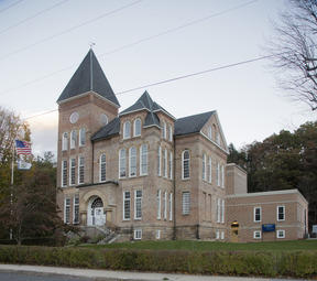
Pocahontas County Courthouse in Marlinton
Seneca State Forest
|
||
|
||

Location of Pocahontas County in West Virginia
|
||

West Virginia's location within the U.S.
|
||
| Country | ||
| State | ||
| Founded | December 21, 1821 | |
| Named for | Pocahontas | |
| Seat | Marlinton | |
| and largest town | ||
| Area | ||
| • Total | 2,440 km2 (942 sq mi) | |
| • Land | 2,400 km2 (940 sq mi) | |
| • Water | 4 km2 (1.5 sq mi) 0.2% | |
| Area rank | 3rd | |
| Population
(2020)
|
||
| • Total | 7,869 | |
| • Estimate
(2021)
|
7,841 |
|
| • Rank | 47th | |
| • Density | 3.2253/km2 (8.354/sq mi) | |
| Time zone | UTC−5 (Eastern) | |
| • Summer (DST) | UTC−4 (EDT) | |
| Area code(s) | 304, 681 | |
| Congressional district | 1st | |
| Senate district | 11th | |
| House of Delegates district | 46th, 66th | |
| Website | https://pocahontascountycommission.com/ | |


Pocahontas County is a county in the eastern part of West Virginia. In 2020, about 7,869 people lived there. Its main town, or county seat, is Marlinton.
The county was created in 1821. It is named after Pocahontas, a famous Native American woman. She was the daughter of a powerful chief from the Powhatan tribe. She married an English settler, and their children became ancestors of many important families in Virginia.
Pocahontas County is also home to the Green Bank Observatory. This area is part of the National Radio Quiet Zone. This means there are strict rules about radio signals to help the observatory listen to space without interference.
Contents
History of Pocahontas County
Early European Settlers
In 1751, an early American explorer named Andrew Lewis was surveying land. He found two men, Jacob Marlin and Stephen Sewell, living where Marlinton is today. They had arrived in 1749 and are thought to be the first European settlers in this part of Virginia. They built their first cabin where Marlin Run met Knapp's Creek. Lewis even found Sewell living in a large hollow sycamore tree nearby! This area is now in Marlinton.
Native American Lands and Conflicts
The Iroquois Confederacy used this area as a hunting ground. They had won this land from other tribes. Native Americans did not want Europeans settling on their hunting grounds. A treaty in 1758 said that the land west of the Allegheny Mountains belonged to the Native Americans. It also said that British subjects could not settle or hunt there.
However, British settlers kept moving into these hunting grounds. This led to many conflicts and attacks. After the Revolutionary War, many Native Americans moved west. Then, the settlers' land claims became official.
Pocahontas County During the Civil War
During the Civil War, Pocahontas County supported the Southern states. The county voted to leave the United States. Many men from the county joined the Confederate army.
Two important battles happened in the county in 1861: the Battle of Cheat Mountain and the Battle of Camp Allegheny. In 1863, the battle of Droop Mountain took place, which the Union army won.
Formation of West Virginia
During the Civil War, a new government loyal to the United States was formed in Wheeling. This government helped create a new state called West Virginia. This new state was made from 48 counties in western Virginia. West Virginia officially became a state on June 20, 1863.
Pocahontas County was added to the new state of West Virginia. After the war, many voters in the county could not vote for a while. This was because they had supported the Confederacy. They got their full voting rights back in 1871.
Changing Districts
The new state government divided counties into smaller areas called townships. This was meant to help local government. But it was hard to do in rural areas. So, in 1872, townships became "magisterial districts."
Pocahontas County first had four townships. They were named Grant, Lincoln, Meade, and Union. These names honored Union generals and presidents. In 1873, they were renamed:
- Grant District became Huntersville District.
- Lincoln District became Edray.
- Meade District became Greenbank.
- Union District became Academy.
Later, in the 1890s, Academy District was renamed again to Little Levels.
Railroads and Timber Industry
Railroads came late to Pocahontas County. Building tracks over the mountains was very difficult and costly. Construction finally began in 1899. After that, the work moved very quickly. Many European immigrants came to the area to work on building these railroads.
Once the railroads were finished, the timber industry grew fast. A large mill, owned by West Virginia Pulp & Paper Company, was built at Cass. By the end of 1920, many small towns appeared along the Chesapeake & Ohio Railway line. These towns were built around the logging and railroad work.
Geography of Pocahontas County
Pocahontas County covers about 942 square miles. Most of this is land, with a small amount of water. It is the third-largest county in West Virginia by area. It is also one of the highest counties east of the Mississippi River. Its average elevation is about 3,219 feet.
The highest point in the county is Thorny Flat on Cheat Mountain. It is about 4,848 feet high.
Rivers Born in Pocahontas County
Pocahontas County is special because many rivers start here. It is the birthplace of eight rivers:
- Cherry River
- Cranberry River
- Elk River
- Gauley River
- Greenbrier River
- Tygart Valley River
- Williams River
- Shavers Fork of the Cheat River
The Monongahela National Forest protects much of the land where these rivers begin. This helps keep the water clean downstream.
Major Roads in Pocahontas County
 U.S. Highway 219
 U.S. Highway 250
 West Virginia Route 28
 West Virginia Route 39
 West Virginia Route 55
 West Virginia Route 66
 West Virginia Route 84
 West Virginia Route 92
Protected Natural Areas
- Monongahela National Forest (part of it is in the county)
- Cranberry Glades Botanical Area
- Gaudineer Scenic Area
Population and People
| Historical population | |||
|---|---|---|---|
| Census | Pop. | %± | |
| 1830 | 2,542 | — | |
| 1840 | 2,922 | 14.9% | |
| 1850 | 3,598 | 23.1% | |
| 1860 | 3,958 | 10.0% | |
| 1870 | 4,069 | 2.8% | |
| 1880 | 5,561 | 36.7% | |
| 1890 | 6,814 | 22.5% | |
| 1900 | 8,570 | 25.8% | |
| 1910 | 14,740 | 72.0% | |
| 1920 | 15,002 | 1.8% | |
| 1930 | 14,555 | −3.0% | |
| 1940 | 13,906 | −4.5% | |
| 1950 | 12,480 | −10.3% | |
| 1960 | 10,136 | −18.8% | |
| 1970 | 8,870 | −12.5% | |
| 1980 | 9,919 | 11.8% | |
| 1990 | 9,008 | −9.2% | |
| 2000 | 9,131 | 1.4% | |
| 2010 | 8,719 | −4.5% | |
| 2020 | 7,869 | −9.7% | |
| 2021 (est.) | 7,841 | −10.1% | |
| U.S. Decennial Census 1790–1960 1900–1990 1990–2000 2010–2019 |
|||
2020 Census Information
In 2020, Pocahontas County had 7,869 people living there. Most people were White (95.3%). About 1.4% of the population was Hispanic or Latino.
The average age in the county was 49.6 years old. About 17.5% of the people were under 18 years old. The average income for a household was $37,225. About 17.5% of the population lived below the poverty line.
Economy and Tourism

Tourism is one of the biggest industries in Pocahontas County. Many people visit the area for its natural beauty and attractions. A popular spot is Snowshoe Mountain, which is busy with tourists in both summer and winter. Many people from out of town also own property in the county.
Communities in Pocahontas County
Towns
Magisterial Districts
- Edray
- Greenbank
- Huntersville
- Little Levels
Census-Designated Places
These are areas that are like towns but are not officially incorporated.
Unincorporated Communities
These are smaller communities that are not officially part of a town or city.
Notable People from Pocahontas County
- Pearl S. Buck: A famous author who was born in Hillsboro.
- W. E. Blackhurst: An author.
See also
 In Spanish: Condado de Pocahontas (Virginia Occidental) para niños
