Cherry River (West Virginia) facts for kids
Quick facts for kids Cherry River |
|
|---|---|

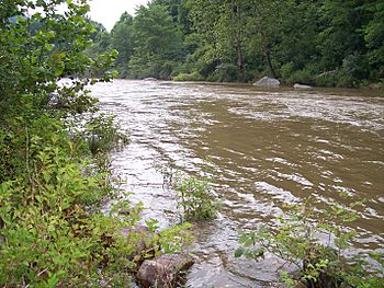
Cherry River in Nicholas County after heavy rains
|
|
| Country | United States |
| Physical characteristics | |
| Main source | Pocahontas County, West Virginia (North and South Forks) 2,226 ft (678 m) (at confluence of forks at Richwood) |
| River mouth | Gauley River, Nicholas County, West Virginia |
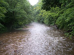
The Cherry River is a tributary (a smaller river or stream that flows into a larger one) of the Gauley River in southeastern West Virginia, United States. Its waters eventually reach the Mississippi River through the Gauley, Kanawha, and Ohio rivers. This whole area is called a drainage basin or watershed. The Cherry River mostly flows through rural areas and forests, especially within the Monongahela National Forest. Along its entire path, the Cherry River features exciting whitewater rapids in a beautiful mountainous setting.
Contents
Discovering the Cherry River
What's in a Name?
The Cherry River has had a few different names over time, like "Cherry Tree Waters" and "Cherrytree Creek." Its current name comes from the wild cherry trees that grow along its banks.
Where the River Begins
The Cherry River actually starts as two separate creeks: the North Fork Cherry River and the South Fork Cherry River. Both of these begin in southeastern Pocahontas County. They flow generally west and northwest through northern Greenbrier County. Finally, they meet in Nicholas County at the city of Richwood.
Whitewater Fun in Richwood
In Richwood, the river is about 2,200 feet (670 meters) above sea level. This high elevation helps create exciting Class 3 whitewater rapids, especially when snow melts in the spring. You can often see these rapids right from the city's streets! It's a unique place where a town of about 2,000 people has whitewater rapids flowing right through it.
Journey to the Gauley River
After leaving Richwood, the Cherry River flows northwest for about 10 more miles (16 kilometers). Part of its journey is next to a rail trail called the Cranberry Tri-Rivers Rail-Trail. The river then meets the Gauley River in a small, historic lumber town called Curtin. Curtin is about two miles south of Craigsville.
Protecting the River and Town
There are no dams on the Cherry River right now. This means that the town of Richwood has sometimes experienced damaging floods. Local leaders have suggested building a dam on the South Fork just above Richwood. This could help protect the town from future floods. It might also help create more reliable water flows for fun whitewater activities.
 | Delilah Pierce |
 | Gordon Parks |
 | Augusta Savage |
 | Charles Ethan Porter |


