Kanawha River facts for kids
Quick facts for kids Kanawha River |
|
|---|---|

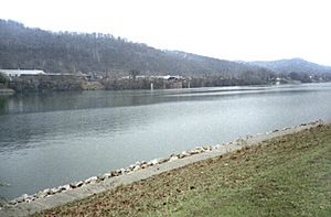
Kanawha River at St. Albans, West Virginia
|
|

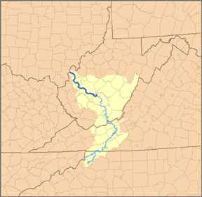
Map of the Kanawha River and its tributary the New River, with the Kanawha River highlighted in darker blue.
|
|
| Country | United States |
| State | West Virginia |
| Counties | Fayette, Kanawha, Putnam, Mason |
| Physical characteristics | |
| Main source | New River Ashe County, NC 2,546 ft (776 m) 36°32′45″N 81°21′09″W / 36.54583°N 81.35250°W |
| 2nd source | Gauley River Three Forks of Gauley, Pocahontas County, WV 2,917 ft (889 m) 38°24′33″N 80°14′17″W / 38.40917°N 80.23806°W |
| River mouth | Ohio River Point Pleasant, WV 538 ft (164 m) 38°50′16″N 82°08′34″W / 38.83778°N 82.14278°W |
| Length | 97 mi (156 km) |
| Basin features | |
| Basin size | 12,236 sq mi (31,690 km2) |
| Tributaries |
|
The Kanawha River (pronounced kə-NAW-ə) is a major river in the U.S. state of West Virginia. It flows for about 97 miles (156 km) before joining the Ohio River. It is the largest inland waterway in West Virginia.
The Kanawha River valley has been an important industrial area since the early 1800s. Many cities and towns are located along its banks.
Contents
Where Does the Kanawha River Start?
The Kanawha River begins in Gauley Bridge, West Virginia. This is where two other rivers, the New River and the Gauley River, meet.
From there, the Kanawha River flows generally northwest. It winds through several counties: Fayette, Kanawha, Putnam, and Mason. It passes by big cities like Charleston and St. Albans. Finally, it flows into the Ohio River at Point Pleasant, West Virginia.
Early History of the Kanawha River Valley
People have lived in the Kanawha River valley for a very long time. The first known people, called Paleo-Indians, were here around 10,000 BC. We know this from old tools and artifacts found by archaeologists.
Later, different ancient cultures lived here. The Adena culture began building large earthwork mounds and enclosures over 2,000 years ago. Some of these mounds can still be seen today. The Fort Ancient culture also had villages in the valley when Europeans first arrived.
Native American Tribes and the River
The Kanawha River area was a place where different American Indian nations competed. The Iroquois from what is now New York pushed out or took over lands from tribes like the Huron and Conoy.
Because they had won battles, the Iroquois, Lenape (also known as Delaware), and Shawnee tribes used this area as a hunting ground. They tried to stop European settlers from moving in during colonial times. However, eventually the settlers took control of the land.
The name "Kanawha" comes from Iroquois dialects. It means "water way" or "canoe way," suggesting it was a path for travel by boat. The river was also sometimes called "Wood's River" after Colonel Abraham Wood. He was an English explorer who explored the river in the mid-1600s.
Industry and Transportation on the River
The Kanawha River valley has large amounts of coal and natural gas. In the past, the river's water level changed a lot, making it hard to use for transportation.
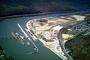
But in the 1840s, people cleared away rocks and logs from the lower part of the river. This made it possible for boats to travel. Later, starting in 1875, locks and dams were built. These structures helped control the water level. Now, boats can travel far up the river, even to a community called Deepwater.
Today, a strong chemical industry is located along the river's banks. This industry is a very important part of the local economy.
Rivers Joining the Kanawha
Besides the New and Gauley Rivers that form it, other rivers flow into the Kanawha.
- The Elk River joins it at Charleston.
- The Coal River joins it at St. Albans.
- The Pocatalico River joins it at Poca.
Cities and Towns Along the Kanawha River
Images for kids
See also
 In Spanish: Río Kanawha para niños
 | Emma Amos |
 | Edward Mitchell Bannister |
 | Larry D. Alexander |
 | Ernie Barnes |


