
Greenbrier County, West Virginia facts for kids
Quick facts for kids
Greenbrier County
|
||
|---|---|---|

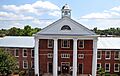
Greenbrier County Courthouse in Lewisburg
|
||
|
||

Location within the U.S. state of West Virginia
|
||
 West Virginia's location within the U.S. |
||
| Country | ||
| State | ||
| Founded | October 20, 1778 | |
| Seat | Lewisburg | |
| Largest city | Lewisburg | |
| Area | ||
| • Total | 1,025 sq mi (2,650 km2) | |
| • Land | 1,020 sq mi (2,600 km2) | |
| • Water | 4.9 sq mi (13 km2) 0.5%% | |
| Population
(2020)
|
||
| • Total | 32,977 | |
| • Estimate
(2021)
|
32,608 |
|
| • Density | 32.173/sq mi (12.422/km2) | |
| Time zone | UTC−5 (Eastern) | |
| • Summer (DST) | UTC−4 (EDT) | |
| Congressional district | 1st | |

Greenbrier County is a county in the state of West Virginia, United States. In 2020, about 32,977 people lived there. Its main town, or county seat, is Lewisburg. The county was created in 1778 from parts of Botetourt and Montgomery counties in Virginia.
Contents
A Look at Greenbrier County's History
Who Lived Here First?
Before European settlers arrived around 1740, Greenbrier County was a hunting ground. The Shawnee and Cherokee Nations used this land. They called it Can-tuc-kee.
A legend said the land was home to ghosts of the Azgens, a white people. The Shawnee believed their ancestors had defeated the Azgens. The ghosts would allow hunting but not permanent settlements.
Shawnee leaders like Pucksinwah and Tecumseh worried when settlers came. By 1771, trade was big in the area. Settlers were even selling fancy items like silk and silver.
The Shawnee leaders saw these settlements as breaking the Azgen rule. They feared losing their hunting lands. These lands were very important for their survival. They also knew settlers would soon cross the Ohio River into their lands.
Battles and Brave Defenders
In 1774, the governor of Virginia, the Earl of Dunmore, raised an army. They planned to fight the Shawnee in what is now Ohio. Half the army met at Fort Pitt. The other half gathered at Fort Union, which is now Lewisburg.
This second group was led by General Andrew Lewis. In October, Lewis's army marched to the Kanawha River. There, they fought a famous battle against the Shawnee. The Shawnee were led by Hokoleskwa. This battle was called the Battle of Point Pleasant.
European settlers faced many attacks from Native Americans. One attack was on Fort Randolph. Another was on Fort Donnally. About 25 men and 60 women and children were at Fort Donnally.
A brave African American slave named Dick Pointer helped defend Fort Donnally. He was said to be nearly 7 feet (2.1 meters) tall. Pointer and Philip Hamman held the log door. This gave the settlers time to wake up and fight back.
Pointer later asked the Virginia General Assembly to free him for his bravery. Accounts differ on whether he was freed. His grave is near Carnegie Hall in Lewisburg. A historical marker stands in the Lewisburg Cemetery. Pointer’s gun is on display at The Greenbrier Historical Society and John A. North House Museum.
Greenbrier County During the Civil War
In 1861, during the time of the Civil War, Greenbrier citizens chose Samuel Price to represent them. He went to the Richmond convention. On April 17, 1861, Virginia voted to leave the Union. Price first voted against it, but then changed his mind.
When the public voted on May 23, 1861, Greenbrier County voted strongly to leave the Union. The vote was 1,000 to 100. The Civil War reached the county in mid-1861. Several battles were fought here.
Battles happened in Lewisburg in May 1862 and White Sulphur Springs in August 1863. Both battles were won by the Union side. Greenbrier County became part of the new state of West Virginia. About 2,000 men from Greenbrier County joined the Confederate army.
Modern Times and Key Events
The oldest golf course in the United States is said to be in Greenbrier County. It was started in 1884 near White Sulphur Springs.
Before World War II, several Civilian Conservation Corps (CCC) camps were along the Greenbrier River. The CCC was a program that put young men to work on conservation projects.
For most of the 1900s, the Meadow River Lumber Company operated a huge sawmill. It was in Rainelle. It was the world's largest hardwood sawmill.
During World War II, The Greenbrier hotel was used as a hospital. It also held diplomats from Axis countries who were stuck in the U.S. After the war, it became a hotel again.
Later, during the Cold War, The Greenbrier had a secret bunker. This bunker was for the U.S. Congress. It was part of a plan to keep the government running in an emergency.
In June 2016, West Virginia had terrible floods. Greenbrier County was hit very hard. It had 16 deaths, more than any other county.
Where is Greenbrier County?
Greenbrier County covers about 1,025 square miles (2,655 square kilometers). Most of this is land, about 1,020 square miles (2,642 square kilometers). Only a small part, about 4.9 square miles (12.7 square kilometers), is water. It is the second-largest county in West Virginia by area.
Much of the northern and western parts of the county are public lands. These include the Monongahela National Forest. Some areas are also owned by coal companies or private forest companies.
In 2005, a company planned to build a large Beech Ridge Wind Farm. This wind farm would have 124 turbines. It would produce 186 megawatts of electricity. The project faced some delays but eventually moved forward.
Neighboring Counties
Greenbrier County shares borders with several other counties:
- Webster County (north)
- Pocahontas County (northeast)
- Bath County, Virginia (east)
- Alleghany County, Virginia (southeast)
- Monroe County (south)
- Summers County (southwest)
- Fayette County (west)
- Nicholas County (northwest)
Protected Natural Areas
Greenbrier County is home to several beautiful natural areas:
- Lost World Caverns
- Monongahela National Forest (part of it)
- Organ Cave System
- Greenbrier State Forest
- Washington/Jefferson National Forest (on the West Virginia/Virginia Line)
People of Greenbrier County
The population of Greenbrier County has changed over time. In 1790, about 6,015 people lived here. By 2020, the population was 32,977. The county's population density is about 34.8 people per square mile.
Most people in the county are white (94.6%). About 2.8% are Black or African American. Other groups make up smaller percentages. The average age of people in the county is 45 years old.
Learning in Greenbrier County
Public Schools
Greenbrier County Schools runs the public school system. A Board of Education, chosen by voters, governs the schools. The Superintendent of Schools manages the system. The main office is in Lewisburg.
Many high schools and middle schools in West Virginia have joined together. But elementary schools often stay in smaller towns.
Here are some of the public schools:
- Alderson Elementary School
- Crichton Elementary School
- Eastern Greenbrier Middle School
- Frankford Elementary School
- Greenbrier East High School
- Greenbrier West High School
- Lewisburg Elementary School
- Rainelle Elementary School
- Ronceverte Elementary School
- Rupert Elementary School
- Smoot Elementary School
- Western Greenbrier Middle School
- White Sulphur Springs Elementary School
Over the years, some schools in the county have closed or changed.
Private Schools
There are also private schools in Greenbrier County:
- Greenbrier Community School (formerly Greenbrier Episcopal School)
- Seneca Trail Academy
- Renick Christian School
- Lewisburg Baptist Academy
Colleges and Universities
For higher education, Greenbrier County has:
- New River Community and Technical College (NRCTC), Greenbrier Valley Campus
- West Virginia School of Osteopathic Medicine (WVSOM)
Getting Around Greenbrier County
Airports
Greenbrier Valley Airport is a single-runway airport. It is about 3 miles (4.8 kilometers) north of Lewisburg, West Virginia. Contour Airlines offers flights from this airport.
Railroads
Amtrak, the national passenger train service, serves the county. You can catch a train in White Sulphur Springs and Alderson. These stops are part of the Cardinal route.
Major Roads
Several important highways run through Greenbrier County:
 Interstate 64
 U.S. Route 60
 U.S. Route 219
 West Virginia Route 12
 West Virginia Route 20
 West Virginia Route 39
 West Virginia Route 55
 West Virginia Route 63
 West Virginia Route 92
Towns and Communities
Greenbrier County has several cities and towns:
Cities
- Lewisburg (the county seat)
- Ronceverte
- White Sulphur Springs
Towns
Other Communities
- Fairlea (a census-designated place)
Images for kids
-
Greenbrier County Courthouse in Lewisburg
See also
 In Spanish: Condado de Greenbrier para niños
