Greenbrier River facts for kids
Quick facts for kids Greenbrier River |
|
|---|---|
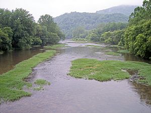
Greenbrier River at Marlinton, West Virginia
|
|
 |
|
| Country | United States |
| State | West Virginia |
| Counties | Greenbrier, Monroe, Pocahontas, Summers |
| Physical characteristics | |
| Main source | West Fork Greenbrier River Pocahontas County 3,396 ft (1,035 m) 38°44′07″N 79°45′37″W / 38.73528°N 79.76028°W |
| 2nd source | East Fork Greenbrier River Pocahontas County 3,746 ft (1,142 m) 38°41′04″N 79°39′31″W / 38.68444°N 79.65861°W |
| River mouth | New River Hinton 1,365 ft (416 m) 37°39′13″N 80°53′05″W / 37.65361°N 80.88472°W |
| Length | 162 mi (261 km) |
| Basin features | |
| Basin size | 1,656 sq mi (4,290 km2) |
| Tributaries |
|
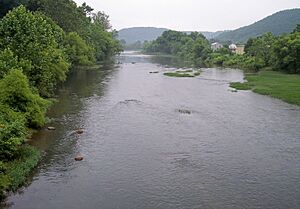
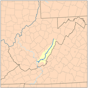
The Greenbrier River is a long and beautiful river in southeastern West Virginia, United States. It flows for about 162 miles (261 km) and is one of the longest rivers in the state. The Greenbrier River eventually joins the New River. Its waters then travel through the Kanawha and Ohio rivers, finally reaching the mighty Mississippi River. This means the Greenbrier River is part of a huge water system, draining an area of about 1,656 square miles (4,290 km²).
Contents
The River's Journey: Where the Greenbrier Flows
The Greenbrier River starts in Pocahontas County at a town called Durbin. It forms when two smaller streams, the East Fork Greenbrier River and the West Fork Greenbrier River, meet. Both of these streams begin high up in the mountains, over 3,300 feet (1,000 meters) high.
From Durbin, the Greenbrier River flows mostly south. It passes through three counties: Pocahontas, Greenbrier, and Summers. Along its way, it flows past several towns. These include Cass, Marlinton, Hillsboro, Ronceverte, Alderson, and Hinton. Finally, at Hinton, the Greenbrier River flows into the New River.
A Look Back: History of the Greenbrier River
The Greenbrier River area has a rich history. For a long time, an important Native American path called the Seneca Trail followed much of the river's course. This trail was also known as the Great Indian Warpath. It helped people travel through the region.
Early Settlers in the Greenbrier Valley
The first permanent European settlers to live west of the Alleghenies arrived in the Greenbrier Valley in 1749. Their names were Jacob Marlin and Stephen Sewell. They built a cabin together in what is now Marlinton. Later, a surveyor named John Lewis found them in 1751. These settlers were among the first to live in the "western waters." This term referred to areas where rivers flowed west towards the Gulf of Mexico, instead of east to the Atlantic Ocean.
Colonel John Stuart: Father of Greenbrier County
Colonel John Stuart (1749–1823) was a key figure in the history of the Greenbrier Valley. He was a commander during the American Revolutionary War. He is often called the "Father of Greenbrier County."
In 1769, when he was 20, Stuart helped explore the Greenbrier Valley. This exploration prepared the land for new settlements. The next year, he built the first mill in what is now Greenbrier County. This mill was located in Frankford. In 1774, he led soldiers from Greenbrier to the Battle of Point Pleasant. He also became the first clerk of Greenbrier County in 1780. He left behind many important historical records.
Fun and Adventure: Uses of the Greenbrier River
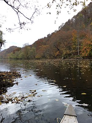
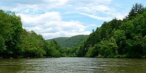
The Greenbrier is special because it's one of the longest "untamed" rivers in the Eastern United States. This means it flows freely without many dams or blockages. Because of this, it's a very popular place for outdoor activities.
Outdoor Activities and Trails
The upper parts of the river flow through the Monongahela National Forest. A famous path called the Greenbrier River Trail runs alongside the river for about 77 miles (124 km). This trail used to be a railroad, but now it's a great place for biking, walking, and running. It connects the towns of Cass and North Caldwell.
Important Waterway and Festivals
The Greenbrier River has always been an important water route. Many towns along its path were built as riverports. The river provides about 30% of the water volume for the New River.
The area around the river has many underground cave systems, called karst systems. These systems are great for trout fishing and cave exploring. Many fun festivals and public events happen along the river throughout the year.
A Nod to History: The Greenbrier River Train Car
To honor the river's role in the state's logging history, the West Virginia State Park, Cass Scenic Railroad in Cass, has a special train car. It's named "The Greenbrier River."
Different Names for the Greenbrier River
Over time, the Greenbrier River has been known by several different names. Here are some of them:
- Green Briar River
- Green Brier River
- Green Bryar River
- Greenbriar River
- O-ne-pa-ke (This is a Lenape word meaning "Dark Path")
- O-ne-pa-ke-cepe (Lenape for "Dark Path Water" or "River")
- Onepake
- Riviere de la Ronceverte (This is French for "River of the Greenbrier")
- We-o-to-we
- We-o-to-we-cepe-we
- Weotowe
Amazing Geology: Caves and Fossils
The Greenbrier River Valley is known for its unique geology, especially its karst landscape. This area has one of the highest numbers of sinkholes in the world. Imagine a green "moonscape" with many collapsed craters! This means the ground can sometimes sink, which makes building things tricky. It's hard to know how big a cave system is just by looking at the surface.
Endangered Karst Ecosystem
The caves and karst areas of the Greenbrier River Valley are very special. In 2001, the Karst Waters Institute listed them among the world's Top Ten Endangered Karst Ecosystems. This means they are important and need protection.
West Virginia's State Fossil: The Giant Ground Sloth
Did you know that the study of ancient animals in America might have started near the Greenbrier River? In Haynes Cave in Monroe County, miners found some bones. They sent these bones to Thomas Jefferson, who later became president. Jefferson identified them as a new animal species. He named it Megalonyx, meaning "Great Claw," because of its eight-inch claws. Later, these bones were identified as belonging to a giant ground sloth. This sloth was later named Megalonyx jeffersonii in honor of Jefferson. The Megalonyx jeffersonii is now the official state fossil of West Virginia.
West Virginia's State Gemstone: Lithostrotionella
The official state gemstone of West Virginia is also found in the Greenbrier River area. It's called the Lithostrotionella. This is a fossilized type of coral. It's found mostly in Pocahontas and Greenbrier counties. It's a type of chalcedony, which is a form of silica.
Wildlife Wonders: Ecology of the Greenbrier River
The Greenbrier River and its surroundings are home to many interesting animals.
Salamanders and Other Amphibians
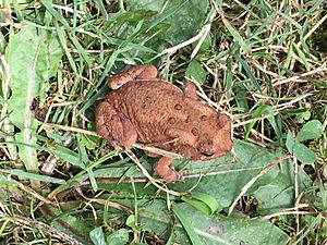
The Greenbrier River is home to one of West Virginia's two unique salamander species, the West Virginia Spring Salamander. The other special salamander, the Cheat Mountain Salamander, lives in the mountains near the river's beginning. The river area also has many other reptiles and amphibians, like frogs and snakes.
Birds and Fish
Many different kinds of birds live here, including the majestic American Bald Eagle. The river is also full of fish! You can find smallmouth bass, rock bass, bluegill, carp, catfish, pike, walleye, and even large muskie.
Protecting the Greenbrier River
Like many rivers, the Greenbrier faces some challenges. It can be affected by pollution from things like logging and floods. Since 2006, it has been on the list of "Impaired Streams" in West Virginia because of bacteria contamination.
Algae is also becoming a problem, especially in warm weather. There's a need to study how much water can be taken from the river for towns to use, especially during dry periods. The West Virginia Department of Environmental Protection and other groups are working hard to protect the river. In 2009, a report showed that the Greenbrier was the most algae-affected river in the state. Steps are being taken to fix this issue.
|
 | Aurelia Browder |
 | Nannie Helen Burroughs |
 | Michelle Alexander |


