Cheat Mountain facts for kids
Quick facts for kids Cheat Mountain |
|
|---|---|

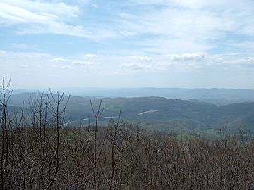
View of US 33 crossing Cheat Mountain (in distance).
|
|
| Highest point | |
| Peak | Thorny Flat (Pocahontas County, WV) |
| Elevation | 4,848 ft (1,478 m) |
| Dimensions | |
| Length | 50 mi (80 km) |
| Geography | |
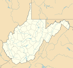
| Location | Cheat Mountain in Randolph County, WV |
| Country | United States |
| Range coordinates | 38°38′28″N 79°54′47″W / 38.64111°N 79.91306°W |
| Topo map | USGS
|
Cheat Mountain is a very tall and rugged mountain ridge. It is located in the Allegheny Mountains in eastern West Virginia, USA. The mountain is about 50 miles (80 km) long from north to south. At its widest, it is more than five miles (8 km) across.
The highest point on Cheat Mountain is Thorny Flat. It is located at the mountain's southern end. Thorny Flat reaches an elevation of 4,848 feet (1,478 m). Several other peaks along the mountain are also over 4,000 feet (1,219 m) tall.
Long ago, Cheat Mountain was home to the largest red spruce forest south of Maine. Today, a large part of the mountain is inside the Monongahela National Forest.
Contents
Where is Cheat Mountain?
Cheat Mountain runs through almost the entire length of central Randolph County, West Virginia. Its northern end is just west of Parsons. The southern end is about 5.5 miles (8.9 km) south of the Randolph/Pocahontas county line. This area is near the community of Stony Bottom.
Most of the mountain is within Randolph County. U.S. Route 219 runs along the western side of Cheat Mountain. This highway connects many towns in the Tygart River Valley. These towns include Montrose, Elkins, and Beverly.
The eastern side of the mountain is more remote. It overlooks the valley of Shavers Fork. The Western Maryland Railroad runs along most of this eastern side. It connects towns like Bowden and Cheat Bridge.
Two major highways cross Cheat Mountain from east to west. U.S. Route 33 crosses in the northern part. U.S. Route 250 crosses in the southern part.
The Cheat River starts near the northern tip of Cheat Mountain. It forms at Parsons where Shavers Fork and Black Fork join together. The Cheat River is a branch of the Monongahela River.
Cheat Mountain's Past
The Civil War on Cheat Mountain
Cheat Mountain was very important during the early part of the American Civil War. A major battle, called the Battle of Cheat Mountain, happened here from September 12–15, 1861.
General Robert E. Lee led his first attack of the Civil War against Union soldiers on Cheat Mountain. The Union troops were led by General Joseph J. Reynolds. The Confederate attacks were not well organized. The Union soldiers defended their position very bravely. This made the Confederate leader think he was fighting a much larger force. In reality, there were only about 300 Union soldiers. Lee eventually called off the attack and pulled his troops back.
Later, in October, Union forces from Cheat Mountain attacked a Confederate camp nearby. They fired artillery and tried to outflank the enemy. But they eventually returned to Cheat Mountain.
The highest Union army camp during the war was at Cheat Summit. It was also known as White Top. This strong fort controlled the Staunton-Parkersburg Turnpike. This road was important for moving supplies and troops. Cheat Summit Fort was used from July 1861 until April 1862. It was abandoned because of very harsh weather and changes in war plans.
You can read more about the Civil War on Cheat Mountain in an article by Ambrose Bierce. It is called "On A Mountain".
Logging on the Mountain
The timber industry in West Virginia grew very fast around the year 1900. In the early 1900s, companies like the West Virginia Pulp and Paper Company cut down many trees on Cheat Mountain. They used a logging operation based in Cass.
By 1905, loggers had reached the mountain's top. By 1960, most of the trees were gone. The mountain looked almost bare. Many books have been written about the logging of Cheat Mountain. One famous book is W. E. Blackhurst's Of Men and A Mighty Mountain (1965). It tells about how hard life was for the lumber workers, many of whom were immigrants.
Cheat Mountain Today: A Tourist Spot
In 1960, Cass Scenic Railroad State Park opened. This park offers train rides for tourists. The train goes up the side of Cheat Mountain to Bald Knob. It uses the same route that the logging trains used in the early 1900s. It is important to know that the Cass Railroad does not go to the very top of Cheat Mountain. Instead, it goes to the top of Back Allegheny Mountain, which is connected to Cheat Mountain.
In 1974, the Snowshoe Mountain ski resort opened. It is located on the southern tip of Cheat Mountain, near Thorny Flat. This resort is a popular place for skiing and other outdoor activities.
 | DeHart Hubbard |
 | Wilma Rudolph |
 | Jesse Owens |
 | Jackie Joyner-Kersee |
 | Major Taylor |


