Bald Knob (West Virginia) facts for kids
Quick facts for kids Bald Knob |
|
|---|---|
 |
|
| Highest point | |
| Elevation | 4,843 ft (1,476 m) |
| Prominence | 902 ft (275 m) |
| Geography | |
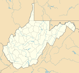
| Location | Pocahontas, West Virginia, United States |
| Parent range | Back Allegheny Mountain |
| Climbing | |
| Access | train via Cass Scenic Railroad |
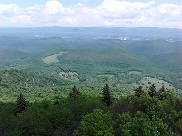
Bald Knob is a tall mountain peak in West Virginia. It's part of the Back Allegheny Mountain range and is located in Pocahontas County. This mountain is also part of the Cass Scenic Railroad State Park. Standing at 4,843 feet (about 1,476 meters) above sea level, Bald Knob is the third-highest point in West Virginia. It's also one of the tallest spots in the whole Allegheny Mountains!
| Top - 0-9 A B C D E F G H I J K L M N O P Q R S T U V W X Y Z |
About Bald Knob Mountain
Bald Knob is only 21 feet (about 6.4 meters) lower than Spruce Knob. Spruce Knob is the very highest point in the Allegheny Mountains. Because it's so high, Bald Knob has a special kind of forest. This forest is called a hemiboreal ecosystem.
Unique Plants and Trees
Lower down the mountain, you'll find trees like oak, hickory, birch, beech, and maple. But near the top, the mountain used to be covered mostly with red spruce trees.
Other trees like Rowan, eastern hemlock, and balsam fir also grow above 4,000 feet (about 1,219 meters). However, these are not as common as the spruce trees.
Forest Recovery
From 1900 to 1960, many trees on Bald Knob were cut down. Red spruce was very valuable, so timber companies came to the area. By 1940, almost all the old red spruce trees were gone. The last big logging happened in 1960.
Today, the red spruce and other high-elevation plants are growing back. It will take many years for the forest to fully recover.
How to Visit Bald Knob
You can reach the top of Bald Knob by hiking. But most people get there by riding the Cass Scenic Railroad. This train uses old logging tracks. It takes visitors to a spot that is 4,730 feet (about 1,442 meters) high. This spot is about a quarter-mile (0.4 km) north of Bald Knob.
Getting There by Road
Most of Back Allegheny Mountain is part of the Monongahela National Forest. But the very top of Bald Knob is inside Cass Scenic Railroad State Park. While many visitors take the train from Cass, you can also get there by Forest Road 267B. This road is closed to cars for most of the year.
You can also hike or bike two miles from Odey Run to reach Bald Knob. For safety, please do not hike along the railroad tracks themselves.
Weather at Bald Knob
Bald Knob usually has mild summers and cold winters. The top of the mountain and its west side get a lot of rain and snow. They receive about 60 inches (1,524 mm) of rain each year. They also get about 180 inches (4,572 mm) of snowfall. The most snow ever recorded in a year was over 300 inches (7,620 mm)!
Extreme Temperatures
Temperatures on Bald Knob can drop very low. They have been known to reach −40 degrees Fahrenheit (−40 °C). Winter weather can happen from early October to early May. Snow has even been seen in the higher parts of the mountain in every month except July.
The last time it freezes is usually in May. The first freeze usually happens in September. However, freezing temperatures can happen at any time of the year.
Interesting Facts About Bald Knob
- Bald Knob is one of only four mountain tops in West Virginia that are taller than 4,800 feet (1,463 meters). The other three are Spruce Knob, Thorny Flat, and an unnamed peak near Snowshoe, WV.
- The south side of Bald Knob is where Leatherbark Run begins. This is West Virginia's highest stream.
- Until 2001, people thought Bald Knob was the second-highest point in West Virginia. But a new survey using GPS technology found that Thorny Flat was a few feet higher. Thorny Flat is about 5 miles (8 km) south of Bald Knob. Since then, another peak on Cheat Mountain might also be a bit higher than Bald Knob.
- Bald Knob is the highest point reached by a standard train track east of the Mississippi River.
 | James Van Der Zee |
 | Alma Thomas |
 | Ellis Wilson |
 | Margaret Taylor-Burroughs |


