Randolph County, West Virginia facts for kids
Quick facts for kids
Randolph County
|
||
|---|---|---|
|
||
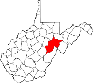
Location of Randolph County in West Virginia
|
||

West Virginia's location within the U.S.
|
||
| Country | ||
| State | ||
| Founded | October 16, 1787 | |
| Named for | Edmund Jennings Randolph | |
| Seat | Elkins | |
| and largest city | ||
| Area | ||
| • Total | 2,700 km2 (1,040 sq mi) | |
| • Land | 2,700 km2 (1,040 sq mi) | |
| • Water | 0.8 km2 (0.3 sq mi) 0.03% | |
| Area rank | 1st | |
| Population
(2020)
|
||
| • Total | 27,932 | |
| • Estimate
(2021)
|
27,806 |
|
| • Rank | 21st | |
| • Density | 10.37/km2 (26.86/sq mi) | |
| Time zone | UTC−5 (Eastern) | |
| • Summer (DST) | UTC−4 (EDT) | |
| Area code(s) | 304, 681 | |
| Congressional district | 2nd | |
| Senate district | 11th | |
| House of Delegates district | 66th, 67th | |
| Website | https://randolphcountycommissionwv.org/ | |
Randolph County is a county located in the state of West Virginia in the United States. It's a place with a rich history and beautiful nature. As of the 2020 census, about 27,932 people live here.
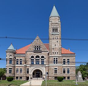
The main town and county seat is Elkins. Randolph County was officially started in 1787. It was named after Edmund Jennings Randolph, who was the Governor of Virginia at that time. This county is also part of the Elkins, West Virginia, Micropolitan Statistical Area.
Contents
History of Randolph County
Early Settlements and Native Americans
The first European people tried to settle in what is now Randolph County around 1752 or 1753. David Tygart, who the Tygart Valley River is named after, and Robert Foyle moved here with their families. Sadly, a group of Native Americans found the Foyle family's cabin and attacked them. One son escaped and warned the Tygart family, who were able to get away safely.
After this event, no other European settlements were tried in this area until 1772. Later, a man named Thomas Skidmore was likely the first European to settle in the area that is now downtown Elkins.
Founding the County
Randolph County was officially created on October 16, 1787. It was formed from a much larger area called Harrison County. At first, Randolph County was part of Virginia, but it is now part of West Virginia.
The county was named after Edmund Randolph, who was the Governor of Virginia. The first county seat was called Randolph Court House, then Edmundton, and by 1790, it was named Beverly. Beverly remained the county seat until 1890, when the county government moved to Elkins.
Randolph County During the Civil War
During the American Civil War, some small battles happened in Randolph County in 1861. These included the Battle of Rich Mountain and part of the Battle of Cheat Mountain. These events were part of a larger series of military actions in western Virginia.
On June 20, 1863, Randolph County became part of the new state of West Virginia. Later that year, the counties were divided into smaller areas called townships to help with local government. These townships were changed into "magisterial districts" in 1872. Randolph County was divided into nine districts, many of which were later renamed.
Geography of Randolph County
Randolph County is the largest county in West Virginia by land area. It covers about 1,040 square miles. Most of this area is land, with only a tiny bit (0.03%) being water.
Rivers and Waterways
Mountains and Natural Features
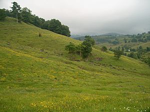
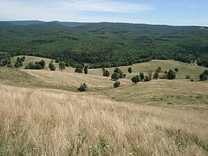
Randolph County is known for its beautiful mountains and natural spots.
- Point Mountain
- Cheat Mountain
- White Top, a peak on Cheat Mountain
- Laurel Mountain
- Rich Mountain
- Shavers Mountain
- Gaudineer Knob, a peak on Shavers Mountain
Caves and Caverns
- Bowden Cave
- Sinks of Gandy
Important Natural Landmarks
These are special places recognized for their unique natural features.
- Blister Run Swamp
- Gaudineer Scenic Area
- Shavers Mountain Spruce-Hemlock Stand
Major Roads and Highways
Getting around Randolph County is made easier by several important roads:
Neighboring Counties
Randolph County shares borders with these other counties:
- Tucker County (to the northeast)
- Pendleton County (to the east)
- Pocahontas County (to the south)
- Webster County (to the southwest)
- Upshur County (to the west)
- Barbour County (to the northwest)
Protected Natural Areas
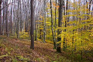
Part of the Monongahela National Forest is located in Randolph County. This is a large protected area with forests and wildlife. Also, a portion of the United States National Radio Quiet Zone is here. This zone helps keep radio signals clear for important scientific research.
Population and People
| Historical population | |||
|---|---|---|---|
| Census | Pop. | %± | |
| 1790 | 951 | — | |
| 1800 | 1,826 | 92.0% | |
| 1810 | 2,854 | 56.3% | |
| 1820 | 3,357 | 17.6% | |
| 1830 | 5,000 | 48.9% | |
| 1840 | 6,208 | 24.2% | |
| 1850 | 5,243 | −15.5% | |
| 1860 | 4,990 | −4.8% | |
| 1870 | 5,563 | 11.5% | |
| 1880 | 8,102 | 45.6% | |
| 1890 | 11,633 | 43.6% | |
| 1900 | 17,670 | 51.9% | |
| 1910 | 26,028 | 47.3% | |
| 1920 | 26,084 | 0.2% | |
| 1930 | 25,049 | −4.0% | |
| 1940 | 30,259 | 20.8% | |
| 1950 | 30,558 | 1.0% | |
| 1960 | 26,349 | −13.8% | |
| 1970 | 24,596 | −6.7% | |
| 1980 | 28,734 | 16.8% | |
| 1990 | 27,803 | −3.2% | |
| 2000 | 28,262 | 1.7% | |
| 2010 | 29,405 | 4.0% | |
| 2020 | 27,932 | −5.0% | |
| 2021 (est.) | 27,806 | −5.4% | |
| U.S. Decennial Census 1790–1960 1900–1990 1990–2000 2010–2020 |
|||
2020 Census Information
In 2020, Randolph County had 27,932 people living in 10,065 households. Most people (93.6%) were White. About 1.6% were African American, and other groups made up smaller percentages. About 1.1% of the population was Hispanic or Latino.
The average age in the county was 44.7 years. About 19% of the people were under 18 years old. The average income for a household was $47,343. About 15.2% of the population lived below the poverty line.
2010 Census Information
In 2010, there were 29,405 people living in Randolph County. The population density was about 28.3 people per square mile. Most people (97.3%) were White. Other groups included Black or African American (1.2%), Asian (0.3%), and American Indian (0.2%). About 0.7% of the population was Hispanic or Latino.
The average age was 43.4 years. About 27.1% of households had children under 18 living with them. The average income for a household was $36,176. About 17.1% of the population lived below the poverty line.
Communities in Randolph County
Randolph County has several towns and communities.
Cities
- Elkins (This is the county seat, where the main government offices are.)
Towns
Magisterial Districts
These are local government areas within the county.
- Beverly
- Dry Fork
- Huttonsville
- Leadsville
- Middle Fork
- Mingo
- New Interest
- Roaring Creek
- Valley Bend
Census-Designated Places (CDPs)
These are areas that are like towns but are not officially incorporated.
Unincorporated Communities
These are smaller communities that are not officially part of a city or town.
- Adolph
- Aggregates
- Alpena
- Arnold Hill
- Bemis
- Brady Gate
- Bruxton
- Canfield
- Cassity
- Crystal Springs
- Czar
- Dryfork
- Elkins Junction
- Elkwater
- Ellamore
- Evenwood
- Faulkner
- Glady
- Horton
- Jimtown
- Kerens
- Little Italy
- Mabie
- Mingo
- Monterville
- Newlonton
- Norton
- Osceola
- Pumpkintown
- Read
- Spangler
- Sullivan
- Tigheville
- Upper Mingo
- Weaver
- Whyte
Notable People from Randolph County
Many interesting people have come from Randolph County:
- Herman Ball, a football player.
- Lemuel Chenoweth, a skilled builder of covered bridges.
- William Wallace Barron, a former governor.
- Dellos Clinton "Sheriff" Gainer, a major league baseball player.
- Marshall Goldberg, another football player.
- Wilma Lee Cooper, a famous country music singer from the Grand Ole Opry.
- Stoney Cooper, also a country music star from the Grand Ole Opry.
- Eldora Marie Bolyard Nuzum, an American newspaper editor.
See also
 In Spanish: Condado de Randolph (Virginia Occidental) para niños
 | James Van Der Zee |
 | Alma Thomas |
 | Ellis Wilson |
 | Margaret Taylor-Burroughs |


