Laurel Fork (Cheat River tributary) facts for kids
Quick facts for kids Laurel Fork |
|
|---|---|

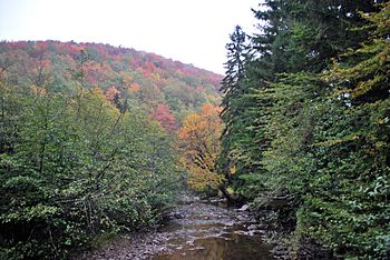
Laurel Fork at Laurel Fork Recreation Area
|
|
| Country | United States |
| State | West Virginia |
| County | Randolph |
| Physical characteristics | |
| Main source | 38°39′55″N 79°40′52″W / 38.66528°N 79.68111°W |
| River mouth | Dry Fork Randolph County, northwest of Harman 2,047 ft (624 m) 38°58′57″N 79°32′43″W / 38.98250°N 79.54528°W |
| Length | 38 mi (61 km) |
| Basin features | |
| Basin size | 60 sq mi (160 km2) |
The Laurel Fork is a river in eastern West Virginia, USA. It is about 38 miles (61 kilometers) long. This river flows into the Dry Fork. From there, its waters travel through several other rivers, including the Black Fork, Cheat, Monongahela, and Ohio rivers. Eventually, its water joins the mighty Mississippi River!
The Laurel Fork helps drain an area of about 60 square miles (155 square kilometers) in the Allegheny Mountains. It is also considered one of the five main rivers that feed into the Cheat River. The others are the Dry Fork, Glady Fork, Shavers Fork, and Blackwater River.
Where the Laurel Fork Flows
The Laurel Fork river flows entirely within Randolph County. It starts near the border of Randolph and Pocahontas counties. This area is a "divide," meaning it separates the water that flows into the Cheat River from water that flows into the Greenbrier.
The river then winds its way north-northeast. It flows between two mountains, Middle Mountain and Rich Mountain. Much of its journey takes it through the beautiful Monongahela National Forest. The Laurel Fork finally meets the Dry Fork river just south of the Tucker County border. This meeting point is about four miles (6 kilometers) northwest of the town of Harman.
Exciting Rapids
The last seven miles (11 kilometers) of the Laurel Fork are especially exciting! This part of the river has continuous "Class 3" rapids. In the world of whitewater rafting, Class 3 rapids are considered moderate. They have waves that are irregular and can be quite strong. There might also be narrow passages that require careful steering. This makes the lower part of the river a fun challenge for experienced paddlers.
Wilderness and Forests
Along the Laurel Fork, you'll find two special areas called the Laurel Fork North Wilderness and Laurel Fork South Wilderness. These are part of the Monongahela National Forest. They are separated only by a road.
These wilderness areas were once heavily logged. A company called the Laurel River Lumber Company cut down all the old, tall trees by 1921. They even built a railroad along the river to help move the timber. Today, the forest has grown back. The West Virginia Department of Environmental Protection says that almost 87% of the land around the Laurel Fork is covered in trees. Most of these are deciduous trees, which means they lose their leaves in the fall.
 | Emma Amos |
 | Edward Mitchell Bannister |
 | Larry D. Alexander |
 | Ernie Barnes |

