Gaudineer Knob facts for kids
Quick facts for kids Gaudineer Knob |
|
|---|---|

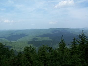
View from Gaudineer Knob
|
|
| Highest point | |
| Elevation | 4,449 ft (1,356 m) |
| Prominence | 720 ft (220 m) |
| Geography | |
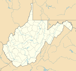
| Location | Pocahontas, West Virginia, United States |
| Parent range | Shavers Mountain |
| Climbing | |
| Access | drive-up via |
Gaudineer Knob is a mountain peak in eastern West Virginia, USA. It sits right on the border between Randolph and Pocahontas County. This knob is the highest point of Shavers Mountain, which is a long ridge in the Allegheny Mountains. It reaches a height of 4,449 feet (1,356 meters) above sea level. You can find it about 1.7 miles east of Cheat Bridge.
History of Gaudineer Knob
For a long time, Gaudineer Knob was a tall, unnamed peak in a huge, wild area. In the late 1930s, it was given its name to honor Donald Gaudineer. He was one of the first forest rangers for the U.S. Forest Service (USFS) in the Monongahela National Forest.
Donald Gaudineer started his career as a young forester in the southern part of the newly created Monongahela National Forest. His office was in a place called Thornwood. As a ranger, he worked on many important projects. He helped plant new trees, built roads to protect against wildfires, and put up fire towers in his area. He also managed the forest in other ways.
Later, in the mid-1930s, Gaudineer moved to the Cheat Ranger District. Sadly, on April 27, 1936, he passed away while trying to save his children from a house fire. To remember his dedication, the U.S. Forest Service decided to name this beautiful peak after him. It was a fitting tribute to a ranger who cared deeply for the forests.
The Old Fire Tower
From 1936 through the 1970s, a fire tower stood on top of Gaudineer Knob. This tower was called the Gaudineer Knob Lookout Tower. Rangers used it to watch over the vast forest and spot wildfires quickly. Today, only the concrete parts that held the tower up are left.
Gaudineer Scenic Area
Just north of Gaudineer Knob, you'll find the Gaudineer Scenic Area. This special place covers about 140 acres and is located around 4,000 feet high. It was created in 1964 and was recognized as a National Natural Landmark in 1974.
What makes this area so unique is a 50-acre section of virgin red spruce trees. These trees are very old and have never been cut down by loggers. While most of the surrounding land was clear-cut (meaning all trees were removed) in the early 1900s, this particular part of the forest was saved. It's like a living museum of what the forest looked like long ago.
 | James Van Der Zee |
 | Alma Thomas |
 | Ellis Wilson |
 | Margaret Taylor-Burroughs |


