Augusta County, Virginia facts for kids
Quick facts for kids
Augusta County
|
|||
|---|---|---|---|
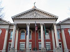
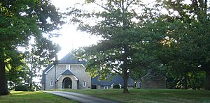
The Augusta County Courthouse in March 2005
|
|||
|
|||
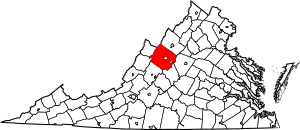
Location within the U.S. state of Virginia
|
|||
 Virginia's location within the U.S. |
|||
| Country | |||
| State | |||
| Founded | 1738 | ||
| Named for | Princess Augusta of Saxe-Gotha | ||
| Seat | Staunton | ||
| Largest community | Staunton | ||
| Area | |||
| • Total | 971 sq mi (2,510 km2) | ||
| • Land | 967 sq mi (2,500 km2) | ||
| • Water | 3.9 sq mi (10 km2) 0.4% | ||
| Population
(2020)
|
|||
| • Total | 77,487 | ||
| • Density | 79.80/sq mi (30.811/km2) | ||
| Time zone | UTC−5 (Eastern) | ||
| • Summer (DST) | UTC−4 (EDT) | ||
| Congressional district | 6th | ||
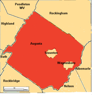
Augusta County is a county located in the Shenandoah Valley of Virginia, in the United States. It's the second-largest county in Virginia by total area. It completely surrounds the cities of Staunton and Waynesboro, which are independent cities (meaning they are not part of the county).
The county's main office is in Verona, even though its official county seat (the place where the county government is) is Staunton.
Augusta County was created in 1738 from a part of Orange County. It was named after Princess Augusta of Saxe-Gotha, who was the mother of the future King George III of the United Kingdom. When it was first formed, it was a huge area. Over time, many parts of it were used to create other counties and even parts of other states. Its current borders were set in 1790.
In 2020, about 77,487 people lived in Augusta County. The county, along with Staunton and Waynesboro, forms a larger metropolitan area.
Contents
History
Augusta County was officially formed in 1738. However, because not many people lived there at first, the county government didn't start working until 1745. It was named after Augusta of Saxe-Gotha, who was a princess and the mother of King George III.
When it was first created, Augusta County was enormous. It included most of what is now West Virginia and all of Kentucky. It even theoretically stretched all the way to the Pacific Ocean!
The county started to shrink in 1770 when its southern part became Botetourt County. More changes happened in the 1770s and 1780s, as new counties and even a new territory (Illinois County) were formed from its vast lands. By 1790, Augusta County had reached its current size.
During the American Civil War, Augusta County was very important for farming. It was known as the "Breadbasket of the Confederacy" because it produced so much food. The Virginia Central Railroad ran through the county, connecting the Shenandoah Valley to Richmond, the capital of the Confederacy.
A major battle, the Battle of Piedmont, took place here on June 5, 1864. The Union Army won, which allowed them to take over Staunton and destroy things that helped the Confederate war effort. Later, during General Philip H. Sheridan's "Burning," many farms were destroyed, and most farm animals were killed.
Staunton, which had been the county seat for many years, became an independent city in 1902. This meant it was no longer part of Augusta County, but it still remained the county seat.
Geography
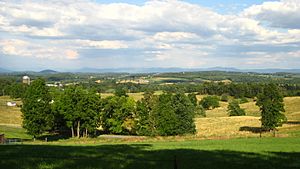
Augusta County covers a total area of about 971 square miles. Most of this (967 square miles) is land, and a small part (3.9 square miles) is water. It is the third-largest county in Virginia by land area.
Neighboring Areas
Augusta County is surrounded by several other counties and independent cities:
- Staunton (completely surrounded by Augusta County)
- Waynesboro (completely surrounded by Augusta County)
- Pendleton County, West Virginia (North)
- Rockingham County (Northeast)
- Albemarle County (East)
- Nelson County (Southeast)
- Rockbridge County (Southwest)
- Bath County (West)
- Highland County (Northwest)
County Districts
The county is divided into seven areas called magisterial districts:
- Beverley Manor
- Middle River
- North River
- Pastures
- Riverheads
- South River
- Wayne
Schools and Parks
- The county's public schools are managed by Augusta County Public Schools.
- Parts of several national protected areas are located here:
- Blue Ridge Parkway
- George Washington National Forest
- Shenandoah National Park
- A regional park called Natural Chimneys is also in the county.
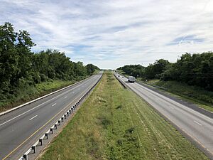
Major Roads
Important highways that run through Augusta County include:
Demographics
| Historical population | |||
|---|---|---|---|
| Census | Pop. | %± | |
| 1790 | 10,886 | — | |
| 1800 | 11,712 | 7.6% | |
| 1810 | 14,308 | 22.2% | |
| 1820 | 16,742 | 17.0% | |
| 1830 | 19,926 | 19.0% | |
| 1840 | 19,628 | −1.5% | |
| 1850 | 24,610 | 25.4% | |
| 1860 | 27,749 | 12.8% | |
| 1870 | 28,763 | 3.7% | |
| 1880 | 35,710 | 24.2% | |
| 1890 | 37,005 | 3.6% | |
| 1900 | 32,370 | −12.5% | |
| 1910 | 32,445 | 0.2% | |
| 1920 | 34,671 | 6.9% | |
| 1930 | 38,163 | 10.1% | |
| 1940 | 42,772 | 12.1% | |
| 1950 | 34,154 | −20.1% | |
| 1960 | 37,363 | 9.4% | |
| 1970 | 44,220 | 18.4% | |
| 1980 | 53,732 | 21.5% | |
| 1990 | 54,677 | 1.8% | |
| 2000 | 65,615 | 20.0% | |
| 2010 | 73,750 | 12.4% | |
| 2020 | 77,487 | 5.1% | |
| U.S. Decennial Census 1790-1960 1900-1990 1990-2000 2010 2020 |
|||
Population in 2020
The 2020 census showed that Augusta County had a population of 77,487 people. The table below shows the different racial and ethnic groups living in the county.
| Race / Ethnicity (NH = Non-Hispanic) | Pop 2010 | Pop 2020 | % 2010 | % 2020 |
|---|---|---|---|---|
| White alone (NH) | 68,011 | 68,375 | 92.22% | 88.24% |
| Black or African American alone (NH) | 2,881 | 3,072 | 3.91% | 3.96% |
| Native American or Alaska Native alone (NH) | 141 | 130 | 0.19% | 0.17% |
| Asian alone (NH) | 365 | 461 | 0.49% | 0.59% |
| Pacific Islander alone (NH) | 13 | 27 | 0.02% | 0.03% |
| Some Other Race alone (NH) | 40 | 198 | 0.05% | 0.26% |
| Mixed Race or Multi-Racial (NH) | 774 | 2,496 | 1.05% | 3.22% |
| Hispanic or Latino (any race) | 1,525 | 2,728 | 2.07% | 3.52% |
| Total | 73,750 | 77,487 | 100.00% | 100.00% |
Towns and Communities
Here are the populations of the towns and some of the larger communities in Augusta County, based on the 2010 U.S. Census:
| # | Town | Population |
|---|---|---|
| 1 | Grottoes | 2,668 |
| 2 | Craigsville | 923 |
Most of the town of Grottoes is actually in Rockingham County. Only a small number of its residents live in Augusta County.
| # | Unincorporated Community | Population |
|---|---|---|
| 1 | Stuarts Draft | 9,235 |
| 2 | Fishersville | 7,462 |
| 3 | Verona | 4,239 |
| 4 | Weyers Cave | 2,473 |
| 5 | Crimora | 2,209 |
| 6 | Lyndhurst | 1,490 |
| 7 | Dooms | 1,327 |
| 8 | Swoope | 1,323 |
| 9 | Jolivue | 1,129 |
| 10 | Greenville | 832 |
| 11 | Fort Defiance | 780 |
| 12 | Sherando | 688 |
| 13 | Mount Sidney | 663 |
| 14 | Churchville | 194 |
Economy
The economy of Augusta County is supported by various businesses and organizations. Here are some of the top employers in the county as of 2023:
| # | Employer | # of Employees |
|---|---|---|
| 1 | Augusta County Public Schools | 1,000+ |
| 2 | Augusta Medical Center | 1,000+ |
| 3 | Hershey | 1,000+ |
| 4 | Target | 500-999 |
| 5 | McKee Foods | 1,000+ |
| 6 | AAF-McQuay | 500-999 |
| 7 | Hollister Co. | 500-999 |
| 8 | County of Augusta | 500-999 |
| 9 | NIBCO of Virginia | 250-499 |
| 10 | University Instructors Inc | 250-499 |
Communities
As mentioned, the independent cities of Staunton and Waynesboro are within Augusta County's borders but are not part of the county itself. Staunton is still the county seat, but most county offices are in Verona.
Towns
- Craigsville
- Grottoes (partial)
Census-designated places
These are areas that are identified for census purposes but are not officially incorporated towns.
Other communities
These are other smaller, unincorporated communities in Augusta County.
Notable people
Augusta County has been home to several important figures throughout history:
- George Caleb Bingham (1811–1879): A famous painter.
- John Colter (c.1774–1812): Born near Stuarts Draft, he was part of the Lewis and Clark Expedition. He was one of the first Europeans to explore the areas now known as Yellowstone National Park and the Grand Tetons.
- Ida Stover Eisenhower (1862–1946): The mother of President Dwight D. Eisenhower, she was born in Mount Sidney.
- John D. Imboden (1823–1895): A general in the Confederate Army during the Civil War.
- John Lewis (1678–1762): He helped open up Augusta County for settlement.
- Joel F. Salatin (b. 1957): The founder of Polyface Farm in Swoope, Virginia, known for its sustainable farming practices.
- Kate Smith (1907–1986): Born in Greenville, she was a famous American singer known for her powerful voice and for popularizing "God Bless America."
- Thomas Woodrow Wilson (1856–1924): The 28th President of the United States of America. He also served as the Governor of New Jersey and President of Princeton University.
See also
 In Spanish: Condado de Augusta para niños
 | Jewel Prestage |
 | Ella Baker |
 | Fannie Lou Hamer |


