Sherando, Virginia facts for kids
Quick facts for kids
Sherando, Virginia
|
|
|---|---|

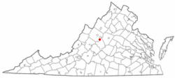
Location of Sherando, Virginia
|
|
| Country | United States |
| State | Virginia |
| County | Augusta |
| Area | |
| • Total | 7.0 sq mi (18.2 km2) |
| • Land | 7.0 sq mi (18.2 km2) |
| • Water | 0.0 sq mi (0.0 km2) |
| Elevation | 1,470 ft (448 m) |
| Population
(2010)
|
|
| • Total | 688 |
| • Density | 98.3/sq mi (37.80/km2) |
| Time zone | UTC−5 (Eastern (EST)) |
| • Summer (DST) | UTC−4 (EDT) |
| ZIP code |
22952
|
| Area code(s) | 540 |
| FIPS code | 51-71904 |
| GNIS feature ID | 1500091 |
Sherando is a small community in Augusta County, Virginia, in the United States. It is known as a census-designated place (CDP). This means it is an area that looks like a town but does not have its own local government.
In 2010, about 688 people lived in Sherando. It is part of a larger area that includes the cities of Staunton and Waynesboro.
Sherando's Past
An important historical site in Sherando is the Mt. Torry Furnace. This old furnace was added to the National Register of Historic Places in 1974. This means it is a special place that helps us remember history.
Where is Sherando Located?
Sherando is found in Virginia at these coordinates: 37.990334 degrees North and -78.950983 degrees West.
The area of Sherando is about 7.1 square miles (18.3 square kilometers). Most of this area is land, with only a very small part being water.
Who Lives in Sherando?
Based on information from the year 2000, there were 665 people living in Sherando. These people lived in 270 different homes.
About 33% of the homes had children under 18 years old living there. The average home had about 2 to 3 people.
The people living in Sherando were of different ages. About 23% were under 18 years old. About 11% were 65 years old or older. The average age of people in Sherando was 38 years.
See also
In Spanish: Sherando (Virginia) para niños
 | Selma Burke |
 | Pauline Powell Burns |
 | Frederick J. Brown |
 | Robert Blackburn |

