Dooms, Virginia facts for kids
Quick facts for kids
Dooms, Virginia
|
|
|---|---|

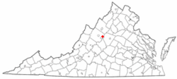
Location of Dooms, Virginia
|
|
| Country | United States |
| State | Virginia |
| County | Augusta |
| Area | |
| • Total | 4.0 sq mi (10.3 km2) |
| • Land | 4.0 sq mi (10.3 km2) |
| • Water | 0.0 sq mi (0.0 km2) |
| Elevation | 1,263 ft (385 m) |
| Population
(2020)
|
|
| • Total | 1,279 |
| • Density | 320/sq mi (124.2/km2) |
| Time zone | UTC−5 (Eastern (EST)) |
| • Summer (DST) | UTC−4 (EDT) |
| FIPS code | 51-22976 |
| GNIS feature ID | 1499350 |
Dooms is a small community in Augusta County, Virginia, United States. It is known as a census-designated place (CDP). This means it is an area identified by the United States Census Bureau for gathering population data.
In 2010, about 1,327 people lived in Dooms. It is part of a larger area that includes the cities of Staunton and Waynesboro.
Where is Dooms Located?
Dooms is found in the state of Virginia. You can find its exact spot using coordinates: 38°6′8″N 78°51′13″W / 38.10222°N 78.85361°W.
The area of Dooms is about 4.0 square miles (10.3 square kilometers). All of this area is land.
Who Lives in Dooms?
The number of people living in Dooms changes over time.
| Historical population | |||
|---|---|---|---|
| Census | Pop. | %± | |
| 2000 | 1,282 | — | |
| 2010 | 1,327 | 3.5% | |
| 2020 | 1,279 | −3.6% | |
| U.S. Decennial Census 2010 2020 |
|||
In 2000, there were 1,282 people living here. They lived in 522 different homes. Most people were White. A small number were African American or Asian. Some people were from two or more races.
About one-fourth of the homes had children under 18 living there. Most homes were made up of married couples. Some homes had a single female parent.
The people in Dooms were of different ages. About 21% were under 18 years old. The average age was 42 years old.
See also
 In Spanish: Dooms (Virginia) para niños
 | Jackie Robinson |
 | Jack Johnson |
 | Althea Gibson |
 | Arthur Ashe |
 | Muhammad Ali |

