Albemarle County, Virginia facts for kids
Quick facts for kids
Albemarle County
|
|||
|---|---|---|---|
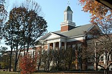
The Albemarle County Office Building
|
|||
|
|||
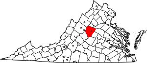
Location within the U.S. state of Virginia
|
|||
 Virginia's location within the U.S. |
|||
| Country | |||
| State | |||
| Founded | 1744 | ||
| Named for | Willem Anne van Keppel, 2nd Earl of Albemarle | ||
| Seat | Charlottesville | ||
| Largest town | Scottsville | ||
| Area | |||
| • Total | 726 sq mi (1,880 km2) | ||
| • Land | 721 sq mi (1,870 km2) | ||
| • Water | 5 sq mi (10 km2) 0.7% | ||
| Population
(2020)
|
|||
| • Total | 112,395 | ||
| • Density | 155/sq mi (60/km2) | ||
| Time zone | UTC−5 (Eastern) | ||
| • Summer (DST) | UTC−4 (EDT) | ||
| Congressional districts | 5th, 7th | ||
Albemarle County is a county in the Piedmont region of Virginia. It is known for its beautiful landscapes and rich history.
The county seat, or main government town, is Charlottesville. Charlottesville is a special "independent city." This means it is a separate city that is completely surrounded by Albemarle County.
Albemarle County is part of the larger Charlottesville Metropolitan Statistical Area. In 2020, about 112,395 people lived here.
Albemarle County was created in 1744. It was formed from the western part of Goochland County. The county was named after Willem Anne van Keppel, 2nd Earl of Albemarle. He was the Governor of Virginia at that time.
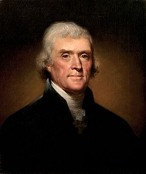
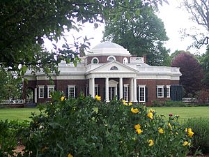
One of its most famous residents was Thomas Jefferson. He was a Founding Father and the third U.S. President. His famous home, Monticello, is located in the county.
Contents
History
When Europeans first arrived, the area that became Albemarle County was home to the Saponi tribe. They were a Native American group who spoke a Siouan language.
In 1744, the Virginia General Assembly officially created Albemarle County. It was made from the western part of Goochland County. The county was named to honor Willem Anne van Keppel, 2nd Earl of Albemarle. He was the Earl of Albemarle and the governor of Virginia.
The county was very large at first. In 1761, parts of it were used to create Buckingham and Amherst counties. Because of this, the county seat moved from Scottsville to a new, more central spot. This new spot was named Charlottesville.
In 1777, Albemarle County was divided again. This time, Fluvanna County was created. This set the final borders for Albemarle County as we know it today.
Albemarle County is famous for its connection to President Thomas Jefferson. He was born nearby in Shadwell. At that time, Shadwell was part of Goochland County. His main home, Monticello, is in Albemarle County. When the American Revolutionary War began in 1775, Jefferson became a colonel in the Albemarle Militia.
During the American Civil War, a small fight called the Battle of Rio Hill happened here. Union soldiers raided a Confederate camp in the county.
Before the Civil War, many people in Albemarle County were enslaved African Americans.
Geography
Albemarle County covers about 726 square miles. Most of this area, 721 square miles, is land. The remaining 5 square miles, or 0.7%, is water.
Waterways
The South Fork of the Rivanna River starts in Albemarle County. This river was very important for transportation in the past. You can find boat access at Darden Towe Park. The James River forms a natural border between Albemarle and Buckingham Counties.
Major Highways
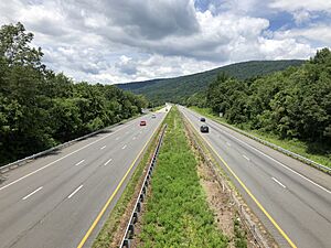
Important roads that run through Albemarle County include:
 I-64
I-64 US 29
US 29 US 250
 SR 6
SR 6 SR 20
SR 20 SR 22
SR 22 SR 53
SR 53 SR 240
Protected Areas
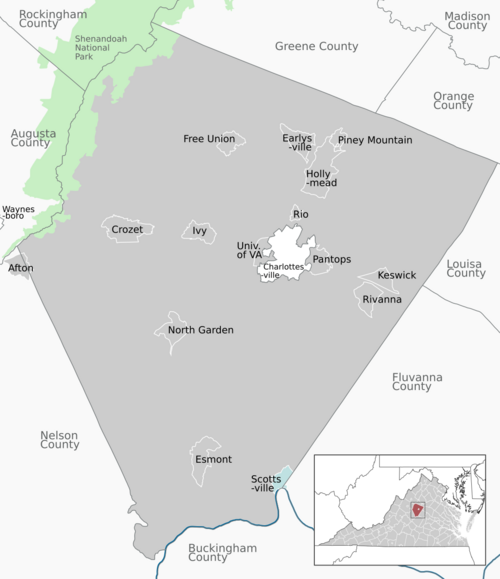
Part of the Shenandoah National Park is along Albemarle's western border. This park is a large area of protected nature.
Neighboring Counties
Albemarle County shares borders with more counties than any other county in Virginia. It borders 8 other counties:
- Charlottesville, Virginia (This city is surrounded by Albemarle County)
- Greene County, Virginia (to the north)
- Orange County, Virginia (to the northeast)
- Louisa County, Virginia (to the east)
- Fluvanna County, Virginia (to the southeast)
- Buckingham County, Virginia (to the south)
- Nelson County, Virginia (to the southwest)
- Augusta County, Virginia (to the west)
- Rockingham County, Virginia (to the northwest)
Parks and Recreation
Albemarle County has many parks and places for outdoor activities. Some of these include:
- Beaver Creek Lake
- Biscuit Run Park
- Chris Greene Lake Park
- Darden Towe Park
- Ivy Creek Natural Area
- Mint Springs Valley Park
- Preddy Creek Park
- Walnut Creek Park
Demographics
| Historical population | |||
|---|---|---|---|
| Census | Pop. | %± | |
| 1790 | 12,585 | — | |
| 1800 | 16,439 | 30.6% | |
| 1810 | 18,268 | 11.1% | |
| 1820 | 19,750 | 8.1% | |
| 1830 | 22,618 | 14.5% | |
| 1840 | 22,294 | −1.4% | |
| 1850 | 25,800 | 15.7% | |
| 1860 | 26,625 | 3.2% | |
| 1870 | 27,544 | 3.5% | |
| 1880 | 32,618 | 18.4% | |
| 1890 | 32,379 | −0.7% | |
| 1900 | 28,473 | −12.1% | |
| 1910 | 29,871 | 4.9% | |
| 1920 | 26,005 | −12.9% | |
| 1930 | 26,981 | 3.8% | |
| 1940 | 24,652 | −8.6% | |
| 1950 | 26,662 | 8.2% | |
| 1960 | 30,969 | 16.2% | |
| 1970 | 37,780 | 22.0% | |
| 1980 | 55,783 | 47.7% | |
| 1990 | 68,040 | 22.0% | |
| 2000 | 79,236 | 16.5% | |
| 2010 | 98,970 | 24.9% | |
| 2020 | 112,395 | 13.6% | |
| U.S. Decennial Census 1790–1960 1900–1990 1990–2000 2010 2020 |
|||
The population of Albemarle County has grown a lot over the years. In 2020, the population was 112,395 people.
The county is home to a diverse group of people. In 2020, about 71.5% of the population was White. About 8.7% were Black or African American. Asian people made up about 7.3% of the population. People of Hispanic or Latino background made up about 7.5%.
The median age in the county was about 38.2 years old. This means half the people were older than 38.2 and half were younger. About 21.5% of the population was under 18 years old.
Many adults in Albemarle County have advanced degrees. About 22% have a graduate or professional degree. This is higher than the national average.
Economy
Many people work in Albemarle County. About 35% of people who work in the county also live there. The other 65% travel in from other areas.
In 2022, the unemployment rate in Albemarle County was 2.7%. This was lower than the national average of 3.6%.
The top 10 employers in the county in late 2022 were:
- University of Virginia
- Sentara Healthcare
- U.S. Department of Defense
- County of Albemarle
- Crutchfield Corporation
- Walmart
- Piedmont Virginia Community College
- Northrop Grumman Corporation
- Boar's Head Inn
- Atlantic Coast Athletic Club
Education
The Albemarle County Public School System manages public education in the county. It serves nearly 14,000 students from preschool through high school. Their goal is to create a community of learners.
The school system has 25 school buildings. These include Community Lab School, Albemarle High School, Western Albemarle High School, and Monticello High School.
Many private schools also serve students in Albemarle County and nearby areas. Some of these are:
- The Covenant School
- Field School of Charlottesville
- Free Union Country School
- The Miller School of Albemarle
- Montessori Community School
- North Branch School
- Peabody School
- Charlottesville Catholic School
- St. Anne's-Belfield School
- Tandem Friends School
The Jefferson-Madison Regional Library system provides library services to the people of Albemarle County.
Communities
The city of Charlottesville is completely surrounded by Albemarle County. In Virginia, cities are legally separate from counties. This means Charlottesville is an independent city.
Here are some of the communities in Albemarle County, with their populations from the 2020 census:
Towns
- Scottsville (524) - This was the original county seat. Part of it is also in Fluvanna County.
Census-Designated Places (CDPs)
These are areas that are like towns but are not officially incorporated as cities or towns.
- Afton (313)
- Crozet (9,224)
- Earlysville (1,153)
- Esmont (491)
- Free Union (187)
- Hollymead (8,601)
- Ivy (917)
- Keswick (321)
- North Garden (461)
- Pantops (4,682)
- Piney Mountain (1,880)
- Rio (2,076)
- Rivanna (2,174)
- University of Virginia (7,704)
Unincorporated Communities
These are smaller communities that are not officially towns or cities. Many of them use Charlottesville addresses.
- Advance Mills
- Alberene
- Arrowhead
- Barracks
- Batesville
- Bellair
- Bentivar
- Blenheim
- Boonesville
- Brownsville
- Burnley
- Cismont
- Cobham
- Covesville
- Earlysville Heights
- Farmington
- Free Union
- Greenwood
- Hatton
- Howardsville
- Hydraulic
- Keene
- Key West
- Lindsay
- Millington
- Milton
- Montvue
- Mountfair
- Nortonsville
- Porters
- Proffit
- Redland
- Rio Heights
- Rivanna (north county)
- Shadwell
- Simeon
- Stony Point
- Warren
- White Hall
- Yancey Mills
Notable People
Many famous people have lived in or were born in Albemarle County:
- Chilton Allan (1786–1858), a U.S. Congressman from Kentucky.
- Dabney Smith Carr (1802–1854), founder of a newspaper and U.S. minister to Turkey.
- George Rogers Clark (1752–1818), a Revolutionary War hero and explorer.
- Edward Coles (1786–1868), a Governor of Illinois.
- Rita Dove (1952- ), a former U.S. Poet Laureate and Pulitzer Prize winner.
- John Grisham, a famous author.
- Thomas Jefferson, the third President of the United States.
- Jack Jouett (1754–1822), known as the "Paul Revere of the South."
- Meriwether Lewis (1774–1809), a famous explorer who led the Lewis and Clark Expedition.
- Howie Long, a former NFL football player.
- Dave Matthews of the Dave Matthews Band.
- James Monroe, the fifth President of the United States.
- Lottie Moon (1840–1912), a Southern Baptist missionary.
- Sissy Spacek, a well-known actress.
See Also
 In Spanish: Condado de Albemarle (Virginia) para niños
 | Kyle Baker |
 | Joseph Yoakum |
 | Laura Wheeler Waring |
 | Henry Ossawa Tanner |


