Scottsville, Virginia facts for kids
Quick facts for kids
Scottsville, Virginia
|
||
|---|---|---|
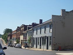
Valley Street, Scottsville, Virginia
|
||
|
||
| Country | United States | |
| State | Virginia | |
| Counties | Albemarle, Fluvanna | |
| Area | ||
| • Total | 1.54 sq mi (3.98 km2) | |
| • Land | 1.52 sq mi (3.94 km2) | |
| • Water | 0.01 sq mi (0.04 km2) | |
| Elevation | 279 ft (85 m) | |
| Population
(2020)
|
||
| • Total | 522 | |
| Time zone | UTC-5 (Eastern (EST)) | |
| • Summer (DST) | UTC-4 (EDT) | |
| ZIP code |
24590
|
|
| Area code(s) | 434 | |
| FIPS code | 51-70800 | |
| GNIS feature ID | 1500041 | |
| Website | scottsville.org | |
Scottsville is a small town located in Albemarle and Fluvanna counties in the state of Virginia, United States. In 2020, about 522 people lived there. It is part of the larger Charlottesville area.
Contents
History of Scottsville
Scottsville has a long and interesting history. You can find many old records and pictures at the Scottsville Museum's online archives.
How Scottsville Became Important
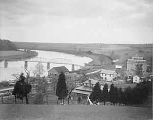
In the 1700s, Scottsville was a very important place in western Virginia. Rivers were the main way people traveled and moved goods back then. Scottsville became a busy center for government and trade.
Later, people tried to make the James River easier to travel on. They built a canal, which is a human-made waterway, next to the river. This canal was called the James River and Kanawha Canal. Scottsville was the biggest port town along this canal.
The goal was to connect the Atlantic Ocean to the Ohio River. However, the American Civil War stopped the project. Also, railroads became a much faster way to transport goods.
Trade and Transportation Changes
Even though the canal project wasn't fully finished, it made Scottsville a very busy town. A wagon road connected Staunton to Scottsville. This meant that all the farm products from the Shenandoah Valley came through Scottsville. The town became the biggest place in Virginia for trading grain.
During the Civil War, Union soldiers damaged the canal, which hurt trade. Then, trains arrived. The train tracks were even built on the old canal path, showing how important trains had become. Eventually, trains stopped carrying passengers, and Scottsville became a quieter town.
Historic Places and People
Near Scottsville, you can find the Hatton Ferry. This ferry crosses the James River during certain times of the year and has been there since the late 1870s.
Thomas Staples Martin was born in Scottsville in 1847. He became a lawyer and later served five terms as a U.S. Senator for Virginia.
Several places in Scottsville are listed on the National Register of Historic Places. This means they are important historical sites. These include the Scottsville Historic District, Cliffside, High Meadows, Mount Ida, and Mount Walla.
In 2019, the town's boundaries were slightly changed. This was done to help the Scottsville Volunteer Fire Department expand and to make a boundary line along the James River clearer.
Geography of Scottsville
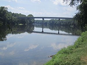
Scottsville is located at 37.8022 degrees north latitude and -78.4969 degrees west longitude.
The town covers about 1.5 square miles (4.0 square kilometers) of land. There is almost no water area within the town limits.
Transportation in Scottsville
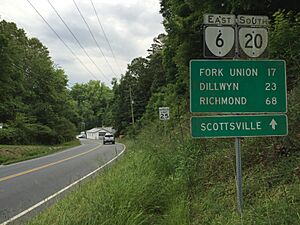
The main roads that go through Scottsville are Virginia State Route 6 and Virginia State Route 20.
- Route 6 goes west towards Waynesboro and east towards Richmond.
- Route 20 goes north towards Charlottesville and south towards Dillwyn.
Education in Scottsville
The Scottsville Museum website has lots of information and photos about schools in the area over time.
In the past, during the Jim Crow era, schools were separated by race. Scottsville School and Esmont High School provided separate education until the 1960s.
Today, students in Scottsville attend:
- Monticello High School
- Leslie Walton Middle School
- Scottsville Elementary School
Population of Scottsville
| Historical population | |||
|---|---|---|---|
| Census | Pop. | %± | |
| 1870 | 388 | — | |
| 1880 | 465 | 19.8% | |
| 1890 | 362 | −22.2% | |
| 1900 | 384 | 6.1% | |
| 1910 | 283 | −26.3% | |
| 1920 | 329 | 16.3% | |
| 1930 | 341 | 3.6% | |
| 1940 | 368 | 7.9% | |
| 1950 | 396 | 7.6% | |
| 1960 | 353 | −10.9% | |
| 1970 | 290 | −17.8% | |
| 1980 | 250 | −13.8% | |
| 1990 | 239 | −4.4% | |
| 2000 | 555 | 132.2% | |
| 2010 | 566 | 2.0% | |
| 2020 | 522 | −7.8% | |
| U.S. Decennial Census | |||
In 2000, there were 556 people living in Scottsville. These people lived in 256 households, and 145 of these were families. The town had about 360 people per square mile.
Most of the people in Scottsville were White (93.51%). A smaller number were African American (4.68%), Native American (0.72%), or Asian (0.36%). Some people were also from two or more races (0.72%). A very small percentage (0.36%) were Hispanic or Latino.
About 24.2% of households had children under 18. Many households (42.2%) were married couples. The average household had 2.17 people, and the average family had 2.82 people.
The median age in Scottsville was 40 years old. This means half the people were younger than 40 and half were older.
Flooding in Scottsville
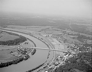
Scottsville used to experience many floods. Since 1870, there have been 21 major floods where the water level rose 20 feet or more above normal.
However, Scottsville has not flooded since 1985. This is because the Army Corps of Engineers built a large wall, called a levee, around the lowest part of the town. This levee protects Scottsville from floods.
Mayor A. Raymon Thacker was a big part of getting the levee built. He started working on it after Hurricane Agnes caused a lot of flooding. The levee has been very successful in keeping the town safe from floods.
See also
 In Spanish: Scottsville (Virginia) para niños
 | William L. Dawson |
 | W. E. B. Du Bois |
 | Harry Belafonte |


