New Virginia, Iowa facts for kids
Quick facts for kids
New Virginia, Iowa
|
|
|---|---|

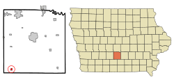
Location of New Virginia, Iowa
|
|
| Country | |
| State | |
| County | Warren |
| Area | |
| • Total | 0.45 sq mi (1.17 km2) |
| • Land | 0.45 sq mi (1.17 km2) |
| • Water | 0.00 sq mi (0.00 km2) |
| Elevation | 1,079 ft (329 m) |
| Population
(2020)
|
|
| • Total | 498 |
| • Density | 1,106.67/sq mi (427.23/km2) |
| Time zone | UTC-6 (Central (CST)) |
| • Summer (DST) | UTC-5 (CDT) |
| ZIP code |
50210
|
| Area code(s) | 641 |
| FIPS code | 19-56595 |
| GNIS feature ID | 2395219 |
New Virginia is a small city in Warren County, Iowa, in the United States. In 2020, about 498 people lived there. It is part of the larger Des Moines area.
Contents
History of New Virginia
New Virginia was first established in 1856. This means people started planning and building the town in that year.
Geography of New Virginia
New Virginia covers a total area of about 1.17 square kilometers (0.45 square miles). All of this area is land, with no water. The city is located in Iowa, a state known for its flat lands and farms.
Population and People
| Historical population | |||
|---|---|---|---|
| Census | Pop. | %± | |
| 1910 | 396 | — | |
| 1920 | 424 | 7.1% | |
| 1930 | 404 | −4.7% | |
| 1940 | 410 | 1.5% | |
| 1950 | 342 | −16.6% | |
| 1960 | 381 | 11.4% | |
| 1970 | 452 | 18.6% | |
| 1980 | 512 | 13.3% | |
| 1990 | 433 | −15.4% | |
| 2000 | 469 | 8.3% | |
| 2010 | 489 | 4.3% | |
| 2020 | 498 | 1.8% | |
| U.S. Decennial Census | |||
The population of New Virginia has changed over the years. In 2020, there were 498 people living in the city. This means the city has a population density of about 427 people per square kilometer.
Most of the people in New Virginia are White. A small number of residents are from other racial backgrounds or identify with two or more races. Less than 1% of the population is Hispanic or Latino.
The average age in New Virginia in 2020 was about 36.9 years old. Many residents, about 30%, were under 20 years old. About 18% of the people were 65 years or older. The city has a fairly even mix of males and females.
Education in New Virginia
Students in New Virginia attend schools that are part of the Interstate 35 Community School District. This district serves the area where the city is located.
See also
 In Spanish: New Virginia (Iowa) para niños
 | DeHart Hubbard |
 | Wilma Rudolph |
 | Jesse Owens |
 | Jackie Joyner-Kersee |
 | Major Taylor |

