Ngauranga Gorge facts for kids
Quick facts for kids
Ngauranga Gorge |
|
|---|---|
| State Highway 1 | |
| Lua error in Module:Infobox_road/map at line 15: attempt to index field 'wikibase' (a nil value). | |
| Route information | |
| Maintained by NZ Transport Agency | |
| Length | 2.8 km (1.7 mi) |
| Existed | 4 November 1939–present |
| Major junctions | |
| North end | Johnsonville |
| South end | Ngauranga |
| Location | |
| Highway system | |
|
|
The Ngauranga Gorge is a special place in the Wellington Region of New Zealand. It's part of State Highway 1, a very important road. This road connects central Wellington City with its northern areas. It also links to Porirua City and the Kapiti Coast. It's the main way to drive north from Wellington.
The gorge is about 2 kilometers (1.2 miles) long. It has a steep slope, going up or down about 8 percent. Around 65,000 vehicles use it every day! It connects the Wellington Urban Motorway with the Johnsonville–Porirua Motorway.
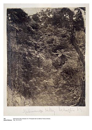
The name "Ngauranga" comes from an old Māori village called Ngā Hauranga pā. This village was located at the bottom of the gorge. After the Second World War, the spelling was made simpler.
Contents
How the Ngauranga Gorge Road Was Built
In the late 1850s, people living in Johnsonville and areas further north needed a better road. The old road through Ngaio Gorge was too steep and dangerous. So, a group called the Ngahauranga Road Association was started.
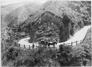
They raised money and asked the governor for help. They felt this new road was very important for Wellington. Building the road began in 1853. By the end of 1855, about 946 meters (3,104 feet) of road were finished. This part was the easiest.
The next year, another 3,340 meters (10,958 feet) were added. But this section was only a narrow path for horses. The full road, wide enough for coaches, officially opened on June 4, 1858. A special event was held with music and a four-horse carriage.
The Centennial Highway Project
Between July 1938 and November 1939, the road through the gorge was greatly improved. This was part of a bigger project called the Centennial Highway. It connected Wellington to Paekakariki.
In June 1938, Bob Semple, who was the Minister of Works, announced changes. The Ngahauranga Gorge road would become part of the new State Highways system. He said the road was dangerous because it was twisty and had too much traffic. About 3,000 to 4,000 vehicles used it daily.
The plan was to make the road straighter and less steep. The goal was to have four lanes for traffic. When the project started, Minister Semple used a bulldozer to smash old wheelbarrows. This showed how new machines would replace old tools. The new four-lane Ngauranga Gorge highway opened on November 4, 1939.
Modern Motorway Development
The first part of the Johnsonville–Porirua Motorway opened in December 1950. At first, traffic had to go through Johnsonville. Later, a bypass was built in the late 1950s. This connected the gorge's four lanes to the motorway.
During the 1960s, the road through the gorge was made even wider. It went from four lanes to six lanes. This needed a lot of digging and rock removal. The removed rock was used to fill in parts of the harbor. This helped build the Wellington Urban Motorway, which was finished in 1969.
The Ngauranga Interchange is a flyover that connects State Highways 1 and 2. It was completed in 1984. This helped remove the traffic lights at the bottom of the Ngauranga Gorge.
Later, in 1997–98, the Newlands Interchange was built at the top of the gorge. This replaced another simple intersection with traffic lights that caused many traffic jams. More digging was needed to build this interchange. A short uphill section was also widened to four lanes.
The North Island Main Trunk railway line also crosses the bottom of the gorge. It goes over the road using a bridge. There are also some industrial buildings and shops at the bottom of the gorge. Further up, there is a quarry.
Cycling Through the Gorge
Cycling up the 2-kilometer (1.2-mile) gorge is a daily challenge for many bike riders. It's a mini-endurance test at the end of their workday. Going downhill in the mornings is fast and exciting.
Cyclists can often go over 90 kilometers per hour (56 mph). Cars usually stay around 80 kilometers per hour (50 mph). This is because there's a speed camera part way down the gorge.
Road Maintenance
Sometimes, the gorge needs maintenance. On July 11, 2017, the southbound lanes (going down) had to close. This was because rocks and dirt slid onto the road. The road was closed for about 18 hours.
 | Jackie Robinson |
 | Jack Johnson |
 | Althea Gibson |
 | Arthur Ashe |
 | Muhammad Ali |


