Nimpkish River facts for kids
Quick facts for kids Nimpkish River |
|
|---|---|

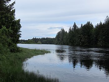
The Nimpkish River below Nimpkish Lake
|
|
| Country | Canada |
| Province | British Columbia |
| Region | Northern Vancouver Island |
| Physical characteristics | |
| Main source | Mount Alston 1,415 m (4,642 ft) 50°01′04″N 126°14′07″W / 50.0177°N 126.2352°W |
| River mouth | Broughton Strait 0 m (0 ft) 50°33′59″N 126°58′55″W / 50.56639°N 126.98194°W |
| Length | 118.1 km (73.4 mi) |
The Nimpkish River is a very important river located on northern Vancouver Island in British Columbia, Canada. It is the longest river on Vancouver Island, stretching about 118 kilometers (73 miles).
The river starts high up on the west side of Mount Alston. From there, it flows northwest into Nimpkish Lake. After leaving the lake, the Nimpkish River continues flowing north. Finally, it empties into the Broughton Strait. This spot is about 8 kilometers (5 miles) east of Port McNeill. It is also southwest of the town of Alert Bay on Cormorant Island.
Where the Name Comes From
The name "Nimpkish" comes from the language of the local Indigenous people. This language is called Kwak'wala. The name is an English version of the word for the people who live in this area, the 'Namgis.
 | Bessie Coleman |
 | Spann Watson |
 | Jill E. Brown |
 | Sherman W. White |

