Ninigret Pond facts for kids
Quick facts for kids Ninigret Pond |
|
|---|---|

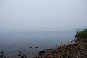
Seen in August 2009
|
|
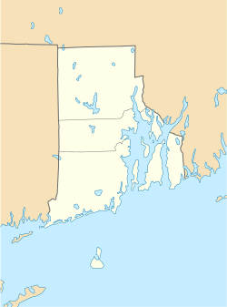
| Location | Charlestown, Washington County, Rhode Island |
| Coordinates | 41°22′45″N 71°38′43″W / 41.3792677°N 71.6453401°W |
| Type | coastal lagoon, saline |
| Primary inflows | Precipitation, groundwater |
| Primary outflows | Block Island Sound |
| Catchment area | 7,645.65 acres (30.9408 km2) |
| Basin countries | United States |
| Max. length | 3.91 mi (6.29 km) |
| Max. width | 1.83 mi (2.95 km) |
| Surface area | 1,580.38 acres (6.3956 km2) |
| Average depth | 4.3 ft (1.3 m) |
| Surface elevation | 0 ft (0 m) |
| Islands | 8 |
Ninigret Pond is a large, salty body of water located in Charlestown, Rhode Island. It's known as a coastal lagoon, which means it's a shallow area of seawater separated from the ocean by a barrier, like a sandbar. This pond is the biggest of nine similar "salt ponds" found in southern Rhode Island.
People enjoy Ninigret Pond for many fun activities. You can go boating, fishing, or just relax by the water. It's also an important place for harvesting seafood like oysters and quahogs. Along its shores, experts have found many old archaeological remains. These show that people have lived and used this area for a very long time.
Ninigret Pond, like other salt ponds nearby, was formed after huge glaciers melted about 12,000 years ago. Because the pond is on low-lying ground, it can be easily flooded during big storms. It is connected to Green Hill Pond by a small channel. The pond is also part of the Ninigret National Wildlife Refuge. Both the pond and the refuge are named after Ninigret, a leader (called a sachem) of the Niantic Native American tribe in the 1600s.
The Pond's Environment
Ninigret Pond is a very important natural area. It's part of a larger system called a watershed. A watershed is an area of land where all the water drains into a common body of water, like a pond or river.
How Water Flows In and Out
The watershed for Ninigret Pond covers a huge area, about 7,645 acres. The pond itself has a surface area of about 1,580 acres. On average, Ninigret Pond is about 4.3 feet deep. Its water is salty, with a salinity level of 24 parts per thousand. This means for every 1,000 parts of water, 24 parts are salt.
The pond gets its water from several sources. It receives a lot of rain every year, over 1.9 billion gallons! It also gets water from underground (groundwater) and from rivers and streams that flow into it. Ninigret Pond is always connected to the Block Island Sound by a special channel that was built to help water flow in and out.
Protecting Ninigret Pond
Over time, as more buildings were built along the eastern shore of Ninigret Pond, there have been signs that the water quality is getting worse. However, many groups are working hard to restore and protect the pond.
One important plant that lives in the pond is eelgrass. Eelgrass beds are like underwater meadows that provide food and shelter for many sea creatures. Sadly, the amount of eelgrass in Ninigret Pond has been decreasing. Projects are in place to help this plant grow back.
In the past, structures called breakwaters were built. These structures accidentally caused too much sand to flow into the pond, which was "choking" it. To fix this, the Coastal Resources Management Council and the Army Corps of Engineers spent over $4.1 million to remove the harmful sand.
Even with these challenges, Ninigret Pond is considered the cleanest of the nine salt ponds in the area. This is a good sign that the restoration efforts are working. In contrast, another nearby pond, Winnapaug Pond, has much higher levels of pollution. In the 1960s, Ninigret Pond was one of the first places studied in a big project that looked at all parts of a coastal marine ecosystem.
 | William Lucy |
 | Charles Hayes |
 | Cleveland Robinson |


