Nora Municipality facts for kids
Quick facts for kids
Nora Municipality
Nora kommun
|
||
|---|---|---|

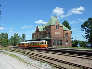
Nora Railway Station
|
||
|
||
 |
||
| Country | Sweden | |
| County | Örebro County | |
| Seat | Nora | |
| Area | ||
| • Total | 694.71 km2 (268.23 sq mi) | |
| • Land | 621.85 km2 (240.10 sq mi) | |
| • Water | 72.86 km2 (28.13 sq mi) | |
| Area as of January 1, 2010. | ||
| Population
(June 30, 2012)
|
||
| • Total | 10,403 | |
| • Density | 14.9746/km2 (38.7840/sq mi) | |
| Time zone | UTC+1 (CET) | |
| • Summer (DST) | UTC+2 (CEST) | |
| ISO 3166 code | SE | |
| Province | Västmanland | |
| Municipal code | 1884 | |
| Website | www.nora.se | |
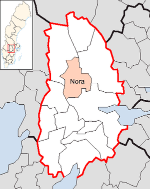
Nora Municipality (Nora kommun) is a local government area in central Sweden. It is part of Örebro County. The main town and administrative center of the municipality is Nora.
The current municipality was formed in 1967. By 1971, the city of Nora became a single, unified municipality.
Towns and Villages
Nora Municipality is home to several smaller communities. These places are important parts of the municipality.
- Dalkarlsberg
- Gyttorp
- Järnboås
- Nora (This is the main town)
- Nyhyttan
- Pershyttan
- Striberg
- Vikersvik
- Ås
Population and People
In 2022, Nora Municipality had a total of 10,707 residents. This number includes people of all ages and nationalities living in the area. About 8,277 of these residents were Swedish citizens old enough to vote.
International Friends
Nora Municipality has special friendships with towns in other countries. These are called twin towns. They help people from different places learn about each other's cultures.
See also
 In Spanish: Municipio de Nora (Suecia) para niños
 | Ernest Everett Just |
 | Mary Jackson |
 | Emmett Chappelle |
 | Marie Maynard Daly |


