North Tea Lake facts for kids
Quick facts for kids North Tea Lake |
|
|---|---|

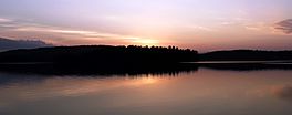
Lake at sunset
|
|
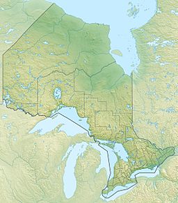
| Location | Nipissing, Ontario, Canada |
| Coordinates | 45°56′35″N 79°02′01″W / 45.94306°N 79.03361°W |
| Type | Lake |
| Part of | Ottawa River drainage basin |
| Primary inflows | Amable du Fond River |
| Max. length | 10.5 km (6.5 mi) |
| Max. width | 2 km (1.2 mi) |
| Surface elevation | 360 m (1,180 ft) |
North Tea Lake is a beautiful lake located in Ontario, Canada. It's part of the Ottawa River drainage basin, which means its waters eventually flow into the Ottawa River. This lake is found in the northwest part of Algonquin Provincial Park, a very popular place for outdoor adventures. Many canoeists love to visit North Tea Lake for its calm waters and scenic views.
About North Tea Lake
North Tea Lake is situated in the Nipissing District in Northeastern Ontario. It stretches about 10.5 kilometers (6.5 miles) long and 2 kilometers (1.2 miles) wide. The lake sits at an elevation of about 360 meters (1,180 feet) above sea level.
Water Flow and Connections
The main river flowing into North Tea Lake is the Amable du Fond River. This river enters the lake from Kawawaymog Lake in the west. The Amable du Fond River also flows out of North Tea Lake at the northeast end. From there, it goes into Manitou Lake. Eventually, these waters join the Mattawa River, which then flows into the larger Ottawa River.
Rivers and Creeks
Several smaller streams and rivers also feed into North Tea Lake. These are called tributaries. They add water to the lake, helping to keep it full and flowing.
- Lorne Creek
- Cayuga Creek
- Amable du Fond River
See also
 In Spanish: Lago North Tea para niños


