Northborough (CDP), Massachusetts facts for kids
Quick facts for kids
Northborough, Massachusetts
|
|
|---|---|

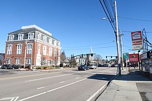
Main Street
|
|

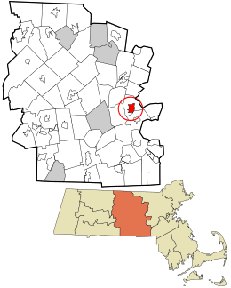
Location in Worcester County and the state of Massachusetts.
|
|
| Country | United States |
| State | Massachusetts |
| County | Worcester |
| Area | |
| • Total | 3.31 sq mi (8.58 km2) |
| • Land | 3.29 sq mi (8.51 km2) |
| • Water | 0.03 sq mi (0.07 km2) |
| Elevation | 302 ft (92 m) |
| Population
(2020)
|
|
| • Total | 6,474 |
| • Density | 1,970.78/sq mi (761.02/km2) |
| Time zone | UTC-5 (Eastern (EST)) |
| • Summer (DST) | UTC-4 (EDT) |
| ZIP code |
01532
|
| Area code(s) | 508 |
| FIPS code | 25-46785 |
| GNIS feature ID | 0610881 |
Northborough is a special area in the town of Northborough, Massachusetts. It is called a census-designated place (CDP). This means it is a place that the government counts for population, but it is not a separate city or town.
Northborough is located in Worcester County. In 2020, about 6,474 people lived here.
Geography of Northborough
Northborough is a small area. It covers about 8.6 square kilometers (3.3 square miles). Most of this area is land. Only a tiny part, about 0.30%, is water.
In 2020, there were about 1,970 people living in each square mile of Northborough. This shows how many people live in a certain space.
People of Northborough
| Historical population | |||
|---|---|---|---|
| Census | Pop. | %± | |
| 2020 | 6,474 | — | |
| U.S. Decennial Census | |||
In 2020, there were 6,474 people living in Northborough. These people lived in 2,514 different homes.
Most people in Northborough are White, about 84.1%. There are also people from other backgrounds. About 1.5% are Black or African American. About 7.5% are Asian. Around 5.1% of people are from two or more races. Also, 5.5% of the people are Hispanic or Latino.
When looking at ages, about 4.2% of the people are under 5 years old. About 21.5% are under 18 years old. Around 15.7% of the people are 65 years or older. More than half of the people, about 54%, are female.
In 2021, the average income for a household in Northborough was about $140,482. The average income per person was about $74,924. A small number of people, about 2.4%, were living in poverty.
See also
 In Spanish: Northborough (condado de Worcester) para niños

