Nukuʻalofa facts for kids
Quick facts for kids
Nukuʻalofa
|
|
|---|---|
|
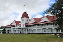
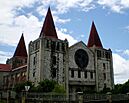
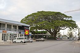
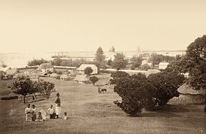
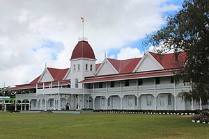
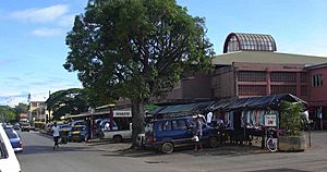
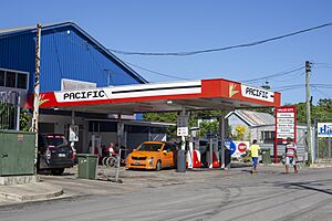
(from top: left to right) Royal Palace of Tonga, Free Church of Tonga, Tonga Parliament Building and Downtown Nukuʻalofa
|
|
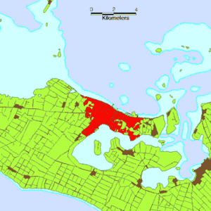
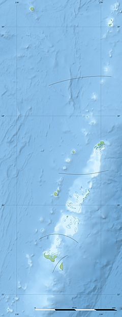
Location of Nukuʻalofa on Tongatapu
|
|
| Country | Tonga |
| Island | Tongatapu |
| Area | |
| • City | 19 km2 (7 sq mi) |
| Elevation | 3 m (10 ft) |
| Highest elevation | 6 m (20 ft) |
| Population
(2022)
|
|
| • City | 27,600 |
| • Metro | 74,454 |
| Time zone | UTC+13 (–) |
| • Summer (DST) | UTC+14 (–) |
| Area code(s) | 676 |
| Climate | Af |
Nukuʻalofa is the capital and largest city of Tonga. It is located on the northern coast of Tongatapu island. This island is part of Tonga's southernmost island group. Nukuʻalofa is a busy and important city for the country.
Contents
History of Nukuʻalofa
Early European Visits
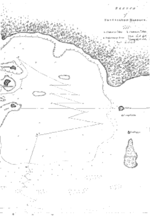
The first European to write about Nukuʻalofa was British Captain James Cook. He arrived on June 10, 1777. Cook described his anchorage as a "snug place" near the shore of Tongatapu. His map clearly showed the bay of Nukuʻalofa.
Captain Cook did not use the name Nukuʻalofa. However, he mentioned nearby islands like Pangaimotu. He also visited Mooa, where important leaders lived. Cook's map is the first known map of the Nukuʻalofa bay area.
The first time "Nukuʻalofa" was written down was in 1810. This was in a book by George Vason, an English missionary. He arrived in Tonga in 1797. Vason spelled the name "Noogollefa." This was before the Tongan alphabet was created in 1826-1827.
Another early book about Tonga was by William Mariner in 1817. He lived in Tonga from 1806 to 1810. Mariner wrote about a civil war and the attack on the Nukuʻalofa fort.
Christian missionaries arrived in Nukuʻalofa in 1826 and 1827. They helped spread Christianity in Tonga. Many people who were being treated unfairly for their faith found safety in Nukuʻalofa. The city grew as a major center for Christianity.
Becoming the Capital City
Nukuʻalofa officially became the capital of Tonga in 1875. King George Taufaʻahau Tupou I announced the Constitution of Tonga on November 4, 1875, in Nukuʻalofa. The Constitution also said that the Parliament would meet in Nukuʻalofa.
As Nukuʻalofa grew, it was divided into three main areas for better management:
- Kolomotuʻa means "old town." This was the original settlement with the old fort. It was where the traditional leaders lived.
- Kolofoʻou means "new town." This area includes the Royal Palace and the government buildings. King George Taufaʻahau Tupou I moved his capital here in the mid-1800s.
- Maʻufanga is on the eastern side of Nukuʻalofa. It was an old village and a safe place for people during civil wars. This area faces Pangaimotu, where Captain Cook anchored his ship.
Recent Times
In 2006, parts of Nukuʻalofa's main business area were damaged. This happened during a time of unrest. Reconstruction began in 2008 with help from a loan.
In 2022, a large tsunami hit the capital city. It was caused by the Hunga Tonga–Hunga Haʻapai volcanic eruption. The city faced significant damage, and repairs may take a long time.
Climate
Nukuʻalofa has a tropical rainforest climate. This means it is warm and rainy all year round. There are slightly wetter and drier times, but no truly dry months. Temperatures are warmest in January and February, around 25°C (77°F). In June and July, they are a bit cooler, around 21°C (70°F).
The city gets over 1700 millimeters (67 inches) of rain each year. Strong trade winds blow almost constantly. Tropical cyclones, also known as hurricanes, can happen here.
| Weather chart for Nukuʻalofa | |||||||||||||||||||||||||||||||||||||||||||||||
|---|---|---|---|---|---|---|---|---|---|---|---|---|---|---|---|---|---|---|---|---|---|---|---|---|---|---|---|---|---|---|---|---|---|---|---|---|---|---|---|---|---|---|---|---|---|---|---|
| J | F | M | A | M | J | J | A | S | O | N | D | ||||||||||||||||||||||||||||||||||||
|
174
29
23
|
210
30
24
|
206
30
24
|
165
29
22
|
111
27
20
|
95
26
20
|
95
25
18
|
117
25
18
|
122
25
19
|
128
26
20
|
123
28
21
|
175
29
23
|
||||||||||||||||||||||||||||||||||||
| temperatures in °C precipitation totals in mm |
|||||||||||||||||||||||||||||||||||||||||||||||
|
Imperial conversion
|
|||||||||||||||||||||||||||||||||||||||||||||||
| Climate data for Nukuʻalofa (Elevation: 2m) | |||||||||||||
|---|---|---|---|---|---|---|---|---|---|---|---|---|---|
| Month | Jan | Feb | Mar | Apr | May | Jun | Jul | Aug | Sep | Oct | Nov | Dec | Year |
| Record high °C (°F) | 32 (90) |
32 (90) |
31 (88) |
30 (86) |
30 (86) |
28 (82) |
28 (82) |
28 (82) |
28 (82) |
29 (84) |
30 (86) |
31 (88) |
32 (90) |
| Mean daily maximum °C (°F) | 29.4 (84.9) |
29.9 (85.8) |
29.6 (85.3) |
28.5 (83.3) |
26.8 (80.2) |
25.8 (78.4) |
24.9 (76.8) |
24.8 (76.6) |
25.3 (77.5) |
26.4 (79.5) |
27.6 (81.7) |
28.7 (83.7) |
27.3 (81.1) |
| Daily mean °C (°F) | 26.4 (79.5) |
26.8 (80.2) |
26.6 (79.9) |
25.3 (77.5) |
23.6 (74.5) |
22.7 (72.9) |
21.5 (70.7) |
21.5 (70.7) |
22.0 (71.6) |
23.1 (73.6) |
24.4 (75.9) |
25.6 (78.1) |
24.1 (75.4) |
| Mean daily minimum °C (°F) | 23.4 (74.1) |
23.7 (74.7) |
23.6 (74.5) |
22.1 (71.8) |
20.3 (68.5) |
19.5 (67.1) |
18.1 (64.6) |
18.2 (64.8) |
18.6 (65.5) |
19.7 (67.5) |
21.1 (70.0) |
22.5 (72.5) |
20.9 (69.6) |
| Record low °C (°F) | 16 (61) |
17 (63) |
15 (59) |
15 (59) |
13 (55) |
11 (52) |
10 (50) |
11 (52) |
11 (52) |
12 (54) |
13 (55) |
16 (61) |
10 (50) |
| Average rainfall mm (inches) | 174 (6.9) |
210 (8.3) |
206 (8.1) |
165 (6.5) |
111 (4.4) |
95 (3.7) |
95 (3.7) |
117 (4.6) |
122 (4.8) |
128 (5.0) |
123 (4.8) |
175 (6.9) |
1,721 (67.8) |
| Average rainy days | 17 | 19 | 19 | 17 | 15 | 14 | 15 | 13 | 13 | 11 | 12 | 15 | 180 |
| Average relative humidity (%) | 77 | 78 | 79 | 76 | 78 | 77 | 75 | 75 | 74 | 74 | 73 | 75 | 76 |
| Source: Weatherbase | |||||||||||||
Economy
Nukuʻalofa is the main center for business and trade in Tonga. It is where most of the country's economic activity happens.
The city has many markets where people can buy goods. There is also a central business district with shops and offices. After some parts of the business district were damaged in 2006, they were rebuilt. This rebuilding started in 2008.
Nukuʻalofa also has several hotels for tourists. These hotels help bring visitors and money to the city.
Transport
Nukuʻalofa is the main transport hub for all of Tonga.
Buses are a common way to get around. They leave from the central bus station near the town center. Bus services are run by private companies. Their drivers set their own schedules. The government sets the bus fares, and school children pay less. Buses are often very full!
Many taxis are also available. These are also privately owned. Some people even use their own cars to offer taxi services in their free time. Taxi fares are set by the government. Most families in Nukuʻalofa own a car. Not many people ride bicycles. There are no trains or trams in Tonga.
Nukuʻalofa has the only deep-water harbor on Tongatapu island. This is why it was chosen as the capital city. Vuna Wharf used to be the international harbor. A new, larger wharf called Queen Sālote Wharf was built later. There is also a wharf for fishermen and ferries that go to other islands. You can catch boats to islands like ʻEua, Haʻapai, and Vavaʻu from here.
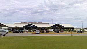
For air travel, Fuaʻamotu International Airport is located on the south side of Tongatapu. It is about 34-37 kilometers (21-23 miles) from Nukuʻalofa.
New Island Creation (2015)
In January 2015, something amazing happened near Nukuʻalofa. A new island was formed by a volcanic eruption! The volcano was called Hunga Tonga–Hunga Ha'apai. The new island was about 1 square kilometer (0.4 square miles) in size. It is located about 65 kilometers (40 miles) northwest of Nukuʻalofa.
Sister Cities
Nukuʻalofa has "sister city" relationships with other cities around the world. These partnerships help promote cultural exchange and friendship.
See also
 In Spanish: Nukualofa para niños
 | John T. Biggers |
 | Thomas Blackshear |
 | Mark Bradford |
 | Beverly Buchanan |


