
Majuro facts for kids
Quick facts for kids
Majuro
|
||
|---|---|---|
     Top: Marshall Islands Capitol Building; Middle: Enek Island, Amata Kabua International Airport; Bottom: Alele Museum, Majuro coastline
|
||
|
||
 |
||
| Country | ||
| Island Chain | Ratak Chain | |
| Population
(2021)
|
||
| • Total | 23,156 | |
| Time zone | UTC+12 (MHT) | |
| Native languages | Marshallese | |

Majuro is the capital and largest city of the Marshall Islands. It is also a large coral atoll made up of 64 islands in the Pacific Ocean. An atoll is a ring-shaped coral reef, island, or chain of islands. Majuro is part of the Ratak Chain of the Marshall Islands.
The atoll has a land area of about 9.7 square kilometers (3.7 square miles). It surrounds a lagoon that is 295 square kilometers (114 square miles) in size. Like other atolls in the Marshall Islands, Majuro has narrow strips of land. It has a tropical trade wind climate, which means it's warm all year round. The average temperature is about 27 degrees Celsius (81 degrees Fahrenheit).
People have lived in Majuro for at least 2,000 years. The first settlers were the Austronesian peoples, who are the ancestors of today's Marshallese people. In the 1870s, Majuro became a place for a Protestant mission and trading stations for copra (dried coconut meat). Later, in 1885, the German Empire took control of the atoll. After that, it was controlled by Japan and then the United States.
In 1978, the Marshall Islands became independent from the Federated States of Micronesia. Majuro then became the new country's capital. The main part of Majuro where most people live is called Delap-Uliga-Djarrit (DUD). In 2021, about 23,156 people lived there. Majuro has a port, shopping areas, and hotels. It also has an international airport with flights to other countries and islands. The economy of Majuro mostly relies on services.
Contents
Geography of Majuro

Majuro Atoll is made up of over 60 islands. Three of these islands are larger than 0.5 square kilometers (0.2 square miles). At the western end of the atoll is the island community of Laura. It is about 30 miles (48 kilometers) from the main DUD area by road. Laura is a growing residential area and has a popular beach. It also has the highest point on the atoll, which is less than 3 meters (10 feet) above sea level. The area called Djarrit is mostly where people live.
Majuro's Climate
Majuro is located slightly north of the Equator. This gives it a tropical rainforest climate. The weather is warm and consistent throughout the year. The average temperature is around 27 degrees Celsius (81 degrees Fahrenheit). It rarely gets colder than 21 degrees Celsius (70 degrees Fahrenheit).
Majuro receives a lot of rain, about 3,200 millimeters (126 inches) each year. The fall months (September to November) are usually the warmest and rainiest. Typhoons are rare in Majuro.
History of Majuro
_(cropped).jpg)

People have lived on Majuro Atoll for at least 2,000 years. These early settlers were the ancestors of the Marshallese people we know today. Scientists have found old cooking sites in the Laura village that show people lived there around the 1st century AD.
In 1869, Protestant missionaries started a church and school on the atoll. By 1876, several companies were trading copra (dried coconut meat) in Majuro. Copra was an important product from the islands.
In the late 1870s and 1880s, two traditional leaders, Jebrik and Rimi, fought for control of the atoll. Their uncle had wanted them to share power, but Jebrik wanted to rule alone. This fighting caused food shortages and slowed down copra production. British warships helped to arrange peace treaties between them.
In 1885, the German Empire took control of Majuro Atoll as part of its protectorate in the Marshall Islands. During World War I in 1914, the Imperial Japanese Navy captured Majuro. In 1920, the League of Nations gave Japan control of the island. Majuro then became part of the Japanese-controlled South Seas Mandate. Local leaders mostly managed daily life until World War II.

On January 30, 1944, the United States Armed Forces arrived in Majuro. They found that Japanese forces had left the island about a year earlier. The U.S. Navy then used Majuro's large lagoon as a major naval base. This base, called Naval Base Majuro, became one of the busiest ports in the world during the war.
After World War II, Majuro was controlled by the United States as part of the Trust Territory of the Pacific Islands. In 1978, the Marshall Islands became a separate country. Majuro was chosen as its capital. It also became the meeting place for the Nitijeļā, which is the Marshall Islands' parliament. Majuro has remained the capital since the Marshall Islands became fully independent in 1986.
In 2013, the Majuro Declaration was signed in Majuro. This was an agreement by leaders from Pacific Islands to work together on climate change and international aid.
People of Majuro
The main areas where people live are the D–U–D communities: Delap, Uliga, and Djarrit. These are three small islands connected together. In 2021, Majuro had a population of 23,156 people.
Religions in Majuro
Most people in Majuro are Christian. Many follow the United Church of Christ (47%) and the Assembly of God (16%). Other Christian groups include Bukot Nan Jesus, Full Gospel, and the Salvation Army. About 8% of the population is Catholic. The main Catholic church, the Cathedral of the Assumption, is in Majuro.
There is also a growing number of Ahmadi Muslims. The first mosque in Majuro opened in September 2012. Other religious groups include LDS churches, Baptist churches, and Jehovah's Witnesses.
Ethnic Groups
The majority of people in Majuro are Marshallese, making up about 93.4% of the population. Other groups living in Majuro include Filipino (1.6%), I-Kiribati (1.2%), and American (1.0%). There are also smaller numbers of Fijian, Chinese, and other Pacific Islanders.
Majuro's Economy

Majuro's economy is mostly based on the service sector. This means that most of the money comes from services like tourism, trade, and government work. In 2011, services made up 86% of the country's economy.
People in the Marshall Islands have also been exploring new ways to use their natural resources. For example, they have experimented with using coconut oil as a fuel for vehicles, power generators, and ships. Coconut trees are very common on the Pacific islands. It takes about 6 to 10 coconuts to make 1 liter of oil.
Air Marshall Islands, the country's airline, has its main office in Majuro.
Education in Majuro
Colleges and Universities

The College of the Marshall Islands is located in Uliga, Majuro. The University of South Pacific also has a campus in Majuro.
Schools in Majuro
The Marshall Islands Public School System runs many public schools in Majuro.
High schools in Majuro include:
- Marshall Islands High School
- Laura High School
- Life Skills Academy
Primary (elementary) schools include:
- Ajeltake Elementary School
- Delap Elementary School
- DUD Kindergarten
- Ejit Elementary School
- Laura Elementary School
- Long Island Elementary School
- Majuro Middle School
- Rairok Elementary School
- Rita Elementary School
- Uliga Elementary School
- Woja Maj. Elementary School
- Carl Kuli Lobat. Elementary School
In the 1994–1995 school year, Majuro also had 10 private elementary schools and six private high schools. There is a Seventh Day Adventist High School and Elementary School in Delap, where students learn English.
Infrastructure and Transport
Water and Sewage
The Majuro Water and Sewer Company gets its water from a special area on the International Airport runway that collects rainwater. This system provides about 140 million US gallons (530 million liters) of water each year. This means each person gets about 14 US gallons (53 liters) of water per day. Water is supplied for 12 hours daily. Because of this, droughts are a common concern in Majuro.
Transportation in Majuro

Air Travel
Marshall Islands International Airport is located in Majuro. It offers flights within the country and to other countries. Four airlines use this airport: United Airlines, Nauru Airlines, Air Marshall Islands, and Asia Pacific Airlines.
Air Marshall Islands flies to most of the inhabited islands in the Marshall Islands once a week. It also has daily flights between Majuro and Kwajalein, except on Thursdays and Sundays.
Sea Travel
Majuro Lagoon is a very busy port. It is one of the world's most active ports for moving tuna from fishing boats to larger cargo ships. In 2018, over 306,000 tons of tuna were moved here.
The Marshall Islands Shipping Corporation manages several government ships. These ships transport people and goods around the islands. They are the main way for people and supplies to reach and leave the outer islands.
The lagoon is also used as a harbor for other boats. These include commercial fishing vessels, cruise ships, sport fishing boats, traditional outrigger canoes, and sometimes even luxury yachts.
Sports in Majuro
Majuro was supposed to host the 2010 Micronesian Games in 2010. However, they decided not to host because they didn't have enough sports facilities. In 2018, the Marshall Islands were chosen to host the Micro Games in 2022 (which were later moved to 2023). A new stadium is being built in Majuro for these games. This new stadium will also host soccer matches, which will help create the Marshall Islands' first national soccer team.
A weightlifter named Mattie Langtor Sasser from the Marshall Islands competed in the 2016 Summer Olympics. She took part in the Women's 58 kg category.
Sister Cities
Majuro has "twin towns" or "sister cities" around the world. These are cities that have special friendly relationships. Majuro is twinned with:
 Inalåhan, Guam, United States (since 1973)
 Kawai, Nara, Japan
 Taipei, Republic of China (Taiwan) (since 1999)
 Basco, Philippines
 Luganville, Vanuatu
 Weno, Micronesia
- Tamuning, Guam, United States
 Tarawa, Kiribati
 Honiara, Solomon Islands
 Nuku'alofa, Tonga
Images for kids
-

The flag of Majuro Atoll
-
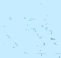
Location of Majuro Atoll in the Marshall Islands
See also
 In Spanish: Majuro para niños
