Oberhavel facts for kids
Quick facts for kids
Oberhavel
|
|
|---|---|
 |
|
| Country | |
| State | Brandenburg |
| Capital | Oranienburg |
| Area | |
| • Total | 1,795.3 km2 (693.2 sq mi) |
| Population
(2002)
|
|
| • Total | 194,802 |
| • Density | 108.507/km2 (281.031/sq mi) |
| Time zone | UTC+1 (CET) |
| • Summer (DST) | UTC+2 (CEST) |
| Vehicle registration | OHV |
| Website | http://www.oberhavel.de |
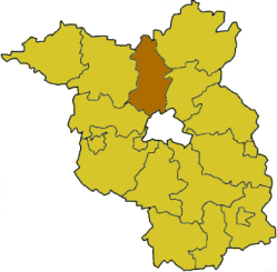
Oberhavel is a district in the northern part of Brandenburg, Germany. It's like a county in other countries.
This district was created on 6 December 1993. It was formed by joining two older districts: Gransee and Oranienburg.
What is Oberhavel's Symbol?
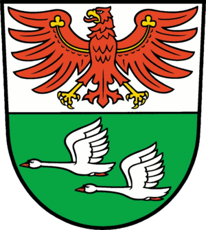
The district of Oberhavel has its own special symbol, called a coat of arms.
The top part of the symbol shows an eagle. This eagle is a very old and important symbol for the state of Brandenburg. The bottom part has two swans flying over a green background. These swans represent the beautiful nature of the area, which has many lakes.
This symbol was first used by the old district of Oranienburg. However, it wasn't officially approved until May 18, 1994, for the new Oberhavel district.
Exploring Oberhavel's Towns and Villages
Oberhavel is made up of several towns and smaller communities. Here's a look at some of them:
| Main Towns | Ämter (Groups of Villages) | Independent Communities |
|---|---|---|
|
1This is the main town for the group of villages. 2This is also a town itself. |
|
See also
- In Spanish: Distrito de Oberhavel para niños
 | Aurelia Browder |
 | Nannie Helen Burroughs |
 | Michelle Alexander |


