Oberhofen im Inntal facts for kids
Quick facts for kids
Oberhofen im Inntal
|
||
|---|---|---|

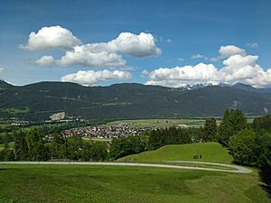
View of Oberhofen
|
||
|
||
| Country | Austria | |
| State | Tyrol | |
| District | Innsbruck Land | |
| Area | ||
| • Total | 18.57 km2 (7.17 sq mi) | |
| Elevation | 622 m (2,041 ft) | |
| Time zone | UTC+1 (CET) | |
| • Summer (DST) | UTC+2 (CEST) | |
| Postal code |
6406
|
|
| Area code | 05262 | |
| Vehicle registration | IL | |
| Website | www.oberhofen.tirol.gv.at | |
Oberhofen im Inntal is a small town in the western part of Tyrol, a state in Austria. It is located in the Innsbruck-Land area. This charming municipality sits about 21 kilometers (13 miles) west of the city of Innsbruck. It is also just 2.6 kilometers (1.6 miles) east of another town called Telfs.
Oberhofen im Inntal used to be part of a nearby town called Pfaffenhofen. However, in 1786, it became its very own independent municipality. This means it started managing its own local affairs.
Understanding Oberhofen's Population
The population of a town tells us how many people live there. Tracking population changes helps us understand how a community grows or shrinks over time. It can show if more people are moving in or out.
How Many People Live Here?
The number of people living in Oberhofen im Inntal has changed quite a bit over the years. From the late 1800s to the early 2000s, the population generally increased. This shows that more people have chosen to make Oberhofen their home.
| Historical population | ||
|---|---|---|
| Year | Pop. | ±% |
| 1869 | 743 | — |
| 1880 | 685 | −7.8% |
| 1890 | 693 | +1.2% |
| 1900 | 674 | −2.7% |
| 1910 | 673 | −0.1% |
| 1923 | 673 | +0.0% |
| 1934 | 647 | −3.9% |
| 1939 | 684 | +5.7% |
| 1951 | 765 | +11.8% |
| 1961 | 826 | +8.0% |
| 1971 | 965 | +16.8% |
| 1981 | 1,129 | +17.0% |
| 1991 | 1,467 | +29.9% |
| 2001 | 1,624 | +10.7% |
| 2011 | 1,682 | +3.6% |
See also
 In Spanish: Oberhofen im Inntal para niños
 | Emma Amos |
 | Edward Mitchell Bannister |
 | Larry D. Alexander |
 | Ernie Barnes |


