Odakota Mountain facts for kids
Quick facts for kids Odakota Mountain |
|
|---|---|
| Highest point | |
| Elevation | 7,198 ft (2,194 m) |
| Geography | |
| Location | Pennington County, South Dakota, US |
| Parent range | Black Hills |
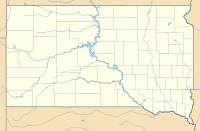
Odakota Mountain is a mountain located in the western part of Pennington County, South Dakota. It's about 9 miles west of a town called Hill City. This mountain is very special because it's the second highest point in the entire Black Hills region and in the state of South Dakota.
Contents
What's in a Name?
For a long time, this mountain didn't have an official name. Before 1969, the U.S. Board on Geographic Names (a group that decides names for places in the U.S.) hadn't given it one. Some people, like the supervisor of the Black Hills National Forest, called it Murphy Mountain.
How Odakota Got Its Name
In 1969, a woman named Evelyn Loretta Bradfelt bought a ranch near the mountain. She wanted the mountain to have a meaningful name. So, she asked the U.S. Board on Geographic Names to call it Odakota Mountain.
Evelyn believed "Odakota" was an indigenous word meaning "establishment of peace." Later, a professor named Harvey Markowitz confirmed that "Odakota" is a variation of words from the Dakota and Lakota languages. These words, "olakota" and "wolakota," mean "friendship," "alliance," or "peaceful relationship." It's a beautiful name for a mountain!
How High Is Odakota Mountain?
Knowing the exact height of a mountain can be tricky! For many years, the height of Odakota Mountain was known as about 7,198 feet.
Measuring the Mountain
In May 2019, a professional surveyor used special tools to find the mountain's exact highest point. They used precise GNSS measurements, which are like super-accurate GPS readings. They found the highest spot is 7,197.70 feet above sea level. This measurement uses a standard called the North American Vertical Datum (NAVD88).
The very top of the mountain isn't a sharp peak. It's actually a flat area covered with trees. This highest spot is a short distance west of a slightly lower rock outcrop made of limestone. To mark the highest point, a special metal disk was placed in concrete with a sign.


