Olive River facts for kids
Quick facts for kids Olive |
|
|---|---|
|
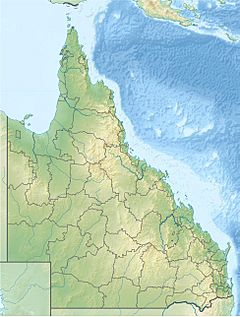
Location of Olive River mouth in Queensland
|
|
| Country | Australia |
| State | Queensland |
| Region | Far North Queensland, Cape York Peninsula |
| Physical characteristics | |
| Main source | Richardson Range, Great Dividing Range in remote country 55 m (180 ft) 12°07′53″S 142°46′41″E / 12.13139°S 142.77806°E |
| River mouth | Temple Bay, Coral Sea north of Lockhart River 0 m (0 ft) 12°10′12″S 143°05′49″E / 12.17000°S 143.09694°E |
| Length | 70 km (43 mi) |
| Basin features | |
| Basin size | 2,056 km2 (794 sq mi) |
The Olive River is a river found in the Cape York Peninsula of Far North Queensland, Australia. It flows through a beautiful, mostly untouched area before reaching the sea.
Contents
The River's Journey
The Olive River starts high up in the Richardson Range. This range is part of the Great Dividing Range, a long chain of mountains in Australia. The river begins its journey in a remote, wild part of the Cape York Peninsula.
At first, the river flows towards the southeast. Then, it turns and heads northeast. It crosses a flat, coastal area that doesn't have many people living there. Finally, it flows over white sand dunes and empties into Temple Bay. This bay is part of the Coral Sea, which is north of a town called Lockhart River. The river drops about 55 metres (180 ft) (180 feet) over its 70-kilometre (43 mi) (43 miles) path.
River's Water Area
The Olive River has a large catchment area. This is the total area of land where rainfall collects and flows into the river. For the Olive River, this area is about 2,056 square kilometres (794 sq mi) (794 square miles). A part of this area, about 43 square kilometres (17 sq mi) (17 square miles), is made up of estuarine wetlands. These are special wet areas where the river's fresh water mixes with the salty ocean water.
Traditional Owners and History
The land around the Olive River has been home to Indigenous peoples for a very long time. The Wuthahti and Kuuku-ya’u peoples are the traditional owners of this area. They have a deep spiritual connection to their country, which includes the river and its surroundings.
In 2009, the Federal Court officially recognized the native title rights of these peoples. This means they have special rights over about 1,980 square kilometres (760 sq mi) (764 square miles) of land and water. This area stretches north from Lockhart River to the mouth of the Olive River. It also includes parts of the Forbes Islands National Park, the Quoin Island National Park, and the Piper Islands National Park.
The Olive River area was explored by a ship called HMS Paluma in 1893. This ship was mapping the coast for the British Navy. It's believed the river was named either after a mayor from a town called Cooktown or because its water often looks like tea.
Unique Plants and Wildlife
The plants that grow along the banks of the Olive River are very special. This area is home to many species that are only found on the Cape York Peninsula. One important plant found here is the threatened cycad plant, known as Cycas silvestris. Cycads are ancient plants that look a bit like palms or ferns. Protecting these unique plants helps keep the area's natural beauty and biodiversity safe.
 | DeHart Hubbard |
 | Wilma Rudolph |
 | Jesse Owens |
 | Jackie Joyner-Kersee |
 | Major Taylor |


